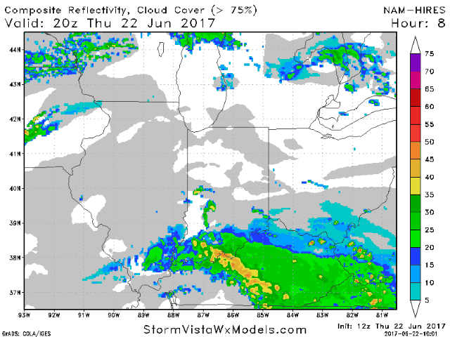
#ILwx #INwx #OHwx #KYwx Thurs PM: Flash flooding & heavy storms possible thru Fri...much cooler wknd ahead. K. Synopsis: Good Thursday morning! Below is the latest update with afternoon data in regards to the heavy rainfall and strong storm threat working in tonight into Friday as a cold front collides…
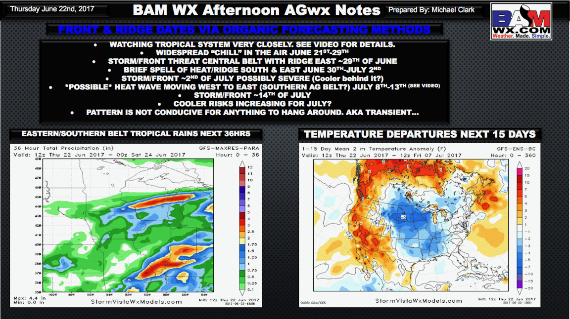
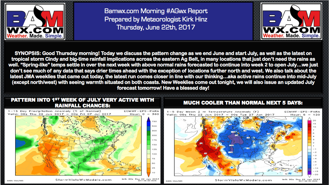
Thursday #AGwx Report: Heavy rain eastern belt...cooler risks increasing into July...analysis here! M. Video (8 min): https://www.youtube.com/watch?v=1_2gKojbgA0&feature=youtu.be&hd=1
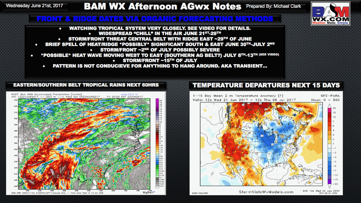
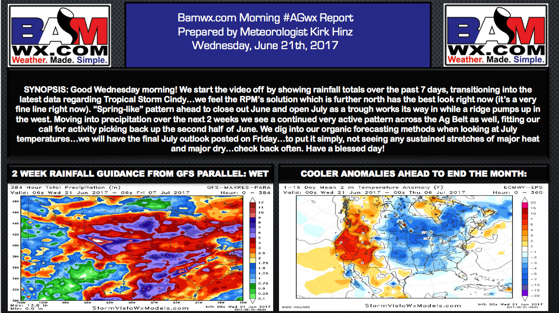
Wednesday PM #AGwx Report: Heavy rains for eastern belt, cooler end to June on tap. M. Slides: Today's Video (8 minutes): https://www.youtube.com/watch?v=UqS88rmK7RQ&feature=youtu.be&hd=1
Wed. #AGwx Report: Flooding rains possible thru late week...cooler open to July. M. Video (9 min): https://www.youtube.com/watch?v=xWuWSmLF0pU&feature=youtu.be&hd=1
Tuesday #AGwx Report: Extreme wet signals in the long-range...updated thoughts into July. M. Video (11 min): https://www.youtube.com/watch?v=itvFc2lJVQo&feature=youtu.be&hd=1
Monday PM #AGwx Update: Crucial tropical analysis with new data & possible east Ag belt impacts. M. **NEW TROPICAL DATA BELOW** Video (6 minutes): https://www.youtube.com/watch?v=CFno-t6_NWA&feature=youtu.be&hd=1
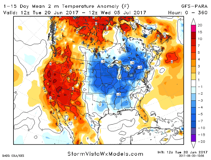
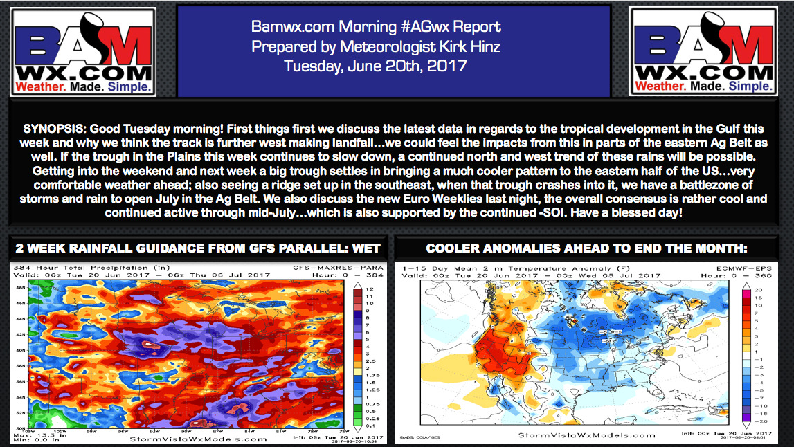
Monday #AGwx Update: Much cooler end to June on tap...pattern looks to remain active. M. Video (11:40 min): https://www.youtube.com/watch?v=H2ineioXIcU&feature=youtu.be&hd=1
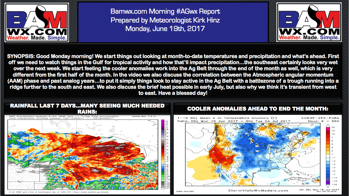
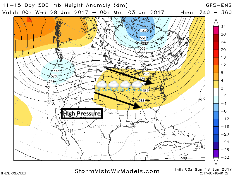
Sunday #AGwx Update: Active and Cooler End to June, Discussing July Risks. E. Good Sunday morning! In today's update, I touch on rainfall and temperature over the last week, then move right into the forecast over the next 2 weeks which will likely feature plenty of active conditions across the…