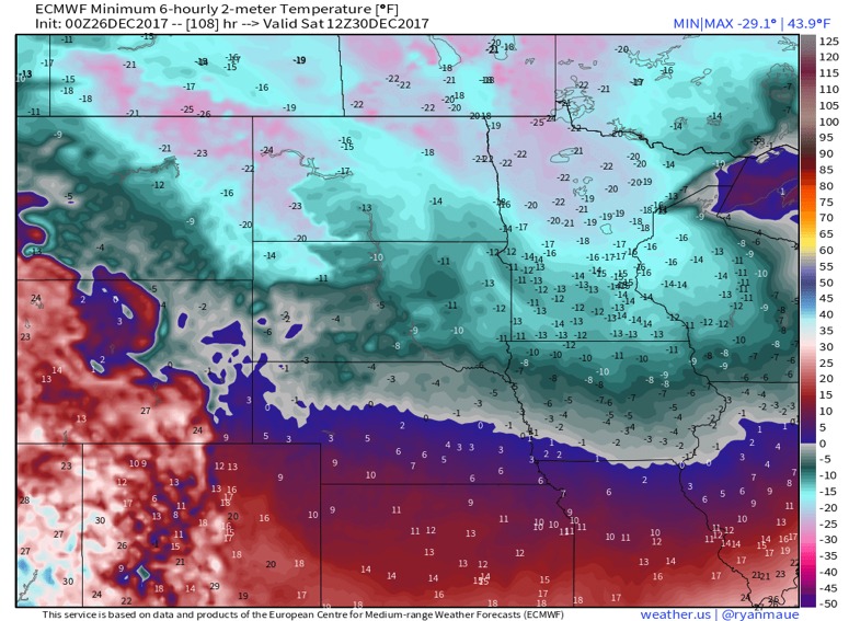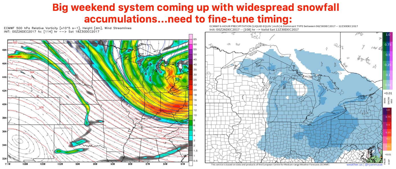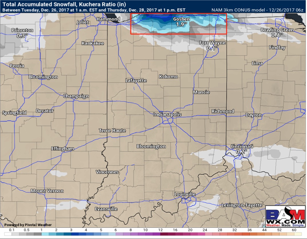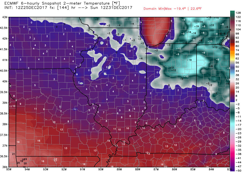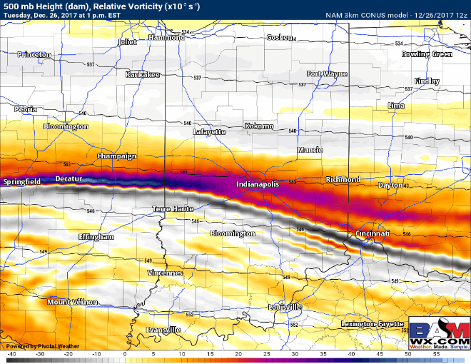
12-26-17 Central IN short-term: Targeting sneaky snow showers next 2-3 days. K.
Synopsis: Hey guys, today's short-term update focuses on the sneaky snow shower chances over the next 2-3 days that models will handle very poorly with such cold temps. As always let us know if you have any questions at all we are around 24-7 to help. Have a blessed day.…