
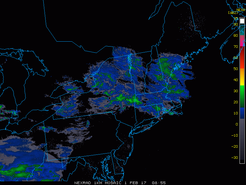
Good morning! We are seeing some light snow in northeastern Massachusetts this morning moving northward as I type this. We are also seeing some light rain and perhaps a few snowflakes mixed in across southeastern Ohio into West Virginia. Western slopes of the Appalachians will see a few rain and snow showers today as this disturbance moves east. Here’s the radar as of 5:50 AM.
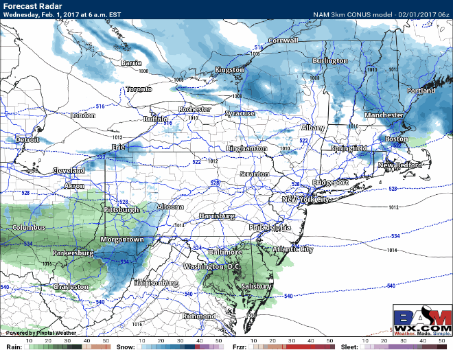
Other than these features, today looks like a benign weather day with clouds, a bit of sun, and warmer than normal temperatures. A few sprinkles may try to get east of the mountains into southern NJ later today, but they’ll be brief. Here’s the projected radar for today.
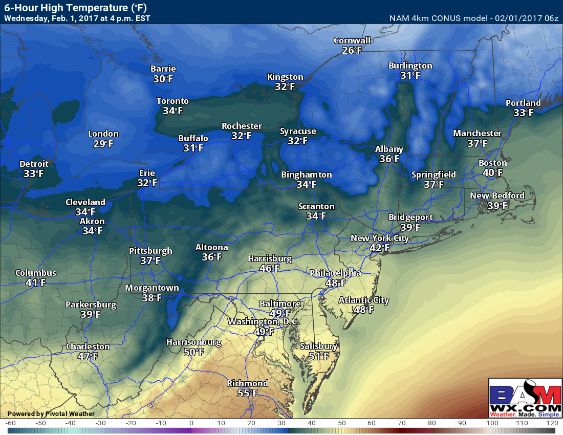
Temperatures will be “warm” for this time of the year, reaching into the 30s north and 40s south. Today’s projected highs:
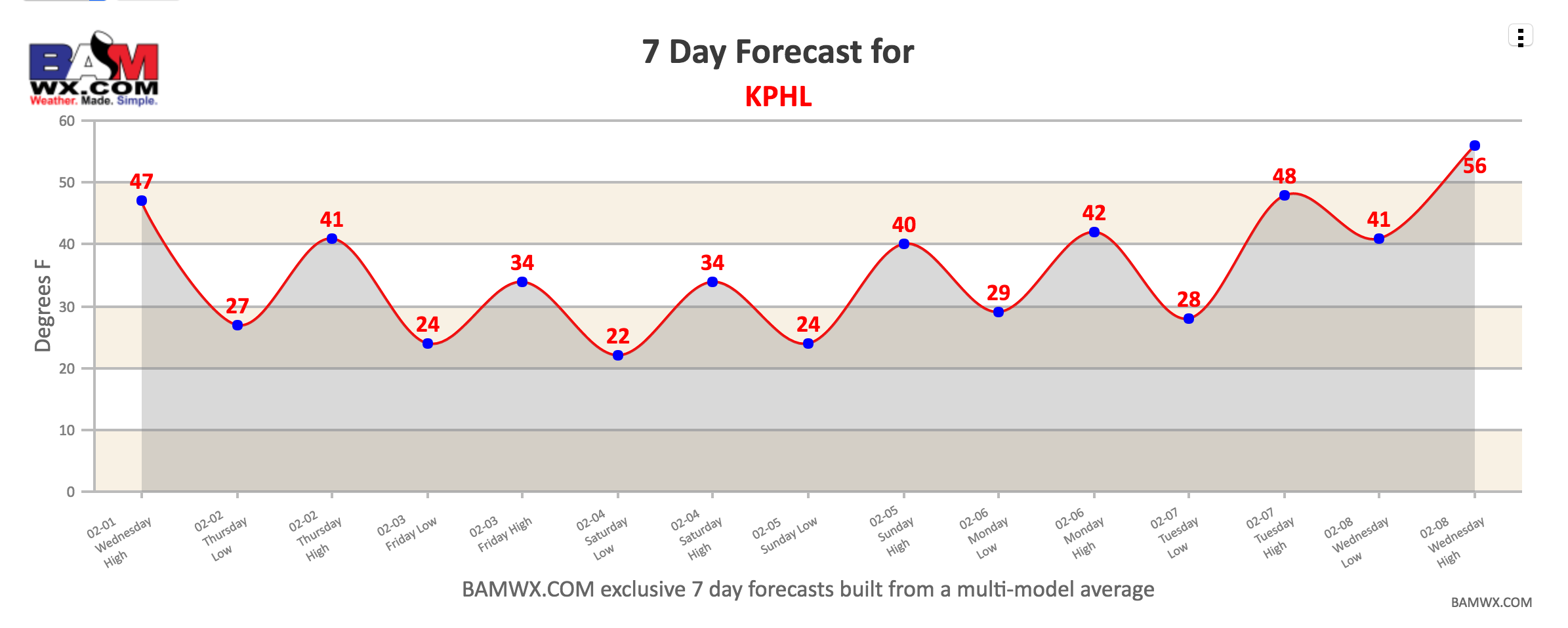
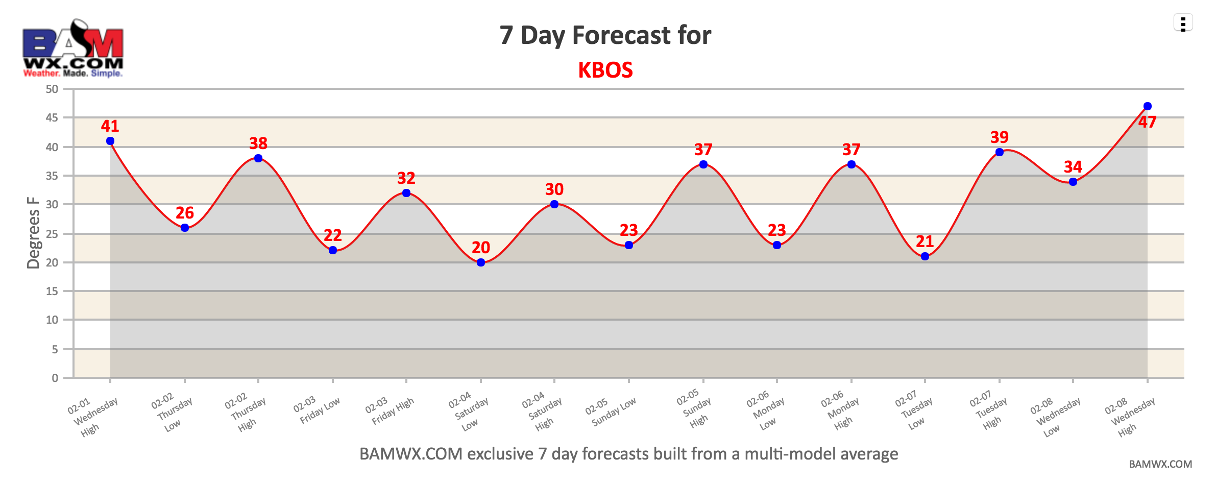
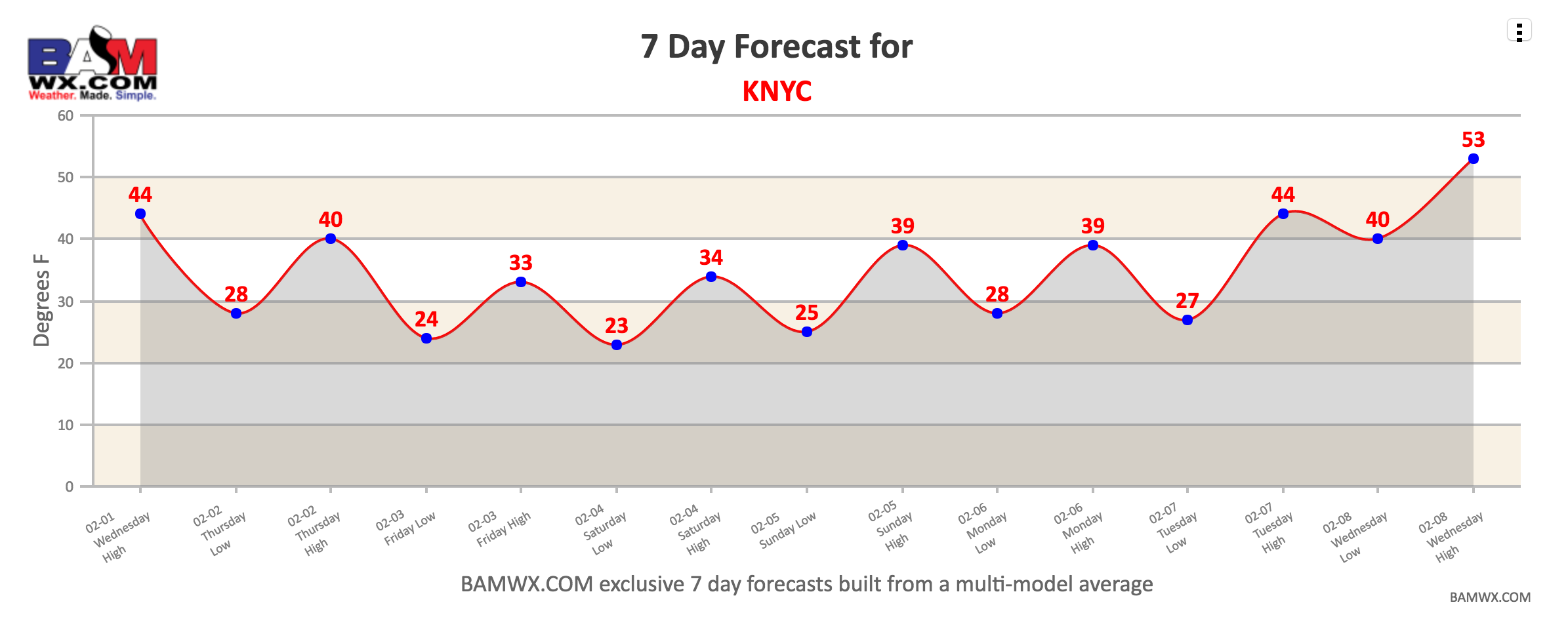
A cold front will move through the region tonight into tomorrow bringing a return to typical winter temperatures. Here are a few 7 day temperature forecasts around the region. Thursday through Saturday likely feature clouds and some sunshine with temperatures mainly in the 20s north and 30s south.

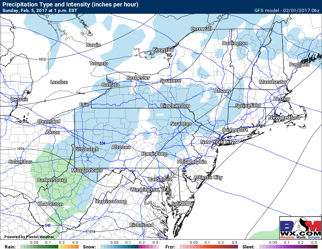
Another disturbance will approach for Sunday, but energy looks to stay un-phased leading to a weaker storm. This will still allow for some snow showers region-wide, but a larger storm is looking more and more unlikely by the day. Here’s the GFS model for 1 PM Sunday – snow showers moving west to east throughout the day with temperatures in the 30s.
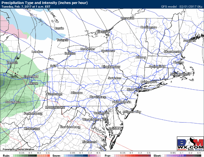
The next bigger storm looks to impact the region Tuesday through Thursday with a plethora of precipitation types. Uncertainty is VERY high with this system, but some rain is likely with possible wintry precipitation especially inland. Worth keeping an eye on! Here’s the latest GFS just to illustrate one possibility.
Confidence and Risks:
- High confidence on today’s forecast.
- High confidence on colder temperatures Thursday into the weekend.
- Moderate confidence on some snow showers Sunday, but low confidence on intensity and duration.
- Low confidence on the track and strength of next week’s mid-week system. Stay tuned.
Today’s video is about 5 minutes. ~Ed