
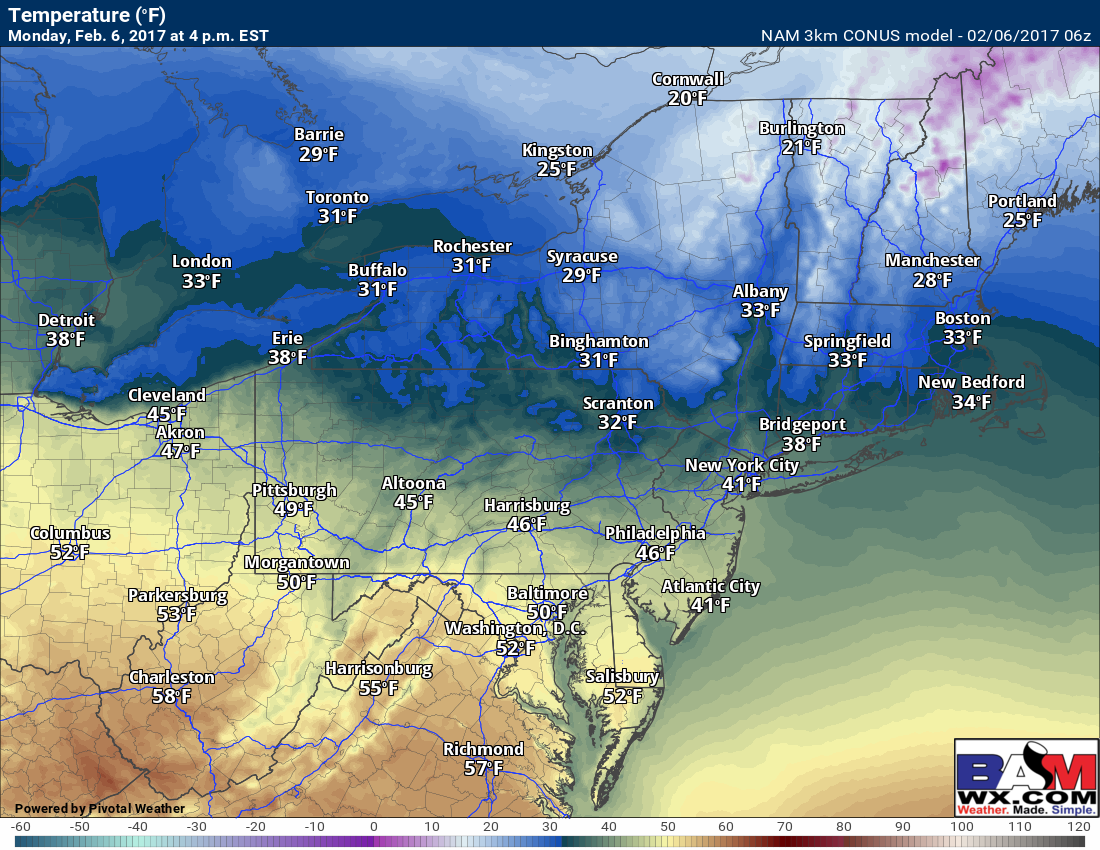
Good morning! Busy forecast coming up this week with multiple threats for snow and ice for much of the region so I’m going to try and keep the points short and sweet. Today will be a mild day with no weather concerns. Clouds will increase from southwest to northeast this afternoon with temperatures warm across southwestern areas and seasonable to slightly below normal across southern New England. Here are the approximate highs for today.
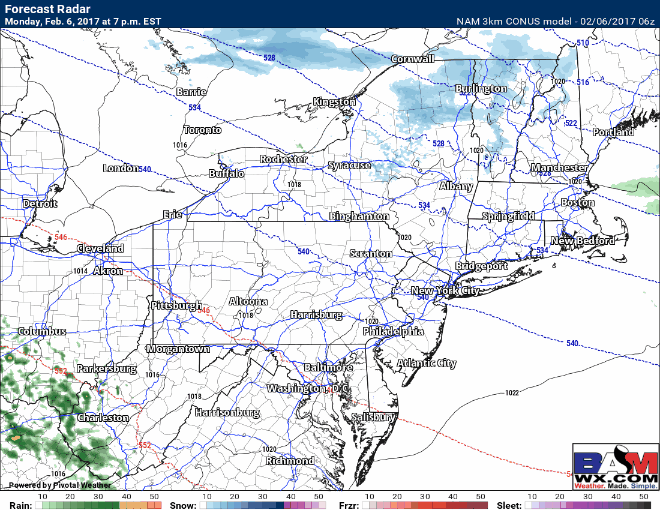
A storm system will approach this evening across the eastern Ohio Valley with showers. These will spread eastward overnight and run into an initially cold airmass across New England, setting the stage for some snow and ice tomorrow morning away from the coastline before a change to rain during the afternoon. Here’s the projected radar showing showers entering Ohio this evening and moving east overnight. Some snow and ice likely make it into interior southern New England around the morning commute tomorrow.
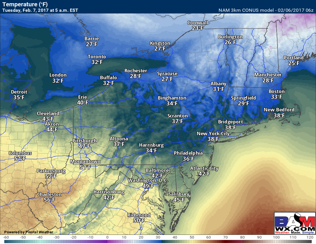
Here’s a look at temperatures tomorrow morning at 5 AM. Notice most areas are near or below freezing across the interior, leading to snow and ice chances.
Here’s my thinking with respect to total snowfall before any change to ice and rain. In northeastern PA, the Hudson Valley, and central CT any accumulation is likely mixed with sleet and a bit of freezing rain as well.

Temperatures will rise throughout the day Tuesday changing snow and ice over to rain for much of the forecast area in southern New England. Some areas in western MA and NW CT can see 0.10″ of freezing rain before the changeover as well. Rain will continue with mild temperatures across Pennsylvania and Ohio. Here’s the forecast radar for Tuesday into Tuesday night.

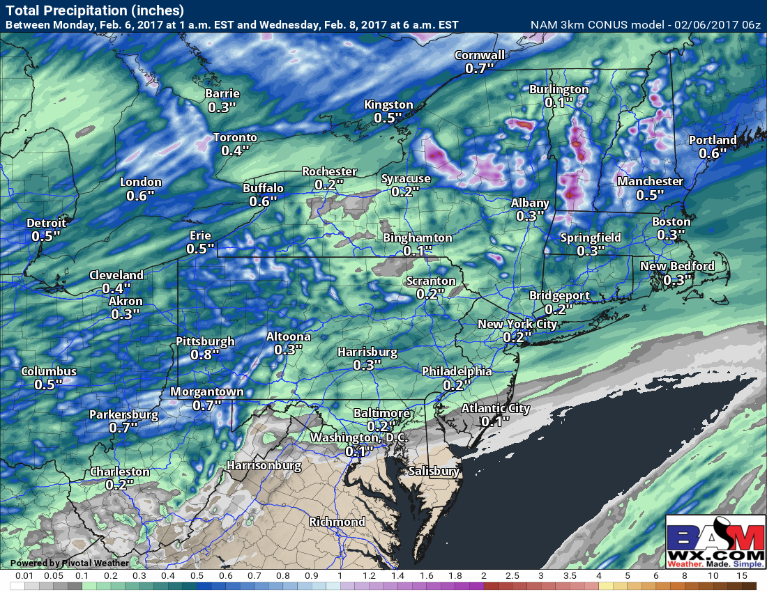
Total rainfall expected will range from 0.25-0.75″ with locally over 1 inch in spots.
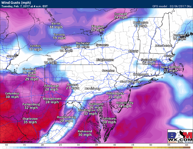
Winds will also be gusty region-wide, gusting past 40mph at times Tuesday through early Wednesday.
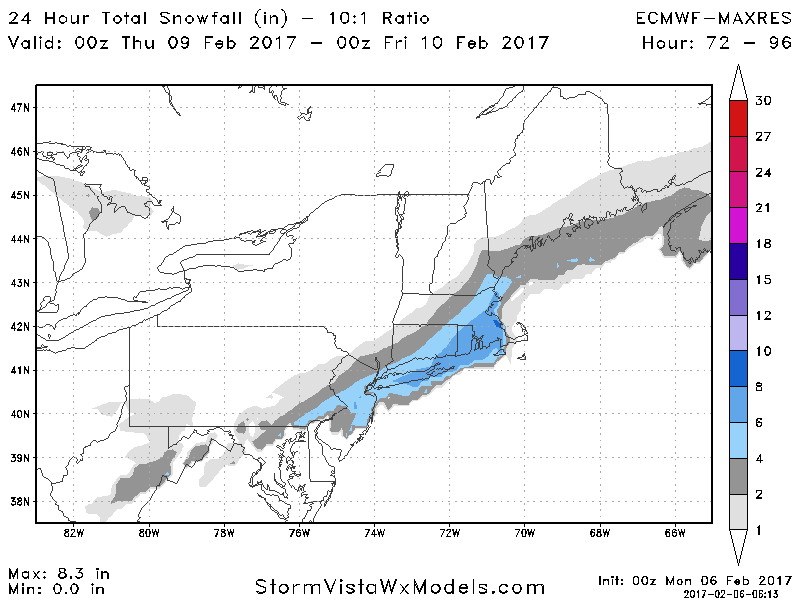
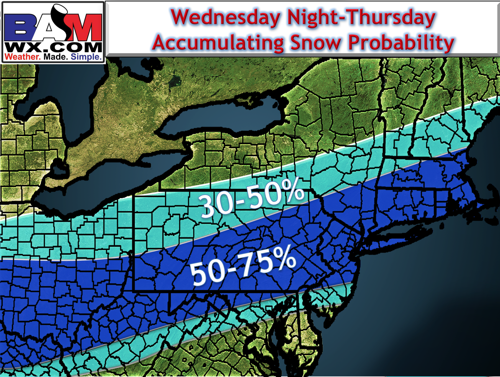
This system will depart Wednesday with cooler temperatures expected. We then turn our attention to the next system late Wednesday night into Thursday. This may bring accumulating snow to areas closer to the coast as a piece of energy dives into the Mid-Atlantic. Here’s the latest GFS and European thoughts on snowfall with this system.

Ensembles do support this system impacting the region. Here are the 51 European ensemble member low locations. Notice many have an area of low pressure southeast of New England supporting some snowfall.

Here’s my probability of 1″ or more. Probabilities have risen overnight.
Confidence and Risks:
- High confidence on snow and ice turning to rain tomorrow morning in interior southern New England. Rain elsewhere.
- Low to moderate confidence on any snow Wednesday night and Thursday – many moving parts can change the forecast at this lead time. Stay tuned!
Today’s video covers it all. ~Ed