
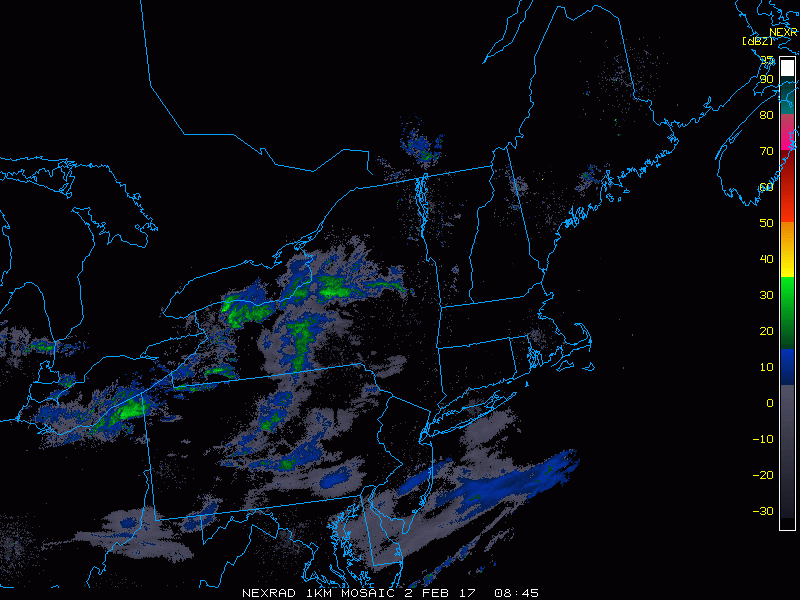
Good morning. We are tracking a cold front moving through northeastern Ohio, western/central PA and western NY right now, leading to some snow showers and squalls moving eastward. Here’s the radar as of 5:45 AM.
This front will allow both colder air into the region this evening as well as quick-hitting snow squalls through the region through the afternoon before they die out after sunset. The further west you are in the Northeast, the better chance of seeing a squall capable of producing a quick coating of snow and reduced visibility.
Timing of these squalls is tricky, but in general I expect them to occur during the morning in eastern Ohio and PA, moving into New England during the afternoon hours. The evening commute may be quite interesting in places like the Hudson Valley and southern New England if these squalls can hold together.
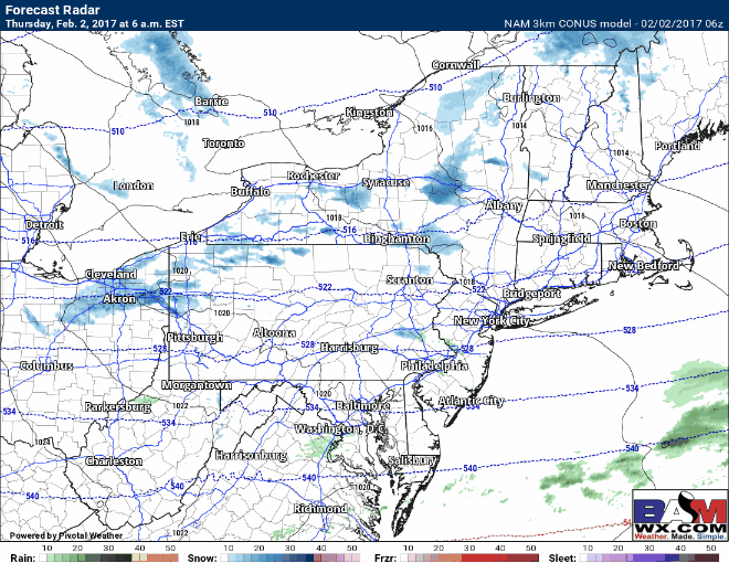
Here’s the projected radar across the Northeast through this evening.
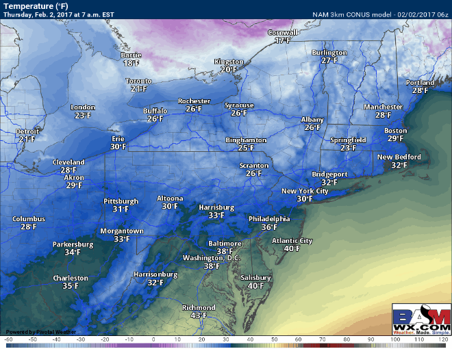
As the cold front moves through, temperatures will actually fall in the west later this morning, then fall later this afternoon farther to the east. Here’s the projected temperature outlook for today. Most will be in the 40s east and 20s and 30s west.
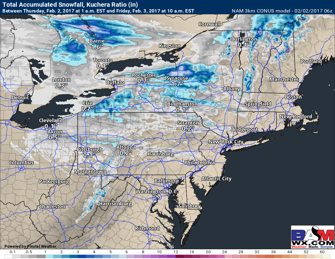
Snowfall today does not look incredibly heavy, but notice plenty of areas will see at least a coating from these snow showers and squalls, especially the further west you go in the Northeast.
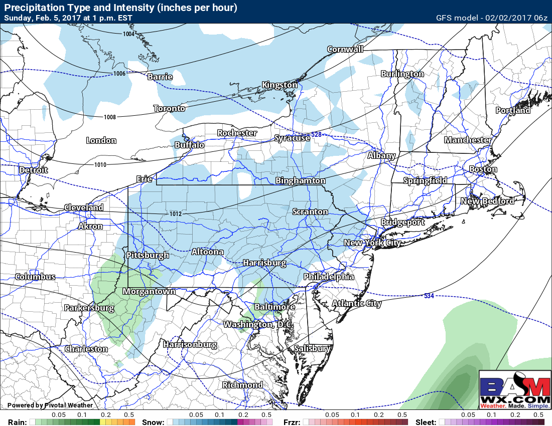
Friday and Saturday look to be fairly nice early February days with temperatures in the 20s and 30s along with some sunshine as high pressure remains nearby. Our next system arrives Sunday as a weak disturbance with only a few snow showers especially across PA and Ohio. Further east, snow showers will be extremely spotty in nature with temperatures near or above freezing. Here’s the GFS model 1 PM Sunday illustrating the potential for a period of light snow or snow showers, only accumulating a coating to perhaps an inch in some higher elevations.
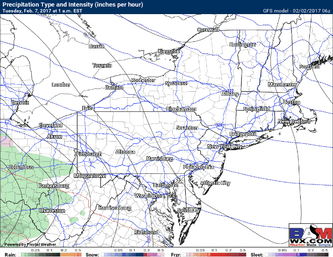
Our next system arrives Tuesday and this one is interesting. Initially, there will be a cold area of high pressure across New England allowing precipitation inland to be in the form of snow and ice Tuesday morning. But, like many storms this year, the high pressure will move eastward and precipitation will change to rain from south to north Tuesday afternoon and continue through the day on Wednesday before colder air filters back in Wednesday afternoon and Wednesday night. Here’s the latest GFS precipitation type forecast.
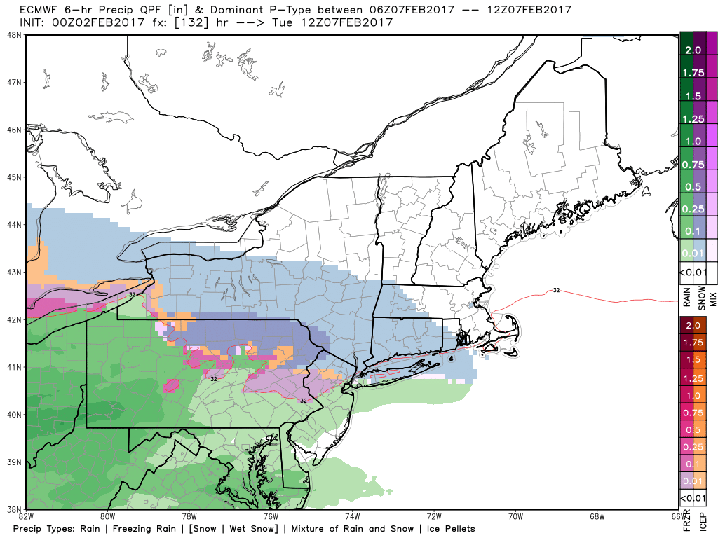
The European model for Tuesday morning is actually remarkably similar for 5 days out as well. We will monitor over the coming days and keep you updated.
Confidence and Risks:
- High confidence on snow squall activity today and colder temperatures through the weekend.
- Moderate confidence on a few snow showers Sunday across the interior northeast.
- High confidence on a storm occurring early next week.
- Low to moderate confidence on precipitation type and timing for the storm Tuesday.
Today’s video is about 5 minutes. ~Ed