
Key Points – Thursday, April 27, 2017:
Synopsis: Good Thursday morning! In today’s update we discuss the frost and freeze concerns and heavy rainfall threat in the east as we move throughout this weekend. Not only are we going to see above normal rains for the southern and eastern half of the Zone, but temperatures overall will be chillier than normal over the next week which certainly won’t speed up the evapotranspiration process. We need to keep an eye on this because if we don’t warm-up getting into May, the saturated soils could hang around for a longer period of time. Have a blessed day.
Freeze warnings and frost advisories hoisted today into Friday morning:

It’s a dry day today for the most part across Zone 8. Rain starts to develop across western Nebraska and Kansas tonight ~6-8pm and expand in coverage into early Friday morning with widespread rainfall.
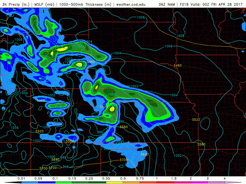
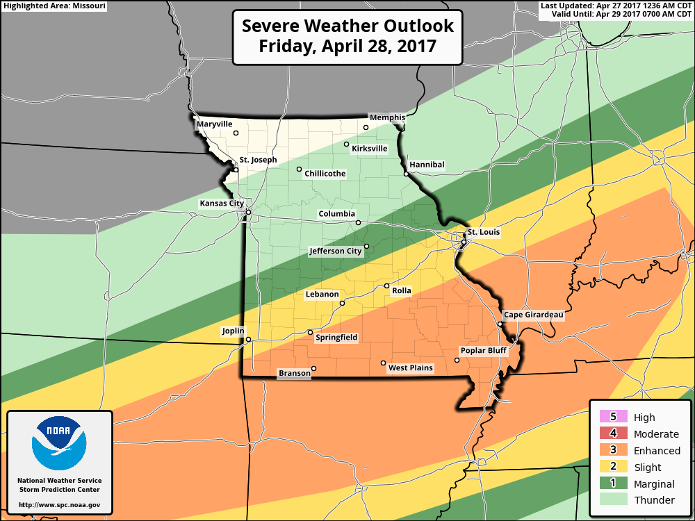
We have a risk for severe storms across far eastern Kansas into the southern half of Missouri later Friday into Saturday morning…currently, all modes of severe are possible including damaging winds, large hail, very heavy rains and isolated tornadoes along the warm front.
Showers and storms work east on Friday along with the low pressure system…waking up Saturday morning to very heavy rainfall (precipitation rates of 1-2″/hr possible) along the warm front and continuing throughout the day into Sunday as the low pressure system tracks through Kansas into Missouri and Iowa. Some clearing will be possible on Sunday across the western half of Zone 8 during the second half of the day as well.
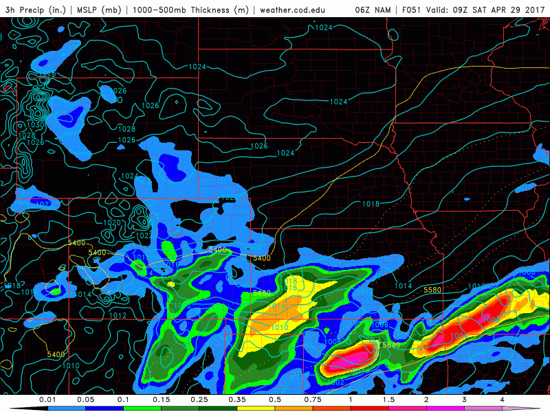
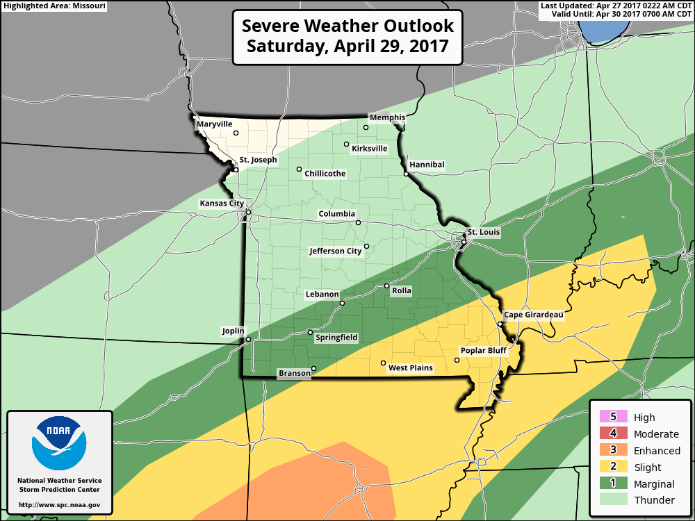
As the low pressure system continues to track east some gusty storms and isolated large hail will be possible later on Saturday as things start to move more towards the Midwest.
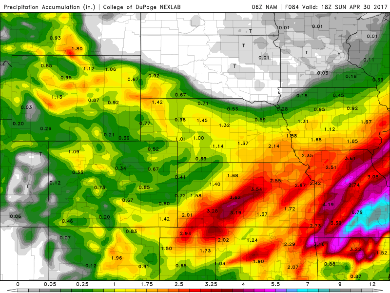
Total rains via the latest NAM forecast model through mid-day Sunday…widespread 2-4″ for Kansas, the problem spot is in Missouri where areas could see 9″+ in the southeastern locations…further north 1-3″ possible getting into northern Missouri and the southern half of Iowa.
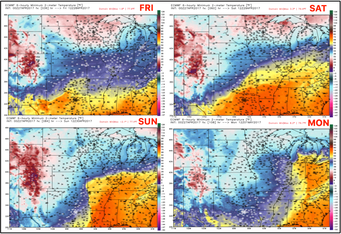
Passed this weekend we have a fairly quiet weather week next week…the issue is the overnight lows getting into Monday morning. Lows targeted for the 30s even some 20s, which certainly won’t help evaporate any of these heavier rains that fall going forward through Sunday.
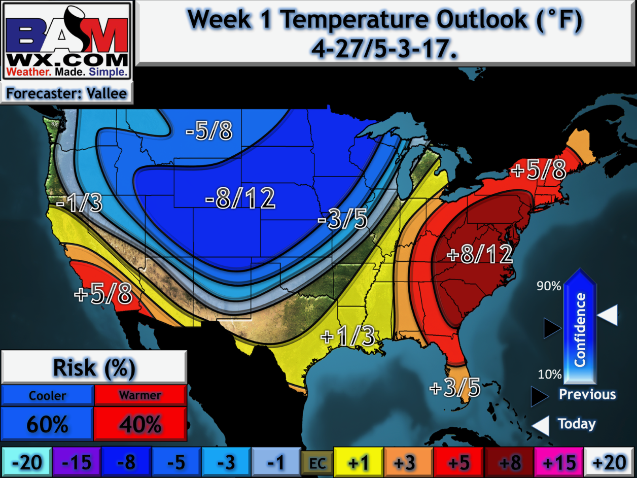
You can see the cooler than normal trend as well with our latest week 1 in-house long-range outlook updated this morning…some spots seeing 10º or greater cooler than normal temps through the start of May. We also discuss in our video the trend in week 2 is similar, not as chilly, but definitely not a warm signal creeping closer to mid-May.
Confidence and Risk:
- Above average confidence we start to see an increase in showers and storms Friday as things get going along the warm front.
- Average risk for strong to severe storms Friday into Saturday morning along the warm front.
- Confidence is average but continues to increase of where the heaviest rainfall sets up across portions of Kansas into Missouri Saturday into Sunday.
- Above average risk for additional strong storms later Saturday into Sunday as the low pressure begins to track into the Midwest.
Today’s video (7 min):