10-10-17 Kansas Update: Rains move out today – moderating temperatures mid/late week. N.
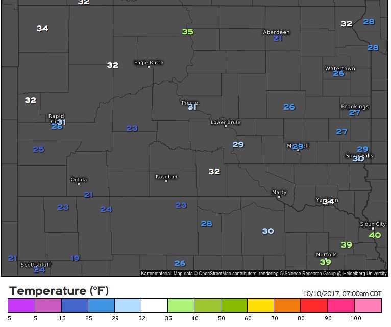
Today's Kansas video (5:36): https://www.youtube.com/watch?v=ULR2VMaAkEs&feature=youtu.be&hd=1 Very chilly morning across the state with freeze warnings in western portions of the state: Rain showers gradually shift east through the day, with sunshine returning from west to east. Our next system moves through this weekend bringing additional rain and storm chances Saturday through…