10-10-17 Iowa Update: Heavy rainfall today – drier mid-week. Frost concerns west tonight. N.
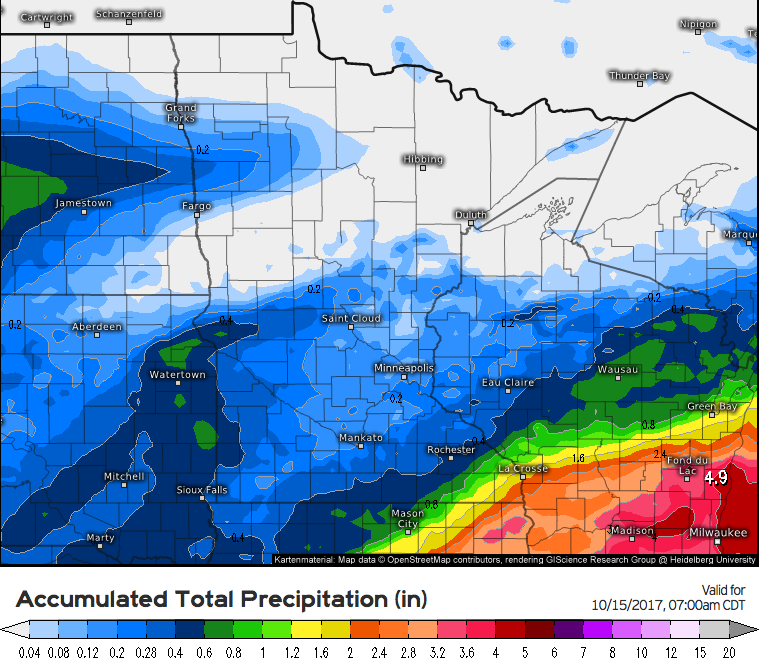
Today's Iowa video (6 min): https://www.youtube.com/watch?v=lNeoE-Y116M&feature=youtu.be&hd=1 Radar loop as of 7am CDT: Forecast rainfall over the next 24 hours....solid 1" to 2" across central, eastern, and southern Iowa through tonight. Weeks 1 and 2 temperature and precipitation outlooks: