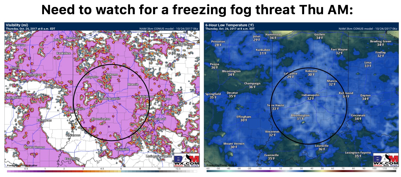
Today's Video (6:21): https://www.youtube.com/watch?v=EBpCCs4J-Mw&feature=youtu.be&hd=1 Very light lake effect showers possible across locations to the north and east...little to no rainfall accumulation will be possible; otherwise, sunny and cooler today.
Key Points - Monday, October 16, 2017: Synopsis: Good Monday morning! High pressure is building in this morning leading to clearing skies and a cool air mass. This area of high pressure sticks around all week with mainly sunny/warm days and clear/cool nights. Expect a gradual warming trend through the week.…
Sat AM IL Forecast Update. Strong Storms/Flash Flooding Today. Possibly Tornadoes. Details Here. M. Video forecast 6 mins. http://youtu.be/BUavEmgnB44?hd=1
Today's Video (4:56) http://youtu.be/Zh0ZKd4d81M?hd=1 Spin in the atmosphere this evening will be conducive for severe weather and localized tornadoes.
Sat AM MO Forecast Update. Severe Storms Tonight..Possibly Tornadoes. Video analysis on severe threat tonight. 6 mins. http://youtu.be/IE5XYYeuUto?hd=1 Area of greatest concern for the strongest storms tonight. 5-11pm roughly. Stay weather aware and if you have questions please do not hesitate to ask them by emailing [email protected]!
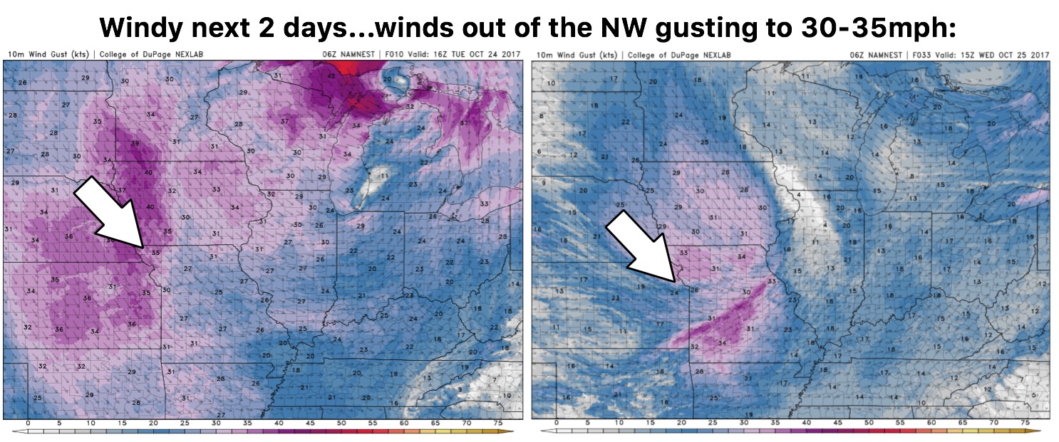
Today's Nebraska Forecast Video: https://www.youtube.com/watch?v=eKMS_DX_YGg&feature=youtu.be&hd=1 Forecast radar over the next 60 hours: Rainfall forecast over the next 60 hours: Strong area of high pressure builds in Sunday and dominates the first half of next week with a dry stretch of weather. (animation of surface pressure anomalies shown below...reds are higher…