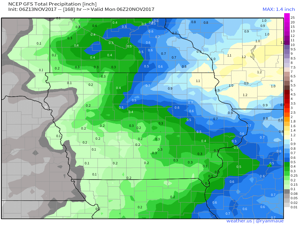
Today's Video (6 min): http://youtu.be/n_PcDKa2YOI?hd=1 Eyeing a strong storm to impact the state Friday into Saturday... Total precipitation idea through the weekend illustrates heaviest rains east. Updated week 1 and 2 outlooks.
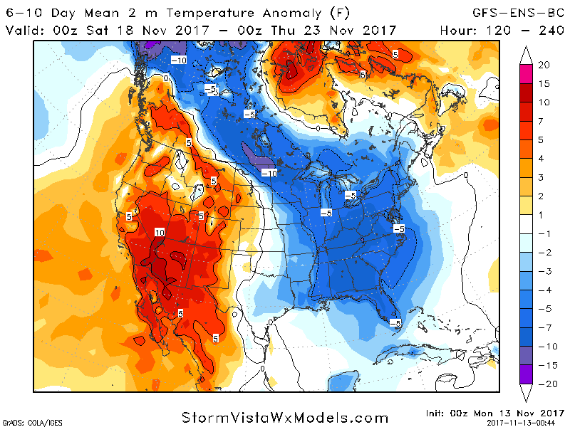
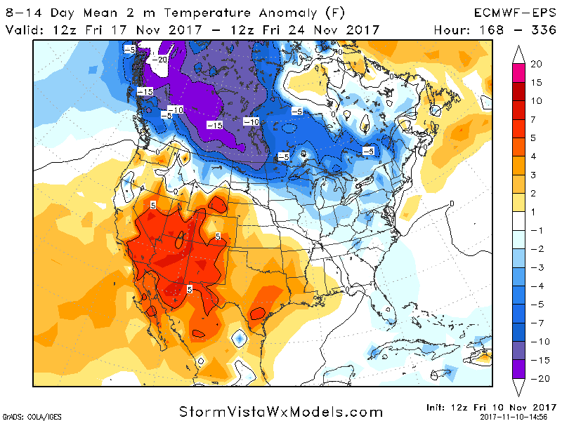
Some colder changes in overnight data especially for week 2 as additional high latitude blocking takes hold in the Atlantic. Quick sheet here: EnergyEAM
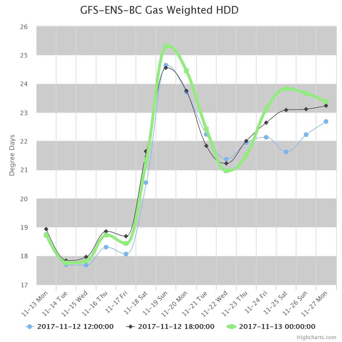
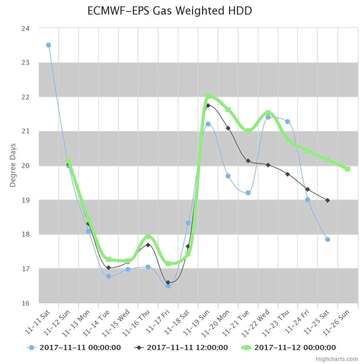
Some chatter about the European warming yesterday in week 2, however, newest data has cooled again. Latest HDD trends shown below. More on this, this week! Quick sheet link here: Sunday Energy
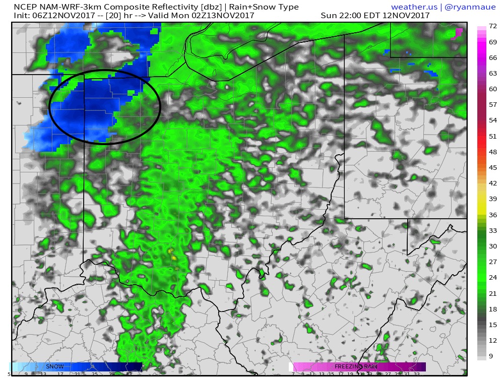
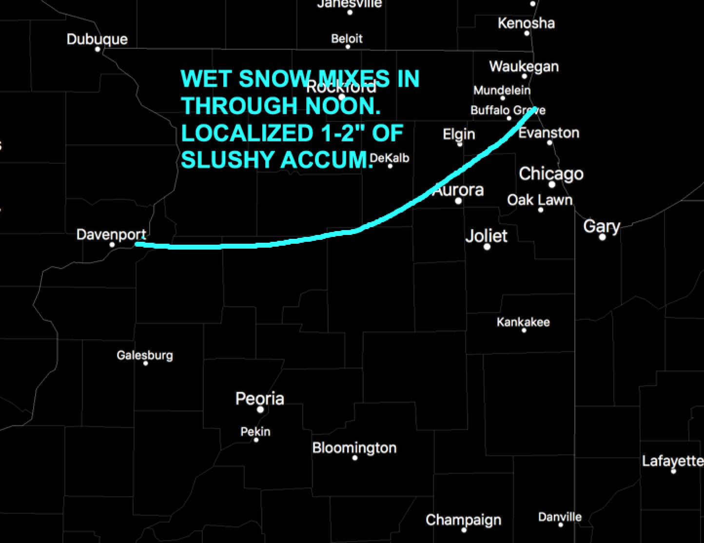
Today's Illinois Video Update: https://www.youtube.com/watch?v=THCnSyT5pVs&feature=youtu.be&hd=1 Some slushy snow accumulations possible in far northern/northwest Illinois this morning north of I-88, with localized 1-2" possible. Pending on banding, it would not shock me to see a band near Rockford to Freeport where locally higher sets up, but it is a nowcasting situation.…