January 2025 will be remembered as the year that turned the sandy beaches on the Gulf Coast to bright white.
By Bret Walts
While the month kicked off with heavy snow, ice, major power outages and arctic cold across the lower Ohio Valley, the highlight of January 2025 will undoubtedly be record cold and snow from Texas to the Carolinas in a storm that prompted the first ever Blizzard Warning on the Gulf Coast. This storm, which produced nearly a foot of snow in parts of Florida, was unlike any seen in recorded history and will be difficult to replicate again in our lifetimes.
The storm ramped up in Texas on the early morning hours of January 21, 2025, producing a rare 2-4″ of snow across the Houston Metro area, shutting down travel across the region. However, the most memorable part of this rare winter storm would be across parts of Louisiana, Mississippi, Alabama and Florida with records shattered across the region. Baton Rouge, New Orleans and Mobile each set all-time records for snow totals throughout the day on January 21st with 10″+ near Pensacola breaking the all-time Florida state record for snow.
Warmer than normal waters off the Gulf Coast enhanced snowfall bands with a visit from the Polar Vortex in the Great Lakes providing an ample supply of cold air to the region. For more on how this rare storm formed, check out our analysis here.
 January Ends with a Thaw
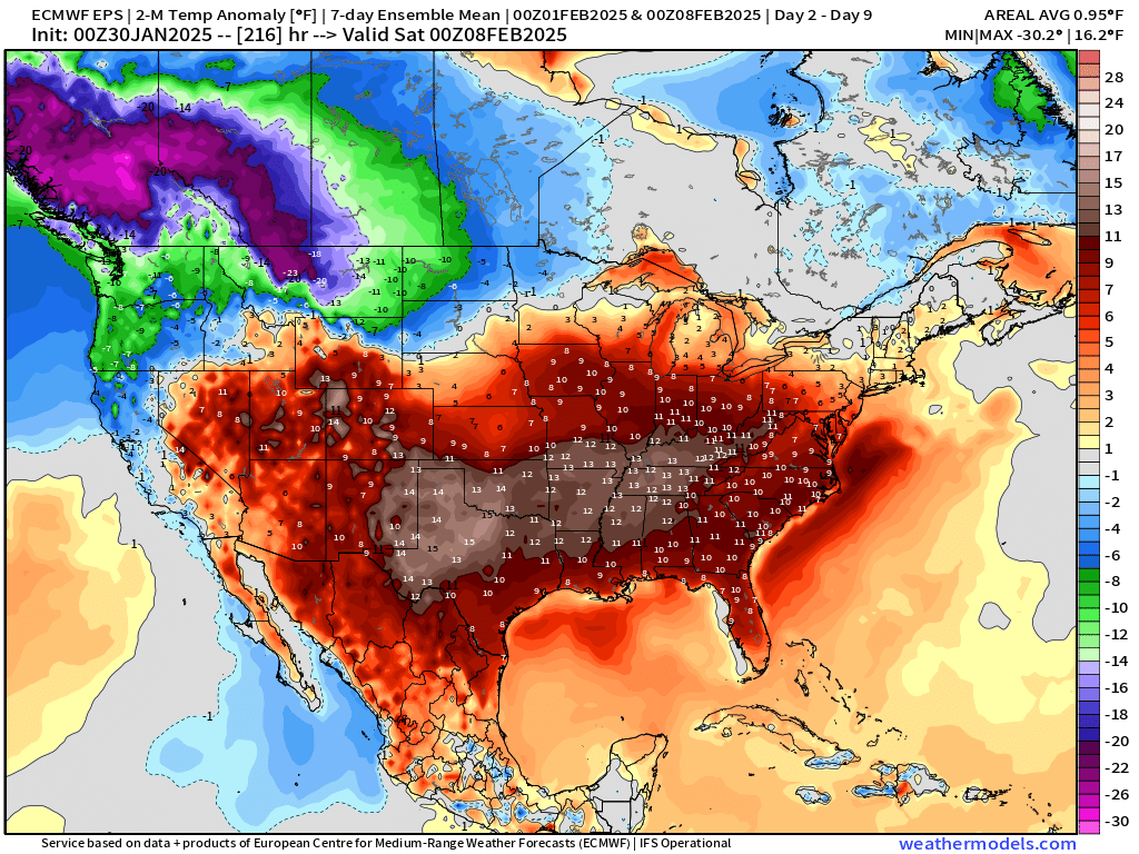
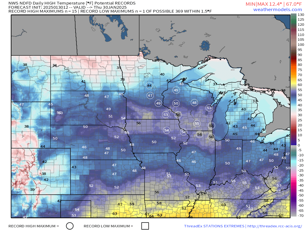
Though much of January 2025 has rivaled some of the colder years of the past 3 decades, the month is ending on a mild note for much of the lower 48. In fact, temperatures will surge into the 50s across the Upper-Midwest today leading to record highs broken for about 15 stations.
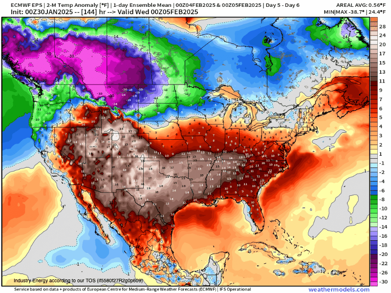
Temperatures for the first week of February will likely average out more than 10F ABOVE normal for this time of the year for many areas that dealt with an abnormally cold January. This will provide relief for heating units across the country that have dealt with the coldest January since 2014 from a heating demand perspective.
Winter Isn’t Done Yet
While the first week of February may feature more “spring-like” weather for much of the Southern two-thirds of the CONUS, February will likely be a month with a lot of volatility. An active storm track across the Eastern US for the second week of February and beyond will lead to big-warm ups and cool-downs with additional winter storm opportunities into the Midwest.
 Increased threats of heavy rain will also be present across the lower Ohio and Tennessee Valley regions. Snow threats will likely shift further north than January bringing snow-drought areas in the Upper-Midwest more chances for winter storms.
Bottom Line: February features more up/downs than January. While the pattern won’t be as cold, it will offer up more storm/winter storm opportunities with stretches of spring-like weather mixed in for the Midwest and a warmer pattern in the southeastern US. Notable cold and snow will be frequent in the Pacific Northwest, Mountain West and Northern Plains.