Below normal winter snow combined with persisting La Niña conditions could enhance drought risks for the Plains into the growing season.
By Bret Walts
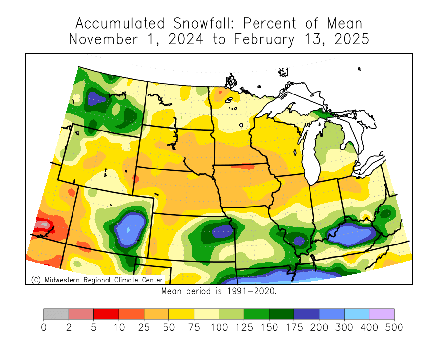
Abnormally dry conditions from late Summer through Fall caused soil moisture to drop substantially for areas across the North Central US into the Midwest and many of these areas have continued to struggle to catch up even amid one of the coldest winters in the past 15 years.
The primary storm track this winter has set up from the Central Plains to the lower Ohio Valley and up the East Coast skipping over the Upper-Midwest and N. Plains. In fact, parts of Northern Iowa have experienced the driest start t0 a year in 133 years of records.
This type of dryness in the part of the year that typically should provide a surplus of moisture thanks to colder temperatures will make to easier for conditions to develop as we work into the warm season. This stage is already set as soil moisture percentiles continue to run low for these areas.

In addition to ongoing dryness, La Niña may exacerbate the problem as we head into spring and summer. This year’s La Niña developed later than normal into the winter season, meaning its impacts will likely be felt well into Spring and potentially summer.
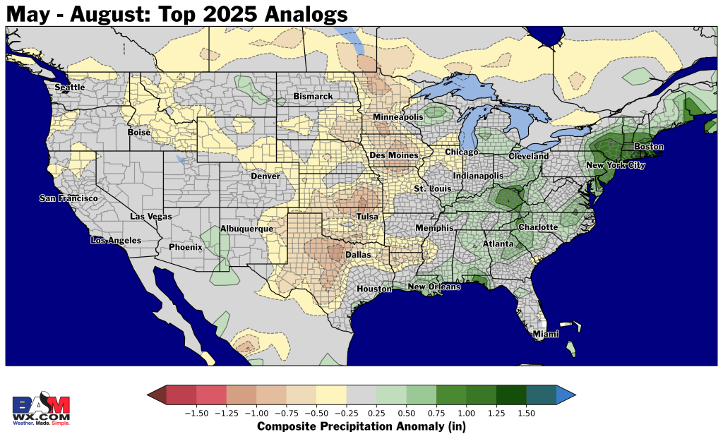
Historically, years that lingering La Niña forcing into Spring and Summer along with similar oceanic conditions across the Globe, tended to run drier than normal across the Plains especially into the Summer months. These years are highlighted in the map below.
Be sure to check out the full Spring/Planting Season forecast breakdown and analysis on February 26, 2025 at 11AM ET at BAMWX.com/webinar.