Winter 2023-2024: warmest on record?
By Hope Kleitsch
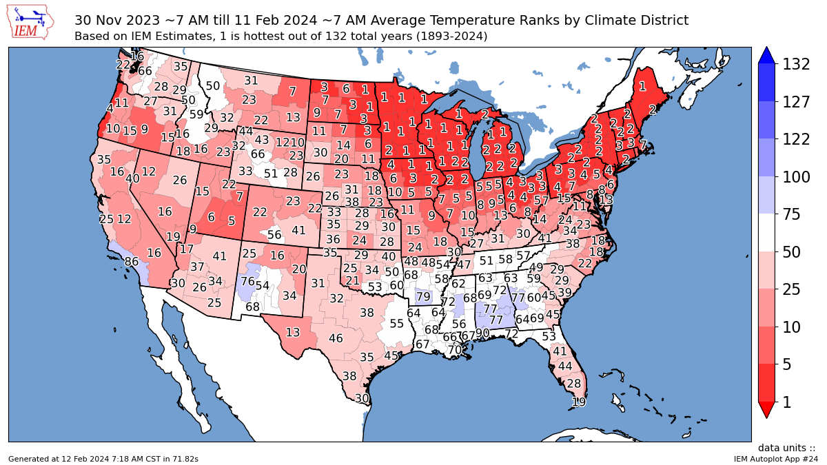
The 2023-2024 winter season has been rather boring for the Ohio Valley region. December was dry and mild. January was wet, cooler than December, but still warmer than average, despite the arctic cold snap. Now, February is very mild and bone dry. All three months have been warmer than average, locally, and for most of the country.
Here’s a look at how this winter has been in Indianapolis:
- December
- Average temperature: 40.8ºF – 7.5º above normal
- Precipitation: 1.26” – 1.66” below normal
- January
- Average temperature: 29.0ºF – 0.5º above normal
- Precipitation: 4.92” – 1.80” above normal
- February (as of 02/14)
- Average temperature: 42.3ºF – 11.9º above average
- Precipitation: 0.10” – 0.93” below normal
- Snowfall
- Total: 4.2”
- Average: 20.2”
- 3rd lowest amount received on record.
Even without the rest of February being recorded, this winter is on track to be the warmest ever in Indianapolis. It has also been quite the lackluster winter in terms of snow. As noted above, this is the third lowest amount of total snowfall for the season on record, with nearly 16” of missing snow. The average last 1.0”+ snowfall for the season is typically on March 1, so there is still time, though the odds are not in the snow lover’s favor.

Around the nation, average temperatures have been above normal and that directly correlates to the heating demand across gas companies throughout the U.S. In the chart above, GWHDDS is the demand for gas heating. The colder it is, the higher the demand is for natural gas to heat people’s homes. The opposite is true for when warmer temperatures infiltrate, lessening the need for natural gas.
The chart is the DJF Gas Weighted heating Degree day observations from 1952 to now. This winter season is estimated to be the warmest on record (least gas needed). The previous warmest record was the 2015-2016 winter season.

So why the warmth?
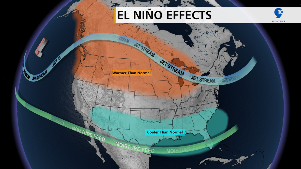
There are many factors that play a role in the nation’s weather. This season has an exceptionally strong El Nino pattern. When El Nino comes into the picture there are a few components that change our weather:
- A strong subtropical jet tends to make the southern U.S. wetter
- A poleward North Pacific Jet stream which allows for warmer air from the Pacific and subtropics to move further north towards Canada.
With a strong El Nino, this pattern is even more amplified and the effects (warmth) become even more noticeable.
In the 2015-2016 season, the abnormal warmth came from a strong El Nino as well. The average temperature for the season trended over 4 degrees above normal in Indianapolis. Other notable strong El Nino years are 1992 and 1998. These two years are also in the top 10 warmest seasons on record, alongside 2015-2016 and 2023-2024.

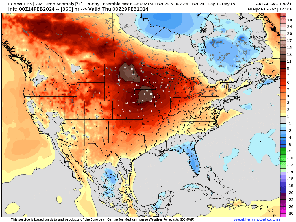
Over the next two weeks, the United States is expected to experience more of the same – warmth across the Northern and Central US with below normal heating demand reflective of the strong El Niño forcing. The map below highlights the average temperatures vs. normal over the next 14 days from the European Ensemble Model:


