Key Points – Friday, June 23, 2017:
Synopsis: Good Friday morning! We have an update on the heavy rainfall moving through the Midwest today as a cold front meets the tropical remains of Cindy. Expecting these rains to move east early Saturday morning leading into a very nice weekend of cooler temp (~70s) and drier conditions. However, as we discuss in the video the pattern looks to remain active getting into mid-next week and beyond as we start feeling more northwest flow. Have a blessed weekend!
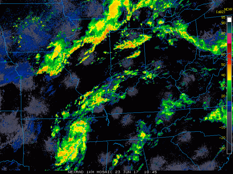
Current Radar:
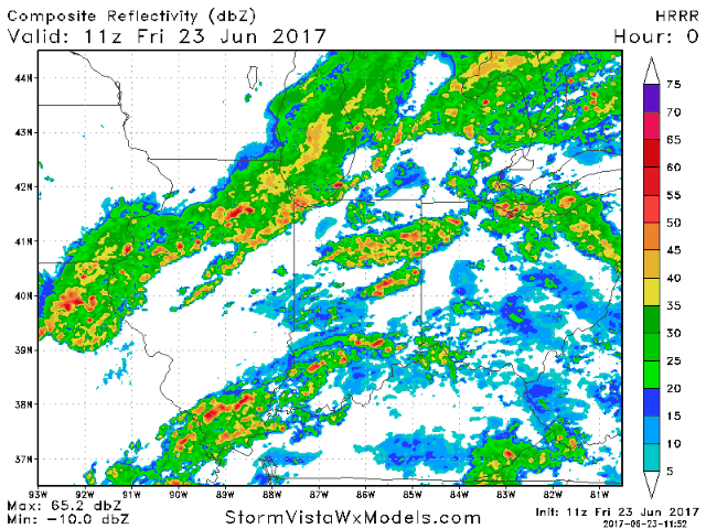
Simulated radar from the HRRR for the rest of the day shows the cold front colliding with the tropical remains of Cindy…very heavy rainfall will work its way out of here by 3-4am Saturday morning. It gets incredibly nice this weekend with much cooler weather settling in.
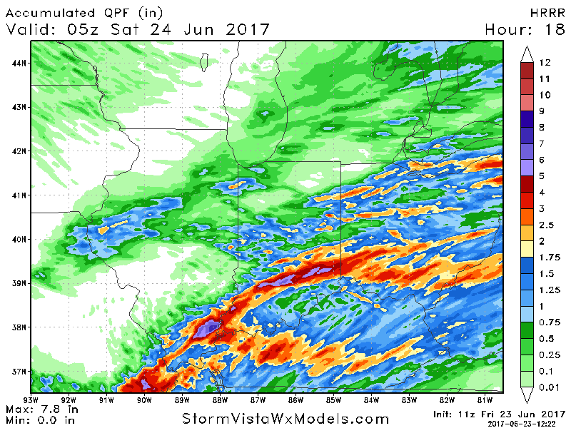
Latest thoughts on total rainfall as this system works its way through over the next 24 hours east…localized heavy rainfall will be possible of 1-3″ with isolated higher amounts possible.
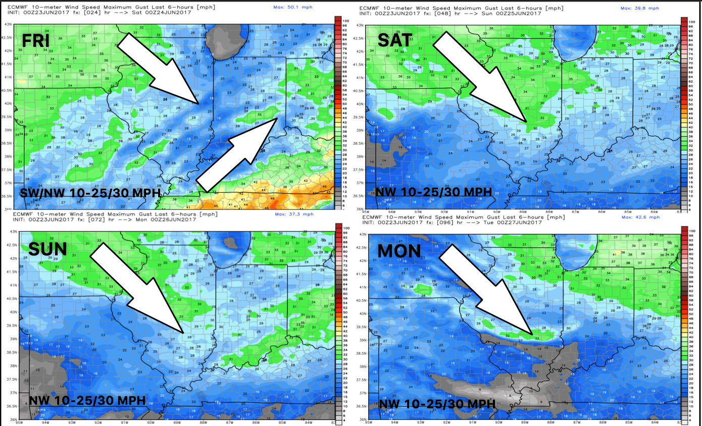
Here’s a glance winds over the next 4 days:
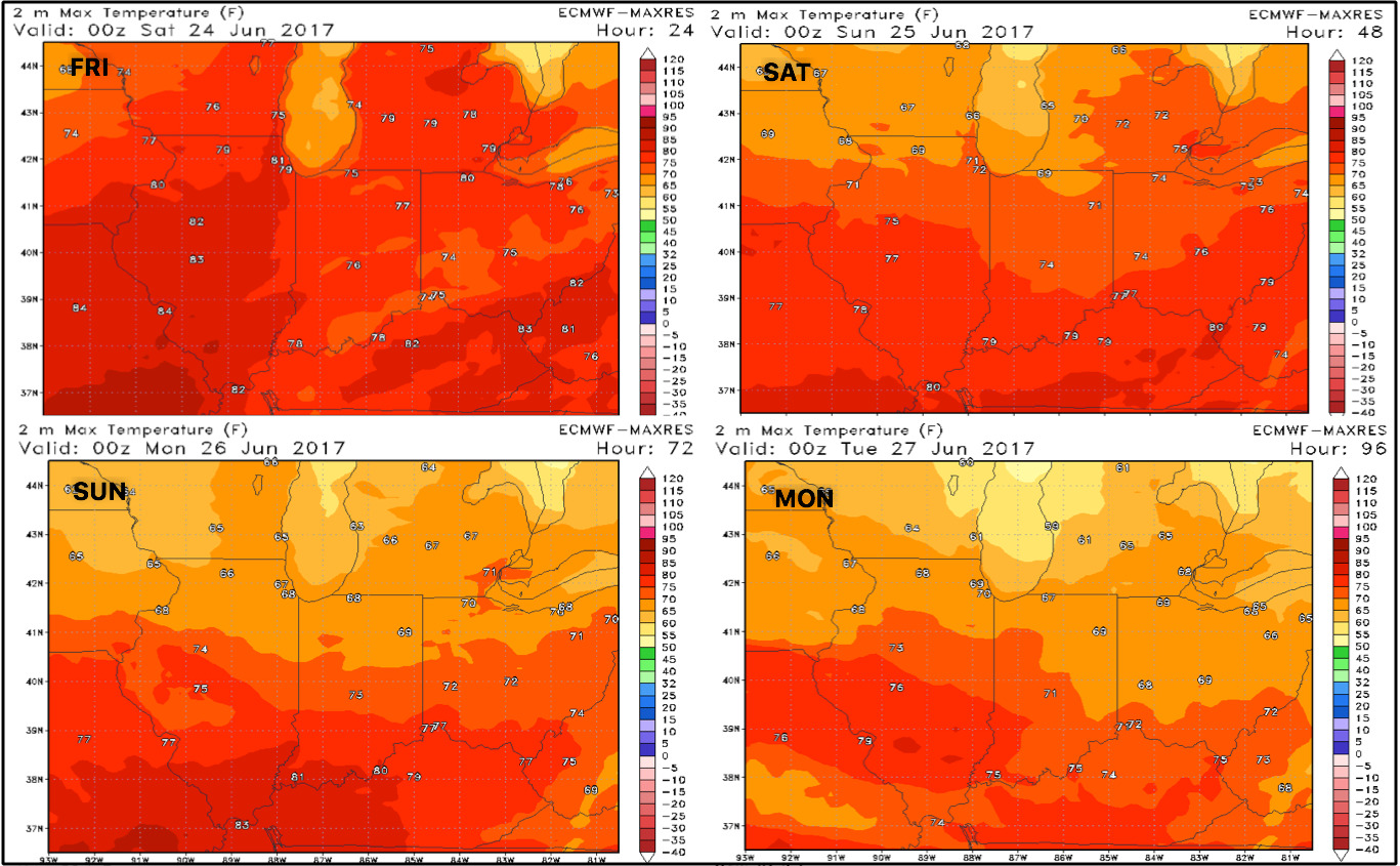
Taking a look at temperatures as well, we see the cooler trend ahead as we move into early next week:
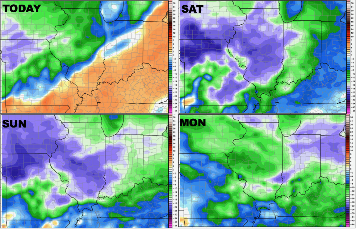
Dew Point anomalies show the much more comfortable air ahead as well:
We discuss in the video how the pattern remains active into mid-next week and beyond into early July…as we start feeling more “Northwest Flow”, the storm cluster season looks to be upon us here in the Midwest. In simple terms, a lot of opportunity for above normal rains as seen below.
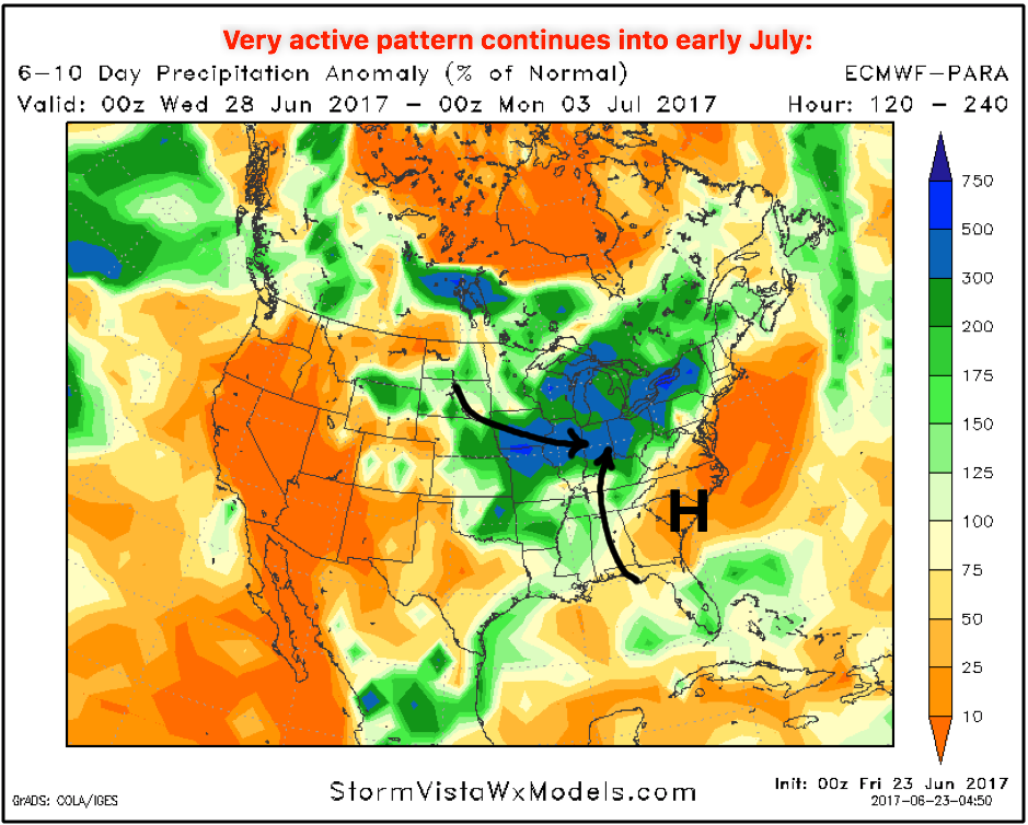
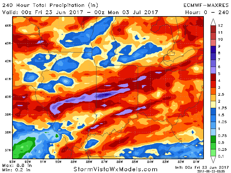
Total rain over the next 10 days…we aren’t 100% sold on the 6″+ call here, but what you want to focus on is how active the pattern is as we open July.
Confidence:
- Above average confidence additional heavy rainfall works south and east across the midwest today into early Saturday.
- Average to above average confidence we will see some locations receive 3″+ localized heavy rains…can’t rule out some flash flooding.
- Above average confidence a much more comfortable, cooler pattern sets in through next week.
- Increasing confidence the pattern activity ramps back up mid-next week and beyond as a northwest flow moves in.
Video (6 min):