Good morning, My latest forecast analysis has changed somewhat from yesterday with respect to the weekend system. Models are behaving very erratically with the track of the heaviest rainfall and how quick the actual storm system moves out. Yesterday the European had an upper level low hanging around and the American data was progressive with the storm. Today its the exact opposite. We should have a much better idea by Wednesday. Tonight late after game time there is a small outside threat of a T’shower so would advise covering field up to avoid the risk. Still looking at a strong storm threat Thursday night with coverage ~60-70% right now. Here is my latest extended forecast for the area specifically.
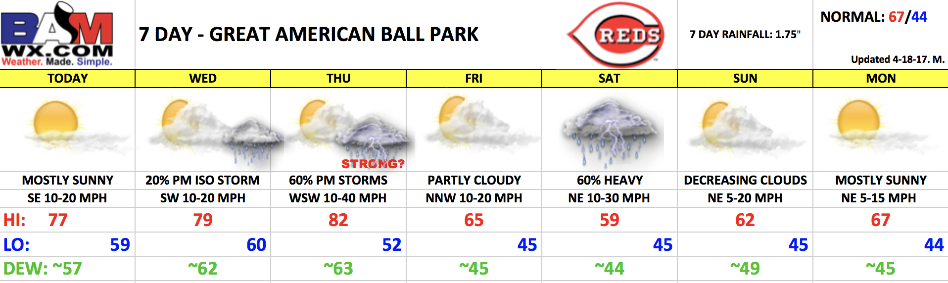
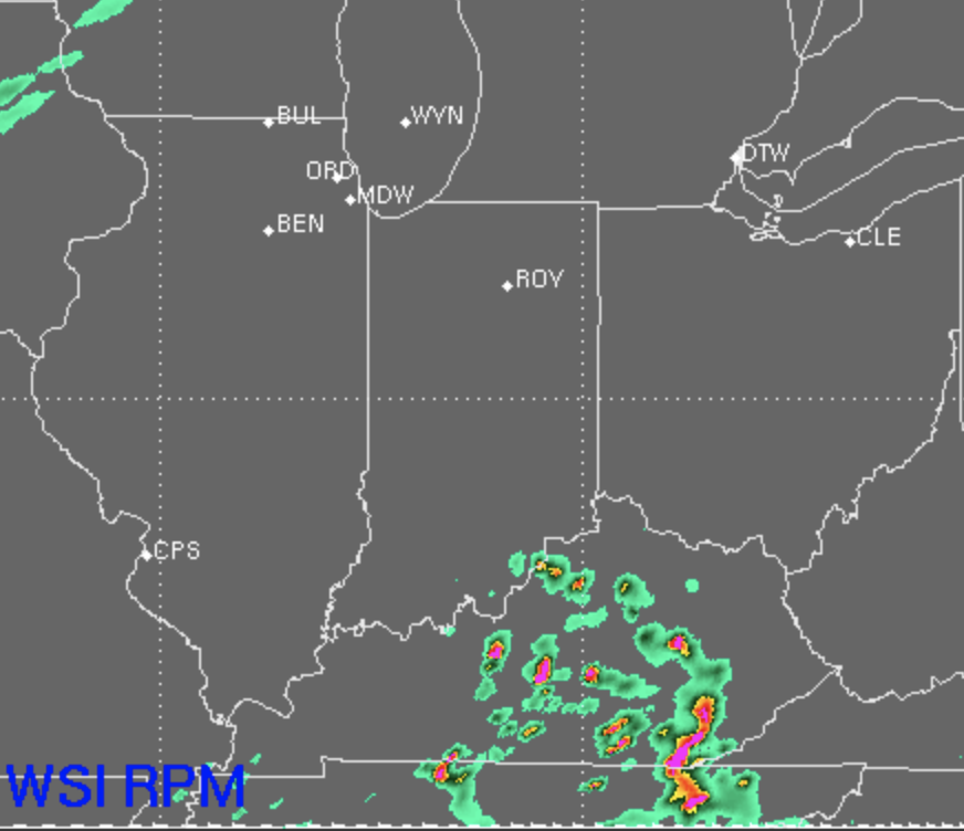
Overall I forecast a dry game this evening. You will see some scattered storms off to your south but upper air wind fields suggest they stay south of the area. Should be a really nice evening for some baseball.
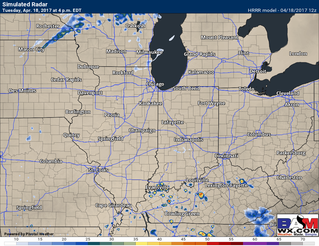
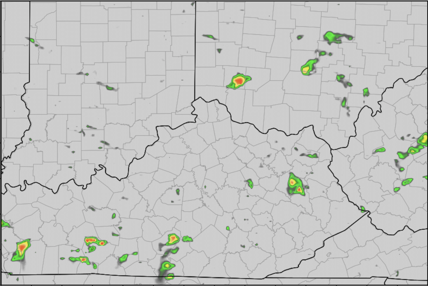
Tonight: Latest HRRR continues to carry a small T’shower chance as warm front lifts north. Again I would cover just in case.
Wednesday: There is a small chance of an isolated storm in the area Wed evening but as of right now it looks widely scattered and a minimal 20% threat.
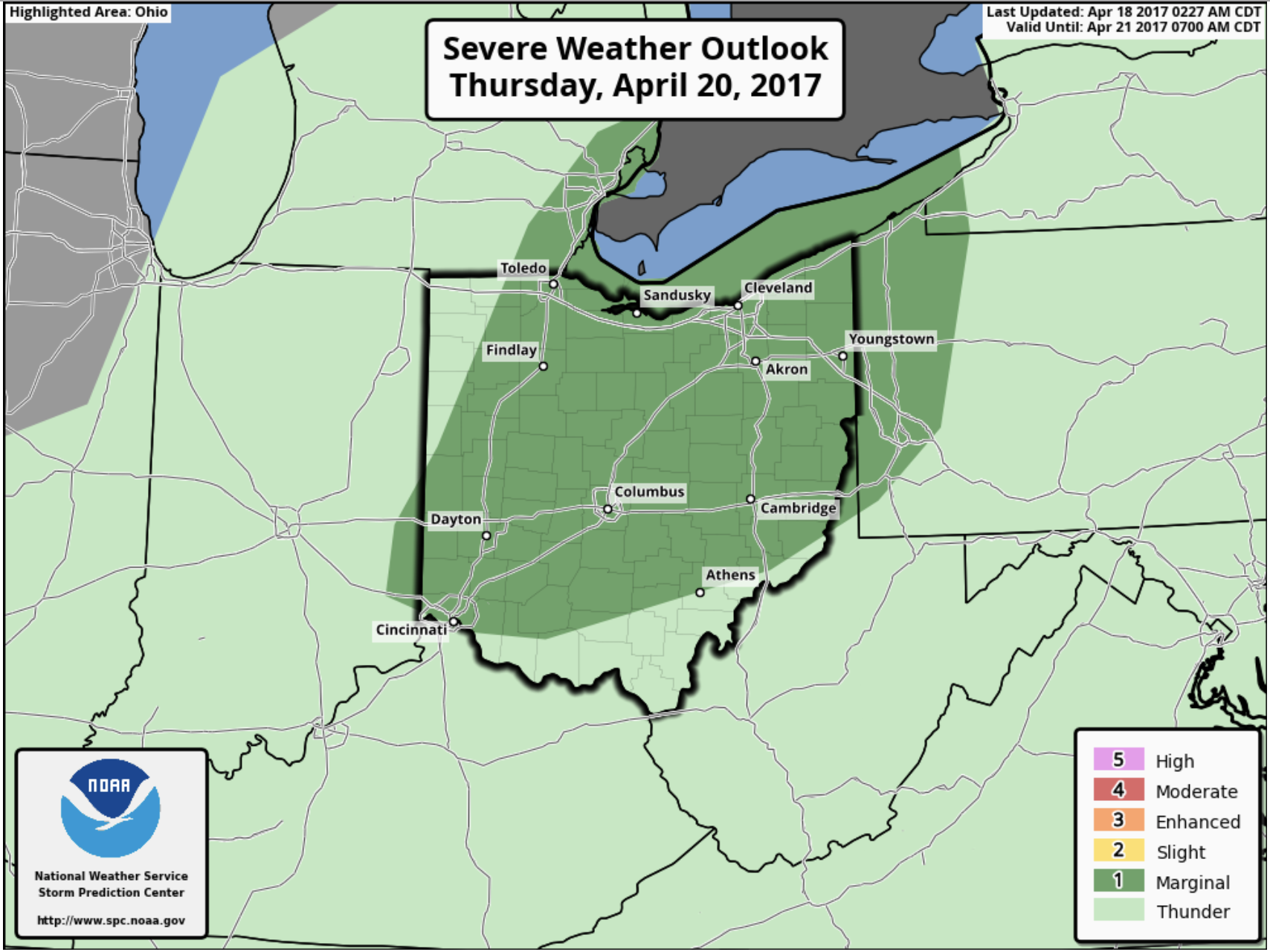
Thursday: I do see an enhanced rain and storm threat Thursday between the hours of 5-10pm as a cold front swings through the area. Right now thinking 60-70% coverage with a few gusty to strong storms not out of the question. Dew points and precip water values are high so a locally heavy rainfall threat needs mentioned too. Currently models really like ~8pm for Cincy area.
Severe storms forecast right now has us in a MARGINAL risk which is the lowest level risk. However I do have a suspicion this could go up to a slight risk given latest dynamics being advertised by data.
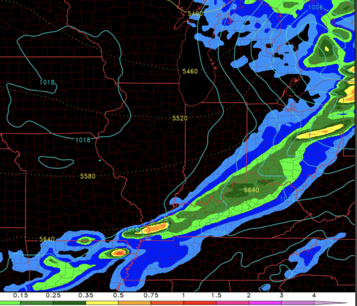
Total rainfall by Thursday AM could end up ~0.50″ to locally 1″ IF we get under a heavy storm along the front.
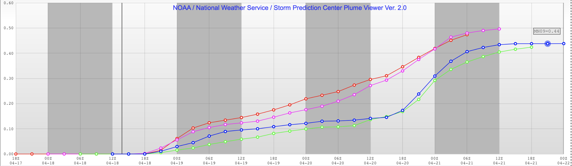
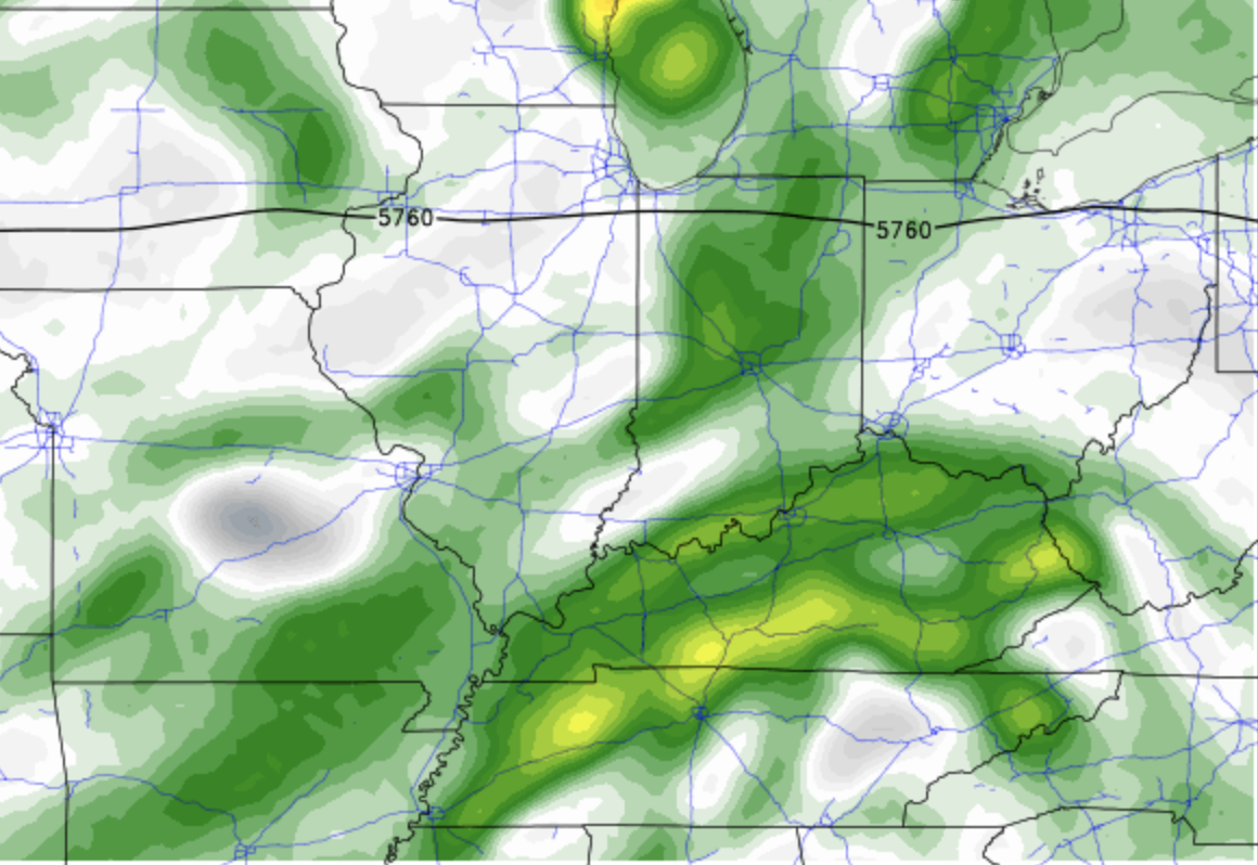
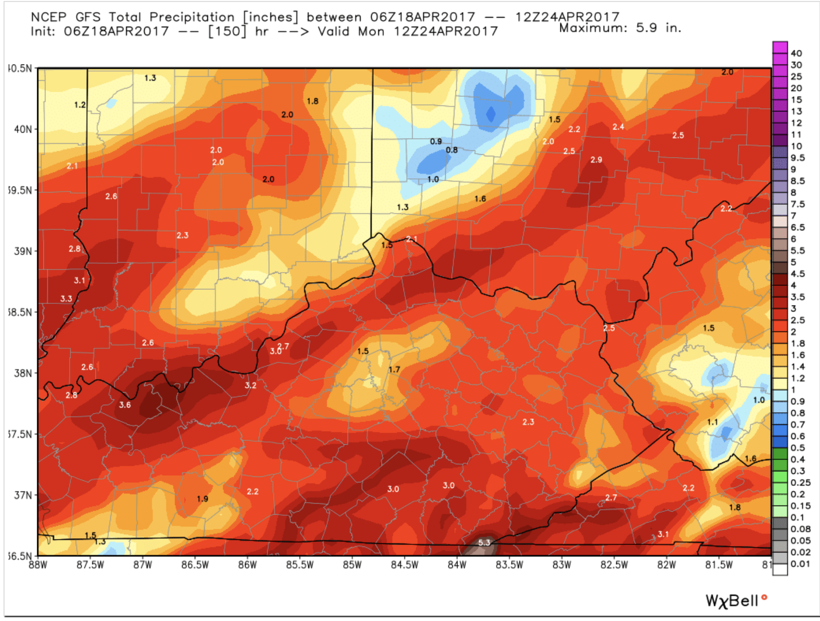
Weekend system total rainfall right now. Again bulk of this looks to come during the day Saturday and exit by early Sunday via latest data. This is still a fickle forecast.
Please let me know if you have any questions.
Respectfully,
Michael Clark
Bamwx.com