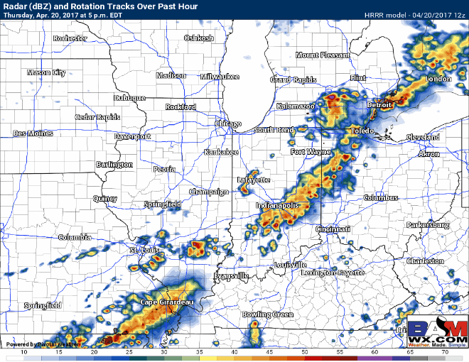
Good morning, monitoring radar and satellite this morning across the region in anticipation f0r strong storms tonight. Overall the ideas from the last several days have not changed. Im targeting storms in the area from 6-11pm. I do think some delays are on the table if we can get under one of these storms. There is a cold front passing tonight so the forcing for development is there for sure. Here is a look at forecast radar tonight from 5pm-1am.
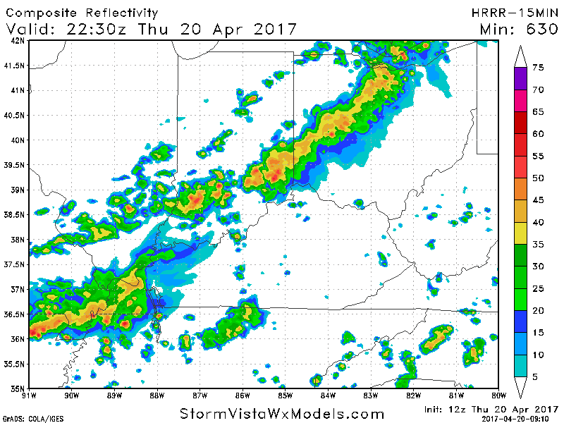
The HRRR 15 min increments (experimental) is pretty aggressive with a prolonged rain threat developing tonight which could cause longer delays or even a cancellation if it pans out. Its just a general idea or possibility.
Severe storms outlook for today still has just north of Cincinnati under a slight risk the reason for this is because these storms will weaken as they are running on a narrow line of instability. With that being said I still believe we are dealing with T’storms tonight. 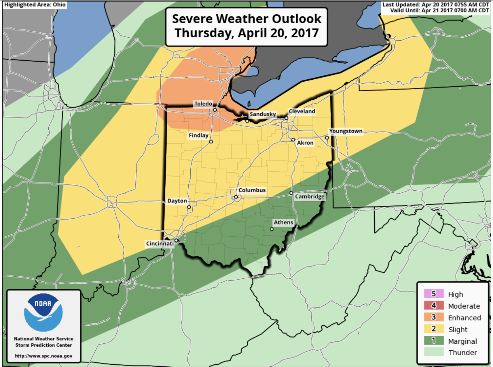
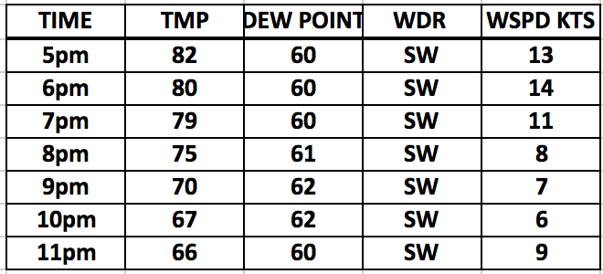
Here is an hour by hour conditions forecast for tonight. Keep in mind a gusty wind up to 50-55MPH can be expected with a storm if its overhead.
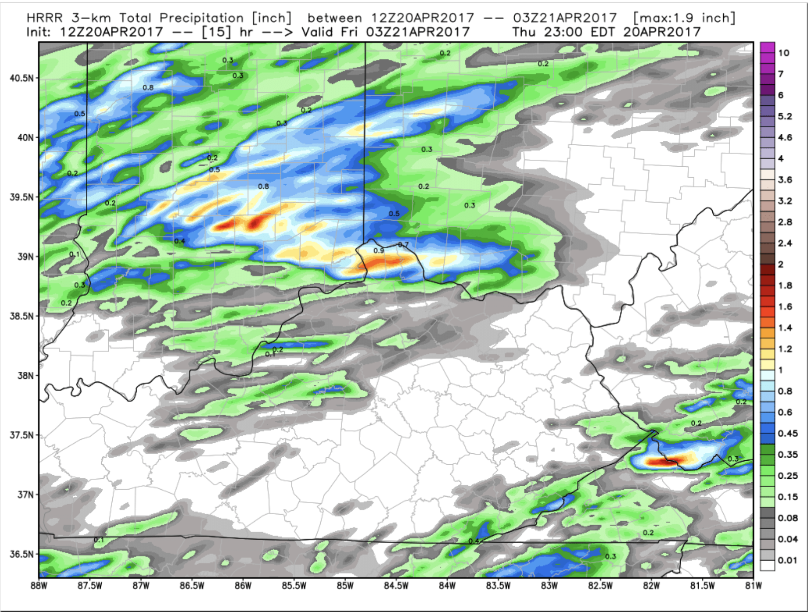
As far as tonight goes the forecast is dry after the storms move through but the rain threat works right back in late Friday. Ill have more on that in the morning. Here is total possible rainfall for tonights system only. If you have any questions please let me know.
Meteorologist
Michael Clark
Bamwx.com