Key Points – Friday, August 4, 2017:
Synopsis: Hey Good Friday morning! Starting off with temps this AM running anywhere from 10-30º below average…unbelievable for this time of year…feels like fall; this very cooler regime hangs around the next 10 days. In the video we target multiple rounds of storms moving west to east across the central Plains this weekend, some these storms may be strong to severe with localized flash flooding. If you have any questions please let us know, have a blessed weekend!
Today’s video (6 min):
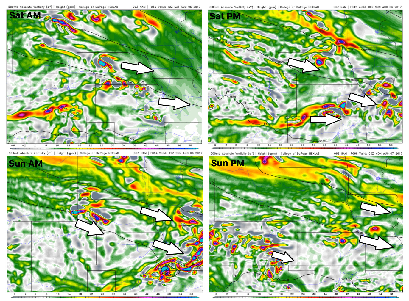
Energy forecast is below where we see multiple storm clusters moving east across the central Plains this weekend:
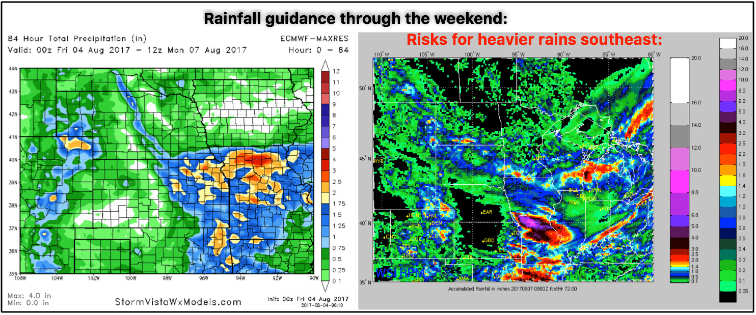
Rainfall guidance is tough this weekend, all depends on where exactly these heavy rainmakers set up shop; we have guidance, as shown below on the right that suggests double-digit rainfall across Missouri which can’t be written off. Otherwise, where storms develop, pockets of 1-3″ (isolated higher amounts) is the forecast. We also think the rainfall guidance is underdone across parts of central Nebraska and central Kansas on the models. We do think parts of Iowa get in on scattered rainfall as well ~0.5-1.0″.
Worth a mention, that the ARW-core of the WRF data (same data in the RPM model on the right above) also suggesting heavy storms possible on Saturday moving west to east through Iowa. More on this in a short-term later today.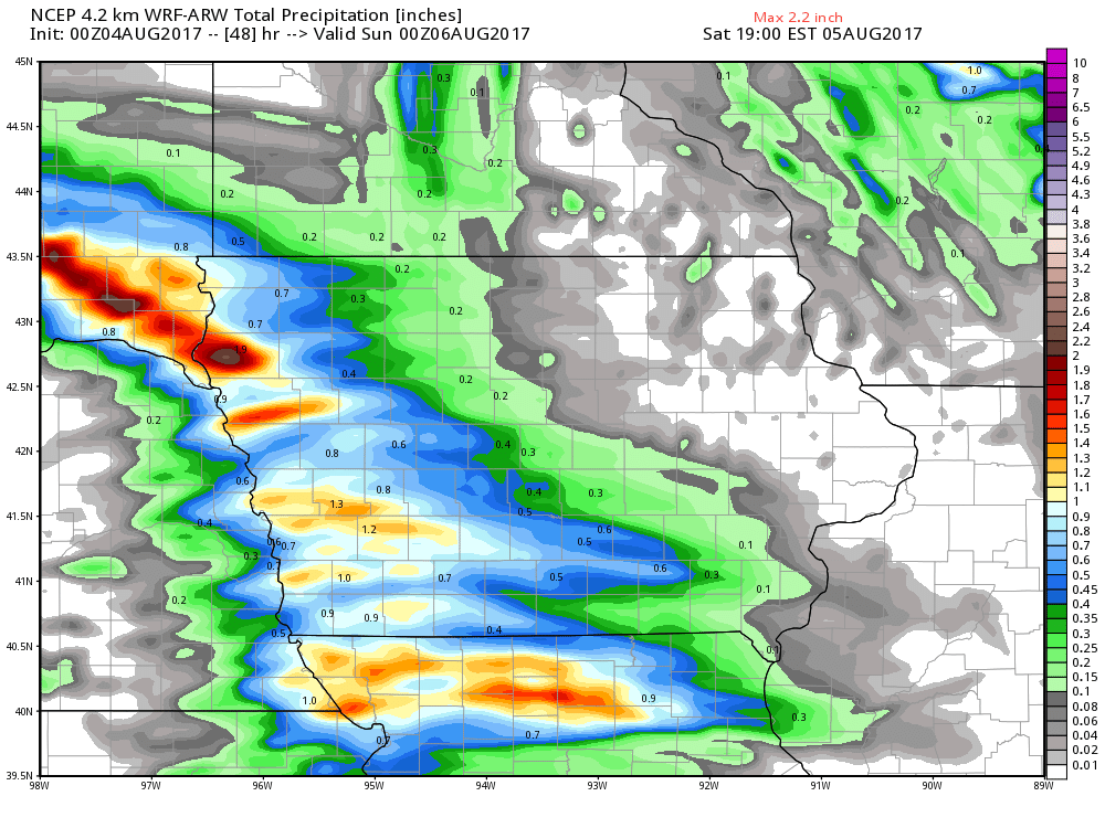
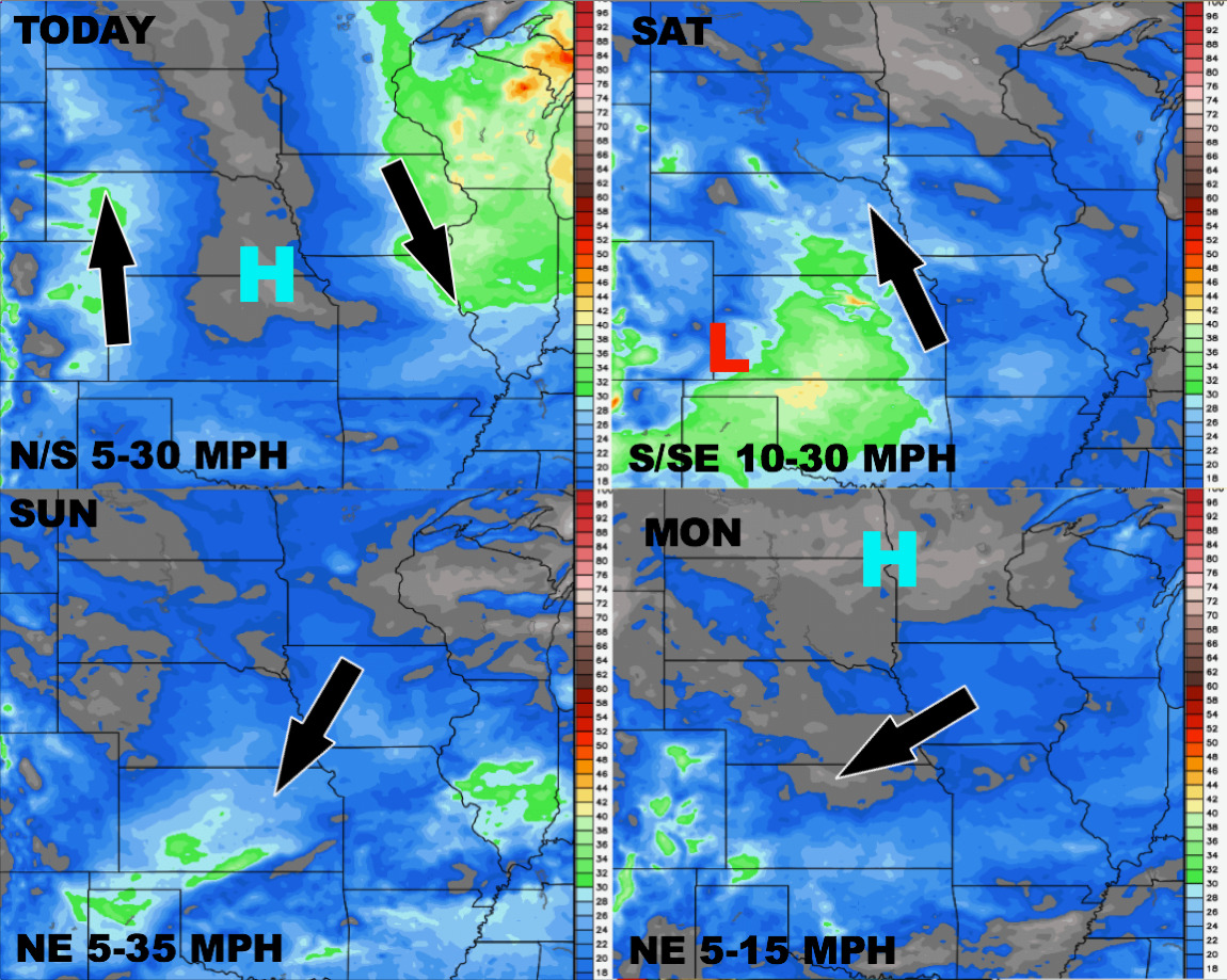
Wind forecast into early next week:
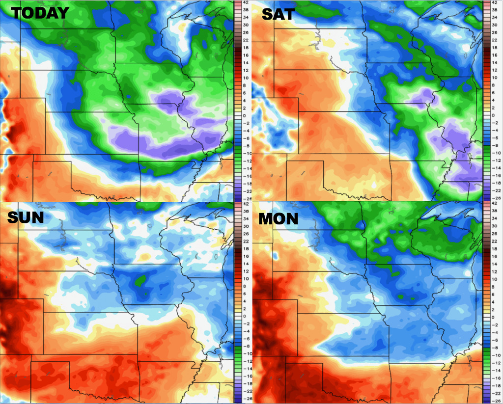
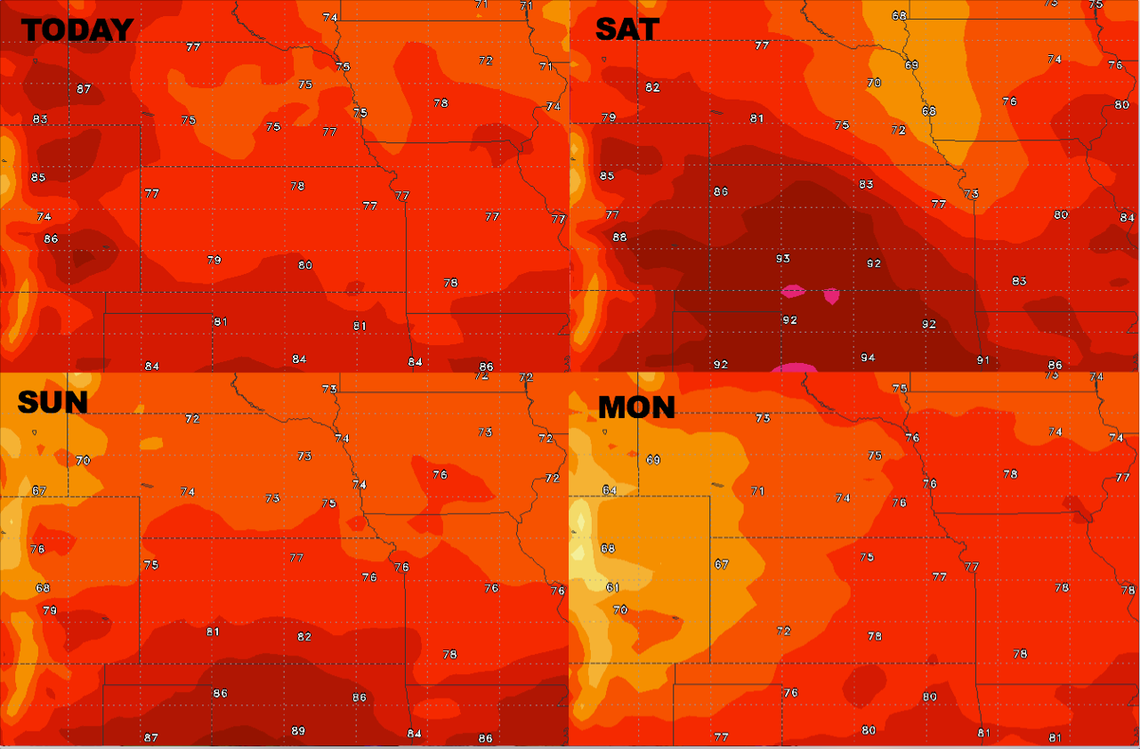
High temperature guidance over the next 4 days stays overall cooler than normal:
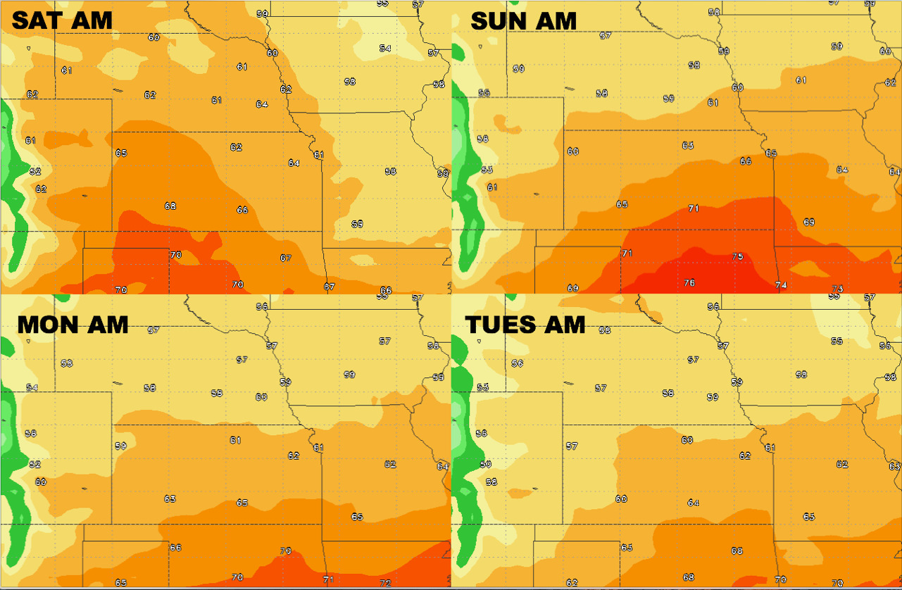
Overnight low temperature guidance:
Dew points from normal: