#SDwx #NDwx #WIwx #MNwx Active Regime Continues, Colder Week 2 Risks Too! E.
Synopsis: Good morning! A relatively tranquil day is expected today, but we are tracking a disturbance to bring some rainfall tomorrow especially across southern and eastern areas of the region. A secondary system will move through the region Saturday with additional rainfall as well. A cold front will usher in cooler air Sunday, raising the freeze threat Monday morning. The next threat for significant rain comes Tuesday to much of the region as an area of low pressure moves through. Yet another system is in the cards for late next week as well – quite a wet pattern!
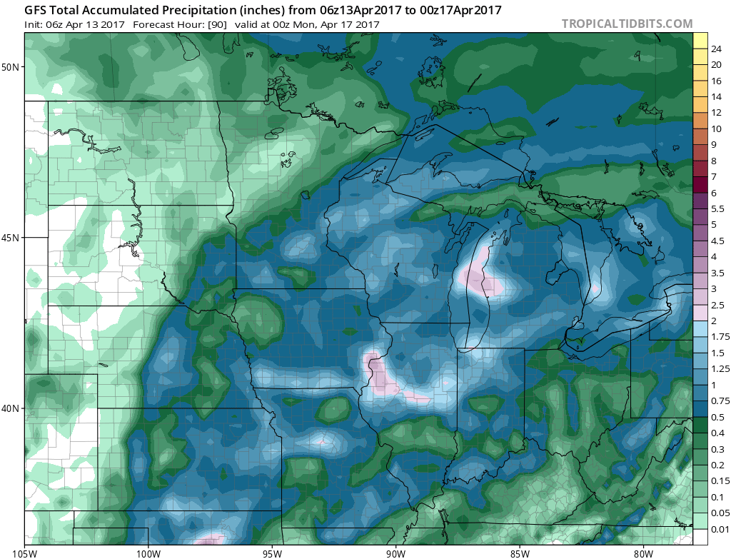
Our first system moves through the region Friday into the weekend with widespread rains, heaviest across the southeastern portion of the forecast area. Here’s a look at the latest GFS model.
Rainfall though Sunday will range from 0.50-1.50″ in southeastern areas, with 0.05-0.25″ across the Dakotas.
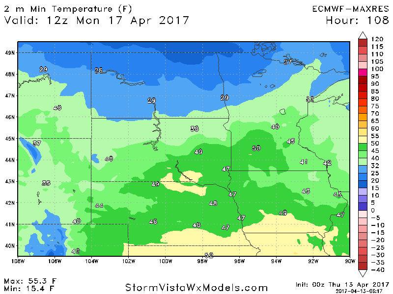
Behind this system, the frost and freeze threat returns for the northern half of the forecast area Monday morning. Here are projected overnight lows.
A more substantial is becoming more likely early next week with widespread heavy rainfall late Monday through late Tuesday. Here’s a look at the latest European model.
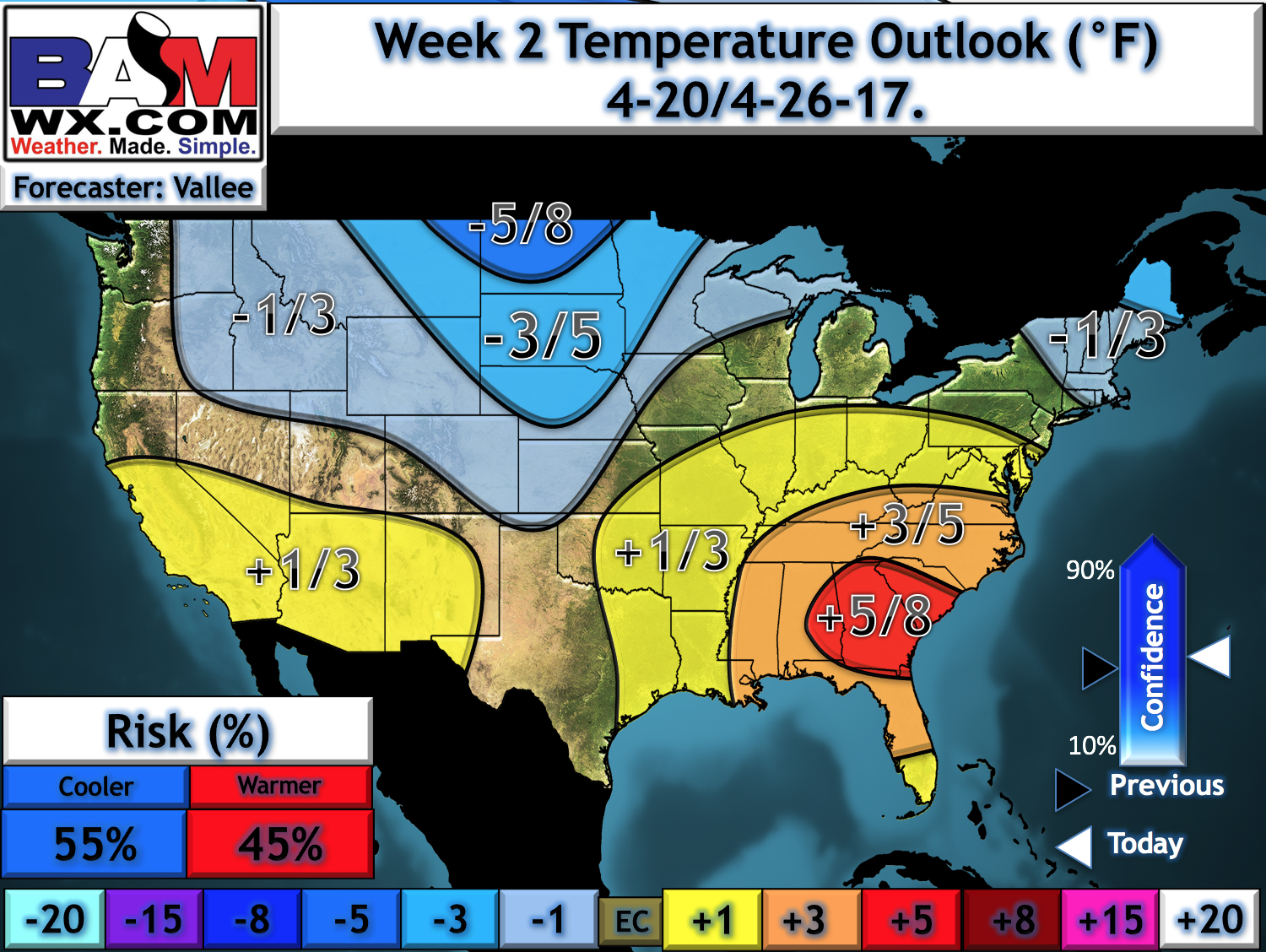
Beyond this, colder risks lie ahead for the end of next week and beyond. This comes with frost and freeze threats especially north. Here’s our latest week 2 temperature anomaly forecast.
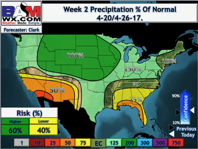
Precipitation will also remain above normal through week 2 as we have discussed for the last few weeks.
Confidence and Risks:
- Above average confidence on above normal rainfall through week 2 across the region.
- Average confidence on rough timing of systems through next week. Exact timing is still uncertain.
- Average to above average confidence on cooler risks continuing through week 2.
Today’s Video (6 minutes):