Synopsis: Good morning and thanks for checking out this zone 9 update! In today’s update, we discuss a wave of low pressure moving through the region along a warm front, as well as a developing strong area of low pressure to our south that may bring severe weather to southern South Dakota and southern Minnesota. Overall, a very active next few weeks is expected with rainfall well above normal. Severe weather threats will also increase, especially the farther south you travel across the Upper Midwest and Plains.
The warm front will ride northeastward today bringing showers and even some freezing rain and sleet to northern Minnesota this afternoon and tonight.
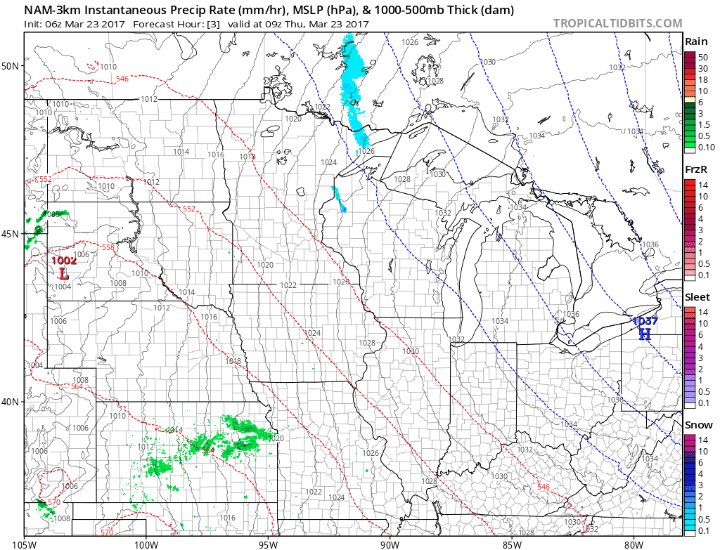
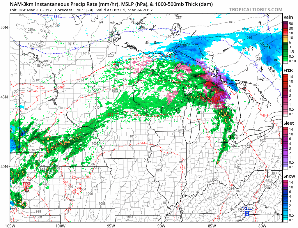
Another stronger area of low pressure will push northward this evening with showers and thunderstorms. Some severe weather is possible in southeastern South Dakota along a warm front early tomorrow morning, but the set up is quite marginal. Hail and damaging winds will be the biggest threat.
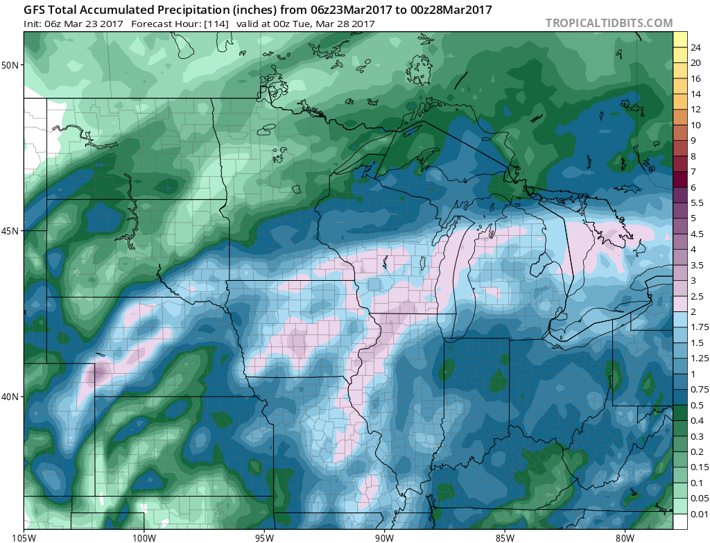
Rainfall through early next week is quite impressive for southeastern South Dakota and southern Minnesota, ranging from 1 to as much as locally 3 inches. Less rainfall is expected across northern areas further away from the storm track.
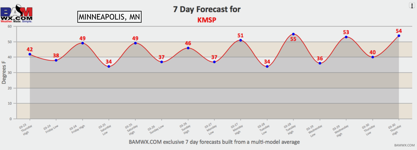
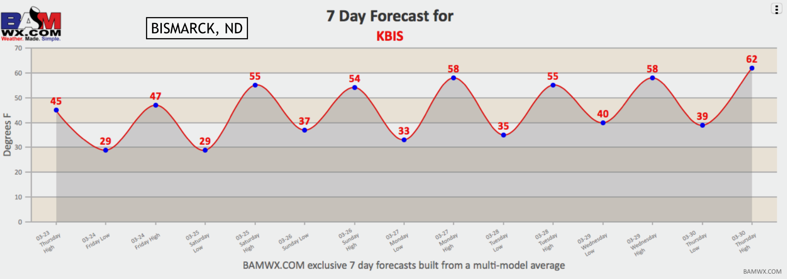
Temperatures over the next week will be rather warm. Here’s a look at our custom 7 day forecasts you can access under the “zones” tab then click on “7 day forecasts” to choose the airport code closest to you.
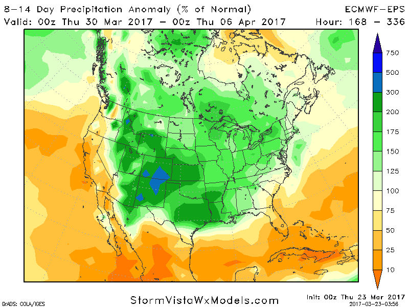
The wet (and warm) regime will continue well into week 2 and beyond as well with 150-250% of normal rainfall expected.
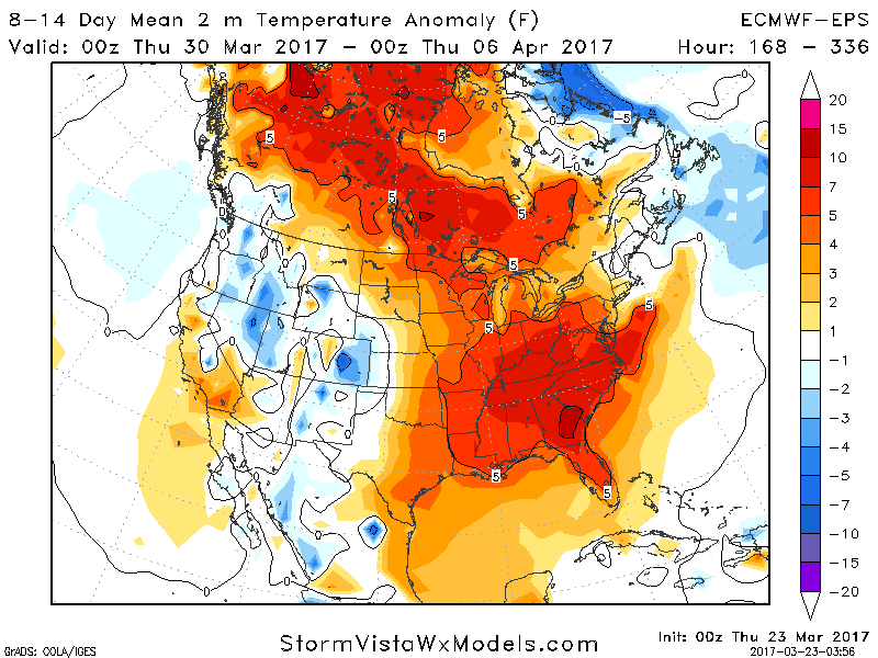
Temperatures will also be above normal region wide. 3-5°F above normal in western areas to as much as 7°F above in eastern areas.
Confidence and Risk:
- High confidence in a stormy, wet, and warm pattern lasting over the next 2 weeks and beyond region wide.
- Average to high confidence in some brief icing tonight across northern areas with steady rain across southern areas.
- Low to average confidence in locally severe storms across southeastern SD and SW Minnesota through tomorrow morning.
Today’s video (7 minutes):