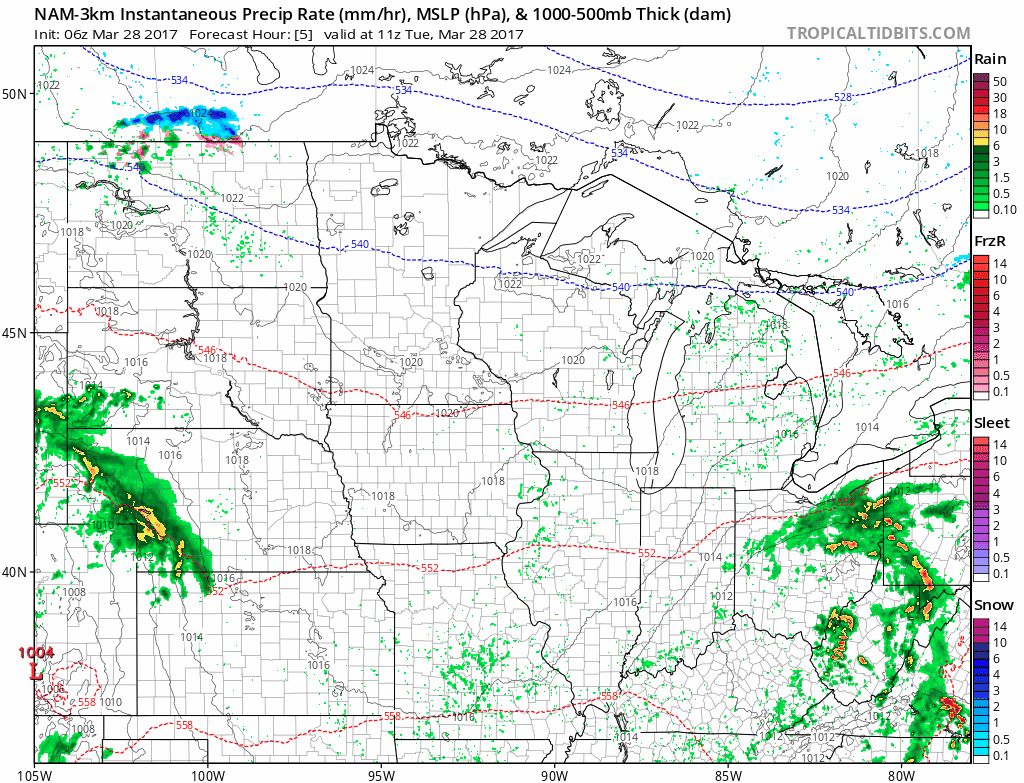
Synopsis: Good morning! We have a few showers currently across extreme northwestern North Dakota and a few showers across southwestern South Dakota as well this morning. This is associated with a developing area of low pressure to our south. This system will consolidate south of the region through midweek with only southern Minnesota and Wisconsin seeing any appreciable rains. This pattern of rainfall staying (mainly) south of the forecast area looks to continue through the weekend along with temperatures staying above normal for this time of year.
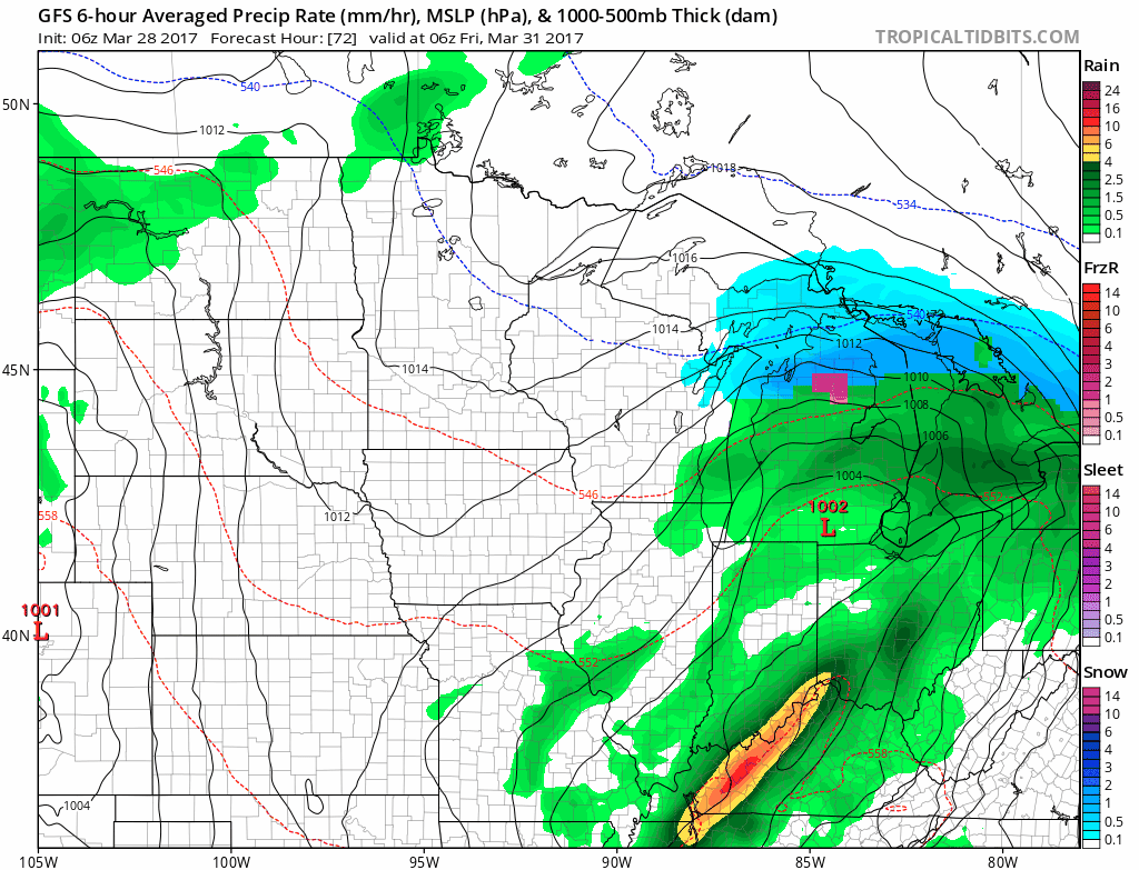
The ongoing activity will remain in western SD through the day today. Elsewhere across the region we will see some sunshine with temperatures into the 50s and 60s for many! Here’s a look at the projected radar through the day.
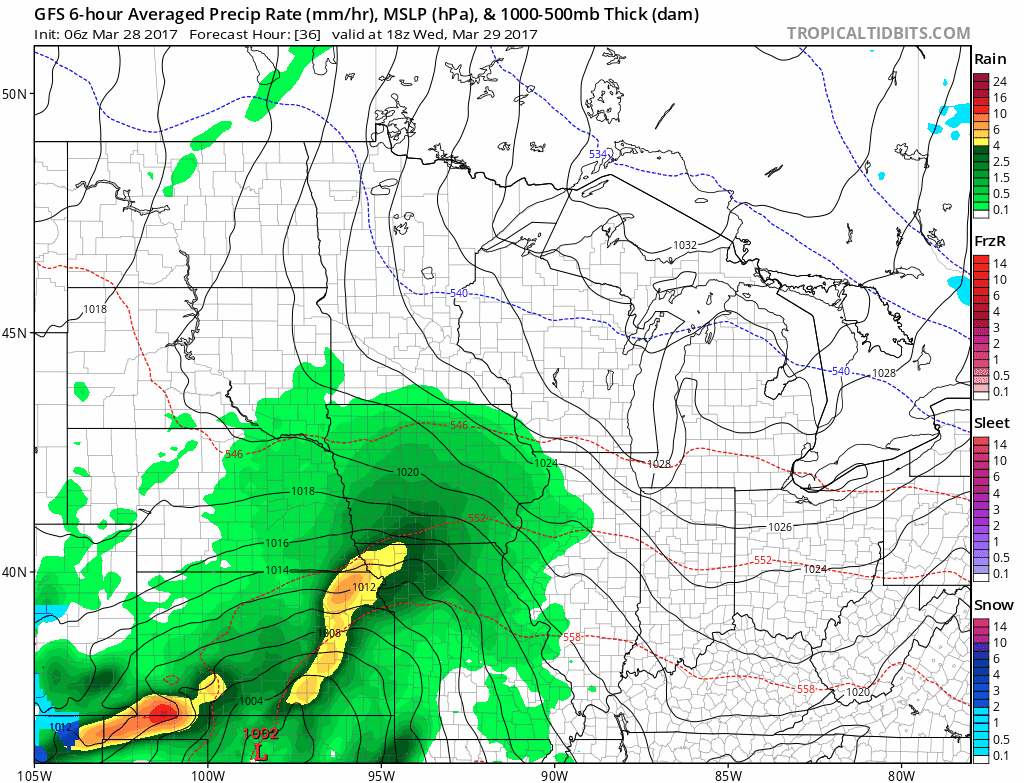
This system will move into southeastern Minnesota and southern Wisconsin by Wednesday night into Thursday with rain and even some snow into central Wisconsin.
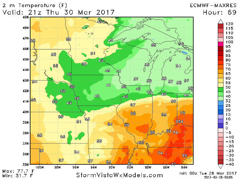
While snow is certainly possible across central Wisconsin, temperatures during the day Thursday look to be above freezing. This will limit any snowfall accumulation. Here’s the latest European surfaces temperatures Thursday afternoon.
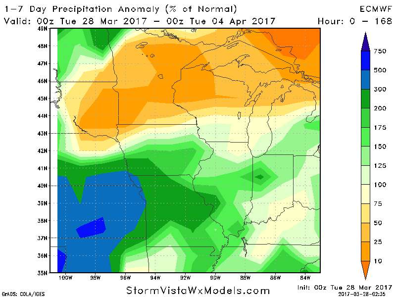
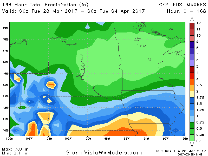
Overall, the theme of systems staying south of the region largely looks to continue through the end of the weekend. The week 1 precipitation anomalies show this quite well.
The next chance of light rain across the Dakotas and northern Minnesota looks to come Thursday night through Friday night as well as a weak disturbance moves through.
A larger system may try to bring some rains to the Dakotas early next week, but a drier than normal theme looks likely for much of the northern half of the forecast area. We discuss this in the video below, so make sure to give it a watch!
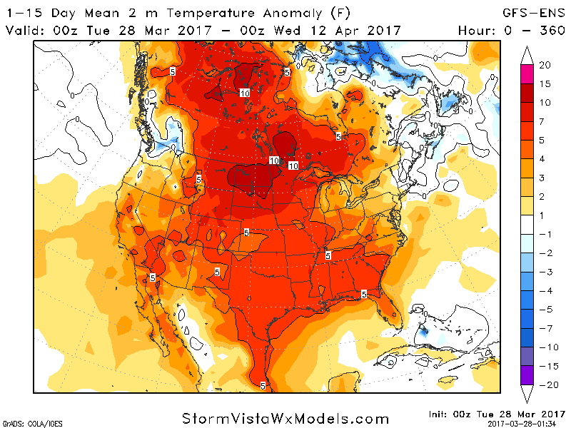
Temperatures look to stay 5-10°F above normal across the region over the next 15 days, but even still frost and freeze threats will remain a risk especially north.
Confidence and Risk:
- High confidence on an active regime in southern areas through this weekend.
- High confidence on above normal temperatures through the next 15 days, with frost and freeze threats continuing.
Today’s video (8 minutes):