Good morning,
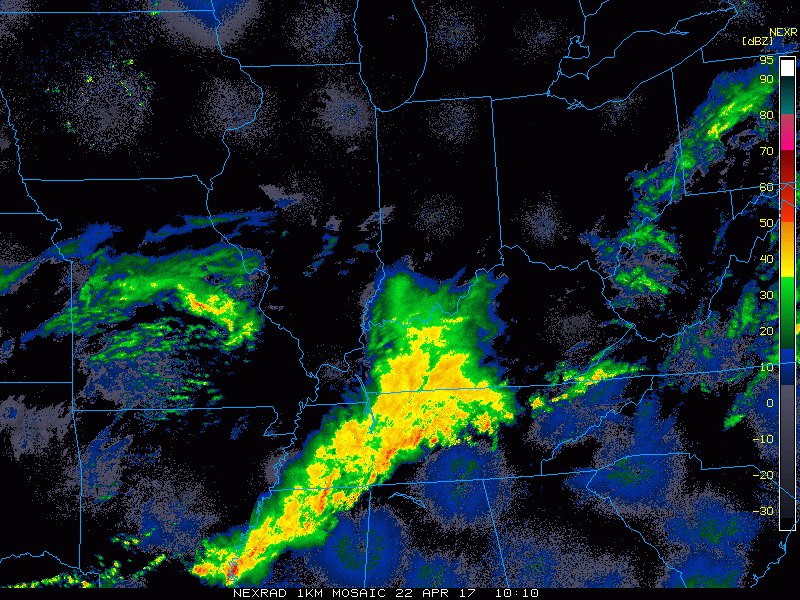
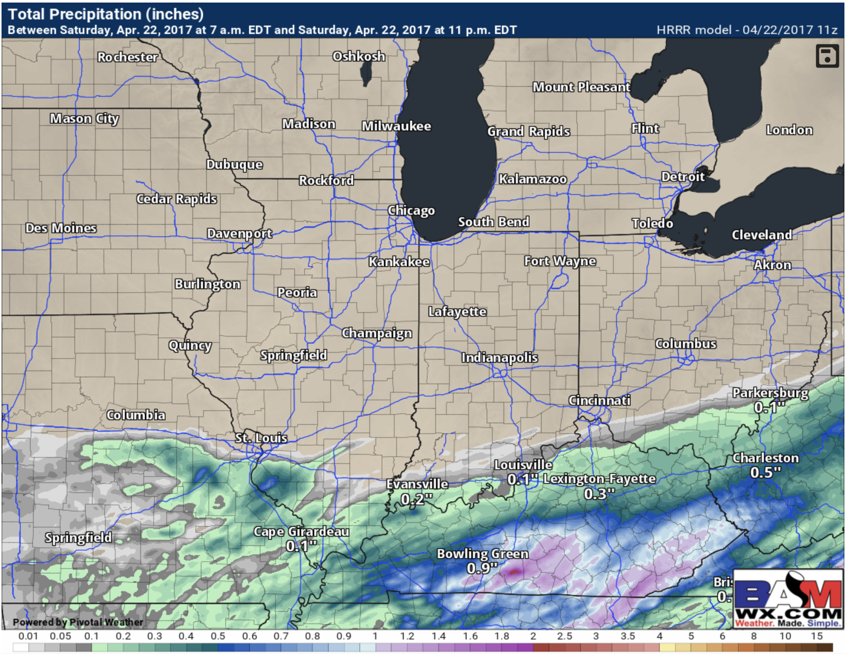
Looking over satellite trends this morning and I like what I see. While we cannot rule out a few showers today overall once again I think we can play the game today. Its not going to be the nicest of days but I think its doable. This is the feature I’m watching across southern IL
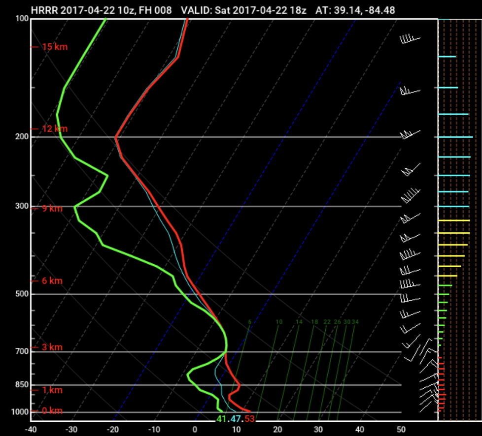
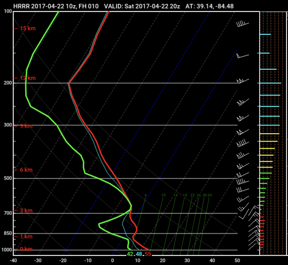
Things we have working in our favor is we are on the far north side of this storm so the storm will be battling dry air issues for sure with dew points in the lower 40s. Below you see a Skew-t, this profile tells us the lowest levels of the atmosphere are still somewhat dry so while the rain might look heavy on radar not all of it can hit the ground today so it cuts down on totals big time and the HRRR is seeing this. We see this at 1 and 3 pm. The red and the green lines not touching mean lack of deep moisture present essentially.
With all of that being said if you actually do see some rain it looks like it would be ~1-3pm. Again I’m not worried about this at all honestly..even the HRRR keeps it south. Now I know the radar loop above looks intimidating but one thing we have happening is the upper level system is about to take a dive SE so it will pull the rain with it too. So the once heavy rain idea has trended south about 100 miles. Kentucky gets drilled today.
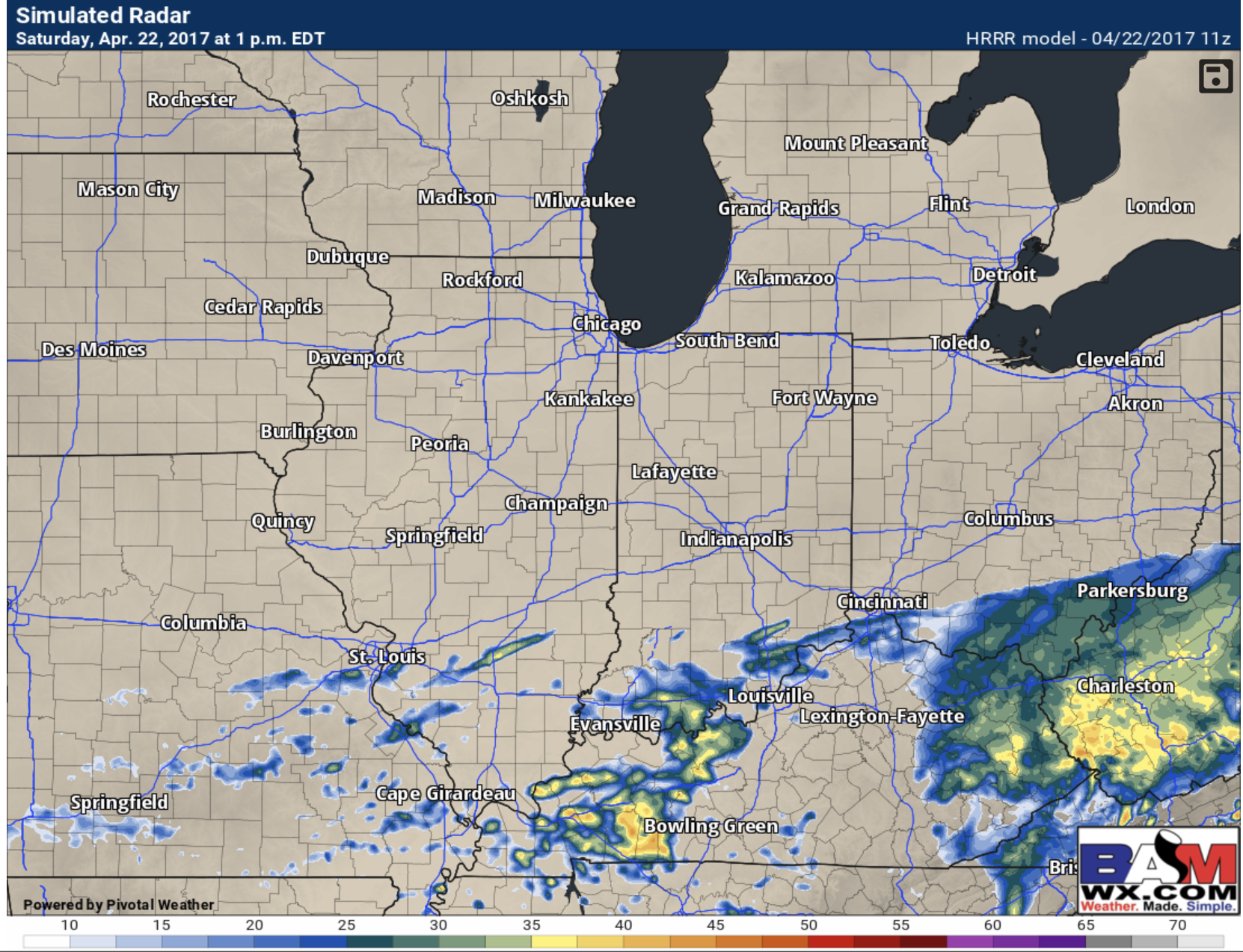
Every model I have access to gives you no accumulating rain today. A few showers sure but thats the about it.
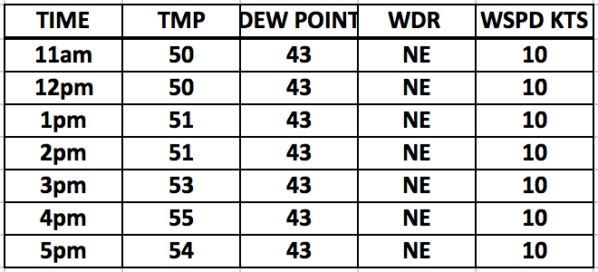
Hourly conditions. It will remain breezy and chilly and somewhat raw today with mostly cloudy skies.
If you have any questions please let me know.
Respectfully,
Meteorologist Michael Clark
Bamwx.com