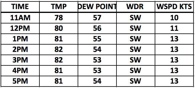
Good morning. Currently we are watching that passing shower threat to the SW. I do think a quick 0.20″ of an inch of water is possible with these passing showers but they will be in and out rather quickly. I would look for skies to clear somewhat and temps to reach the lower 80s with a brisk SW wind today at 10-25 MPH at times. Gusting to 35 MPH at times.
Radar loop as of 8:20AM: I would say up to 0.20″ of water is possible with these passing showers.
Hour by hour conditions today:
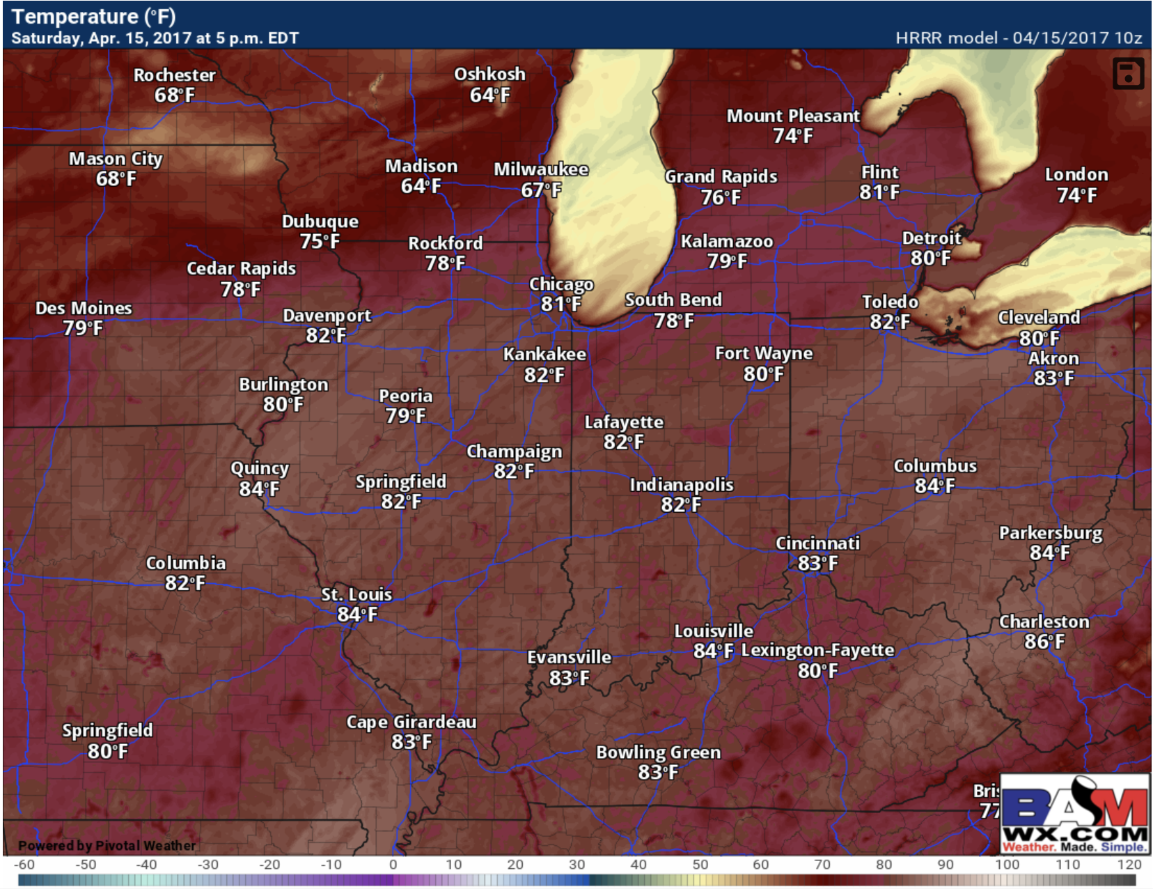
High temps today:
I dont anticipate much in the way of any rain or storm threats today esp in the Cincy area. Not much going on as main forcing mechanism is west with cold front that comes tomorrow. You can see the passing AM shower picked up on morning hi-res data so it has a good handle on the current atmosphere we believe.
Tomorrow is a different story as the cold front will be in the area providing a focal point for storm development and good forcing from 2-11pm across the Ohio river valley. Here is a forecast radar loop from 2-11pm. I do believe storms develop as early as 1-2 pm right now and some could be strong with heavy rainfall.
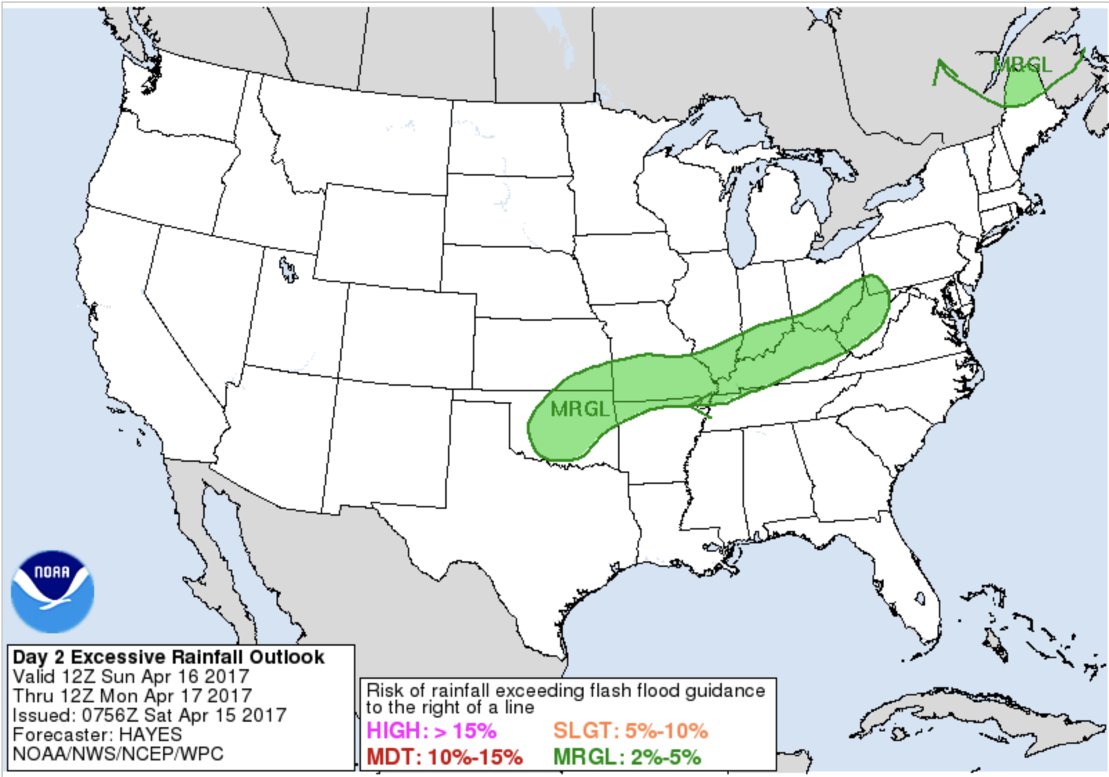
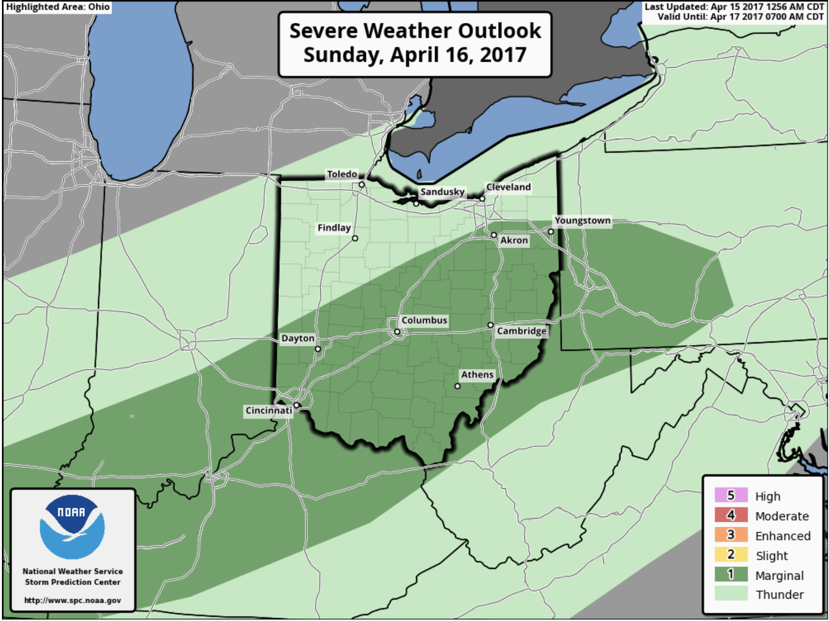
Being that temps will soar into upper 70s sufficient moisture and instability will support a strong storm threat and also a heavy rainfall threat. Both the SPC and WPC agree and have us in a marginal risk for excessive rainfall and severe storms in the timeframe discussed.
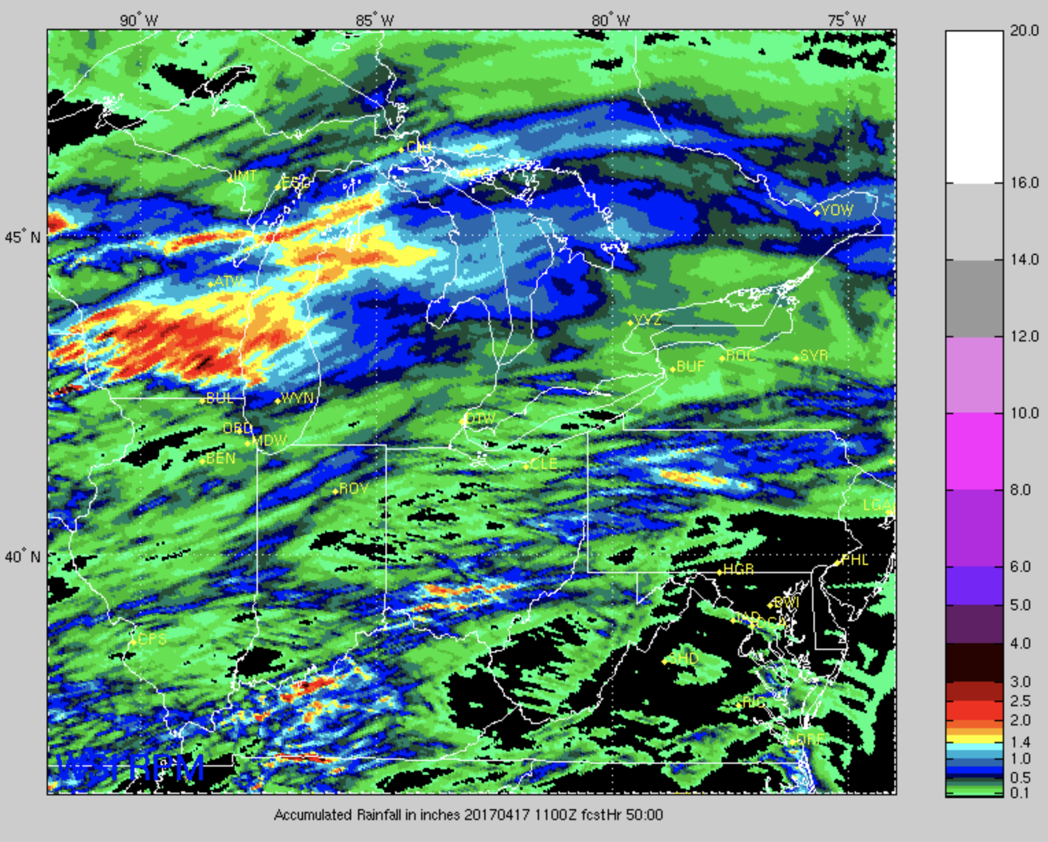
Total rainfall from the latest NAM 3 and RPM models for tomorrow evening.
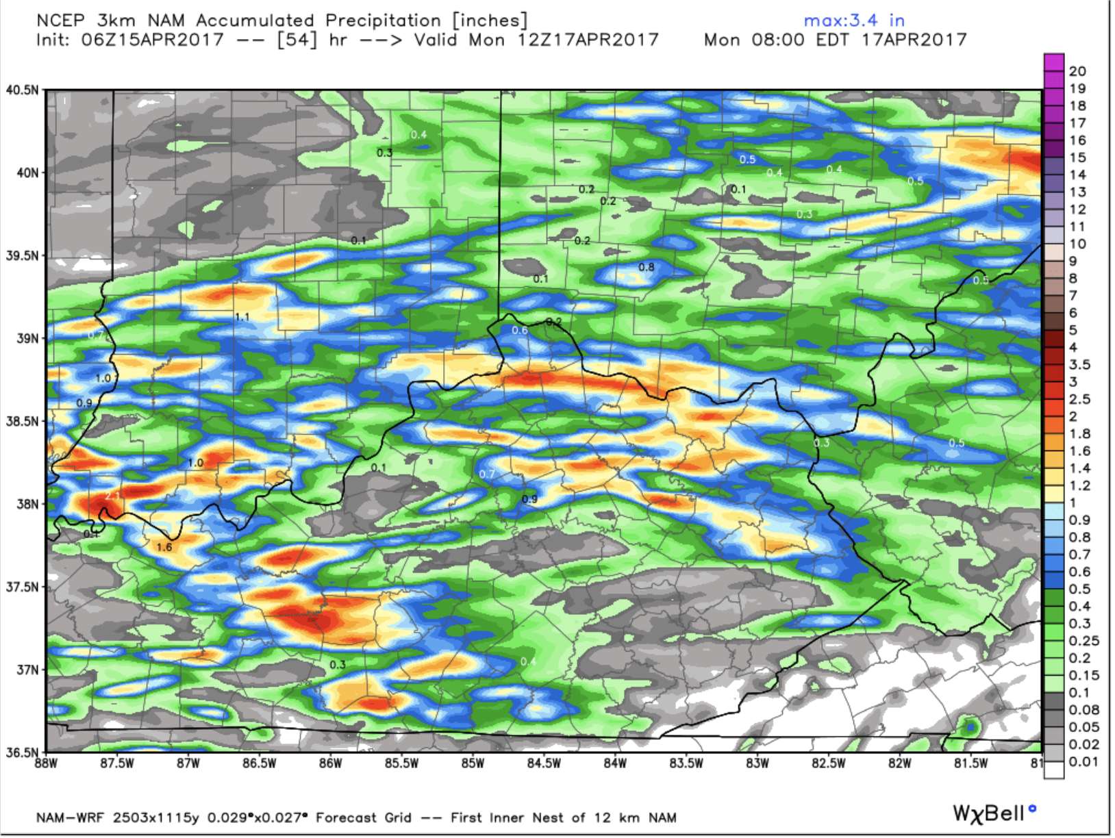
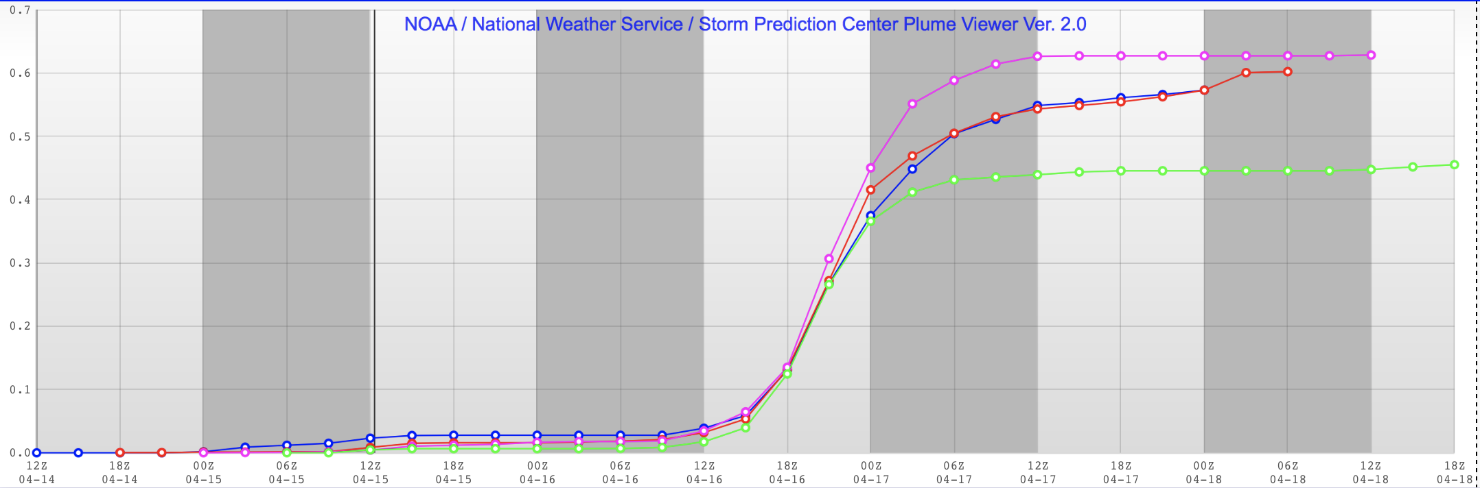
If we take a 104 model average over last 24hrs it would suggest ~0.55″ of rainfall tomorrow is on the table. It is worth a mention that the latest run (green line) came down somewhat.
Ill be watching closely for you and please let me know if you have any questions.
Respectfully,
Michael Clark
Bamwx.com