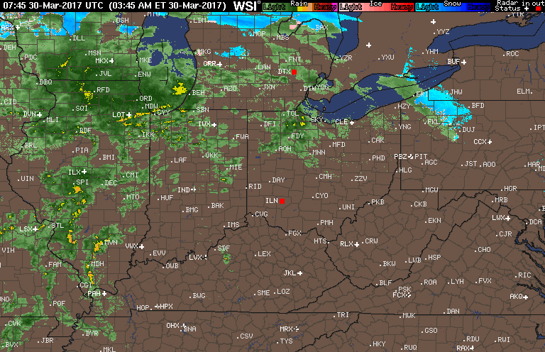
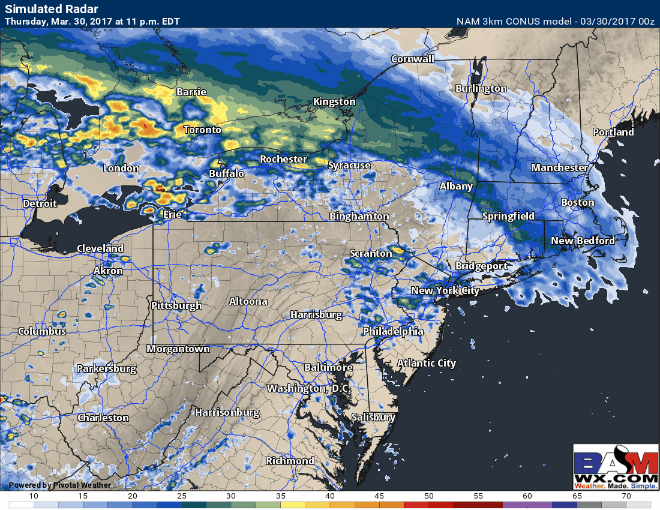
Good morning! We continue to watch a warm front pushing through the Ohio Valley this morning with rain and a few rumbles of thunder. Here’s the latest radar as of 5:45 AM.
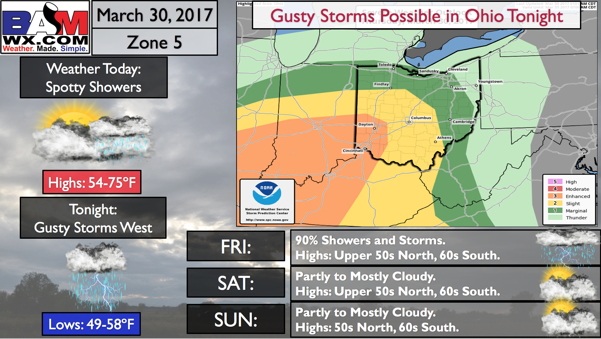
Our weather story today focuses on the gusty storms possible tonight.
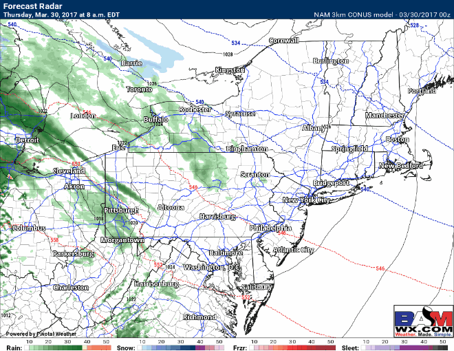
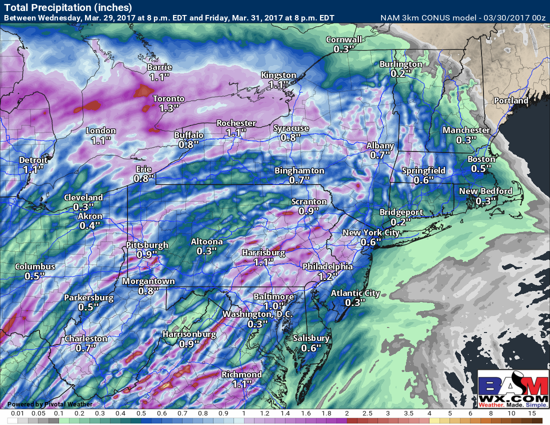
The warm front will slowly push northeastward today bringing showers along with it. Here’s the projected radar through this evening.
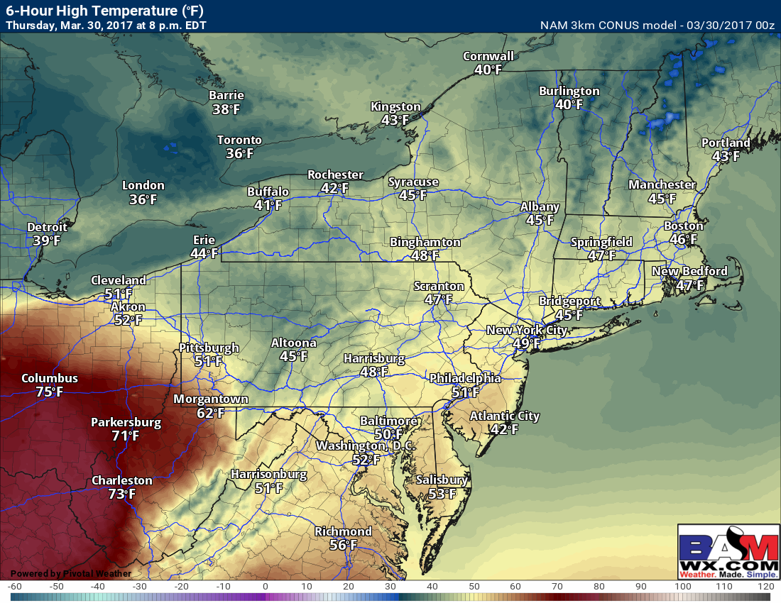
Along the front, there will be an intense temperature gradient today with western PA in the 50s, while central Ohio gets into the middle and upper 70s!
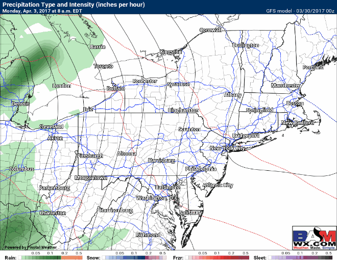
Later this evening, a line of thunderstorms will push into Ohio along a cold front. This will lead to a damaging wind threat along with very heavy rain late tonight into early tomorrow morning. Showers and thunderstorms will continue into the day tomorrow as well. Here’s the projected radar.
Total rainfall will range from 0.25-1.00″ with locally 2-3″ in the most persistent thunderstorms.
The weekend looks seasonable and dry with some sunshine. Our next rain and thunderstorm opportunity comes Monday as an area of low pressure approaches from the west.
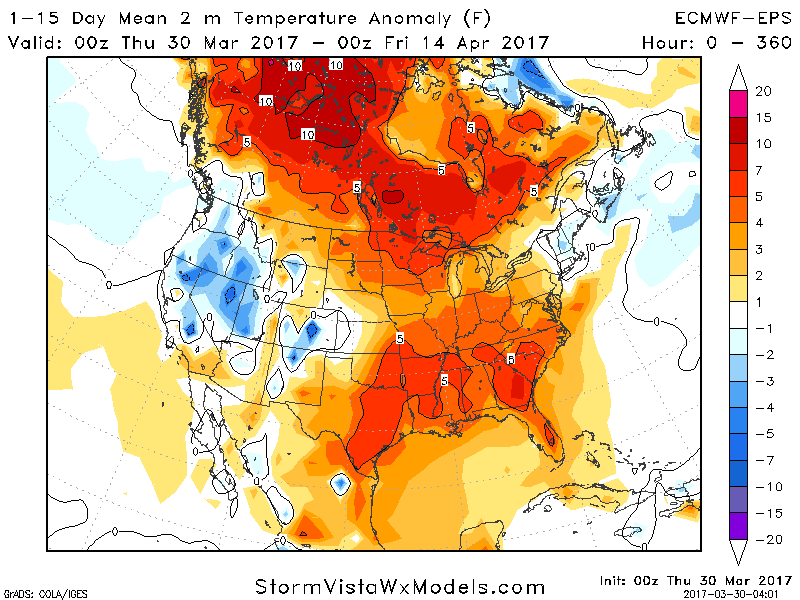
Temperatures over the next 2 weeks look largely above normal along with these active, wet times.
Confidence and Risk:
- High confidence on thunderstorms tonight across Ohio bringing the threat of damaging winds, hail, and heavy rain. They will weaken as they approach the PA border.
- High confidence on drier conditions across the region this weekend.
- Moderate confidence in our next rain maker approaching for Monday.
Today’s video covers it all! ~Ed