Good morning!
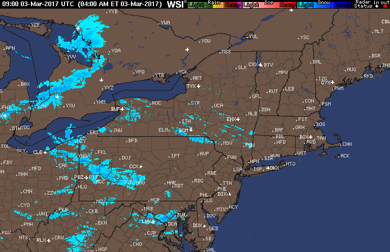
We are watching a few snow showers pushing through Ohio and PA this morning, leaving a coating of snow for most, but up to a few inches in the higher elevations of western PA. Here’s the latest radar as of 6 AM.
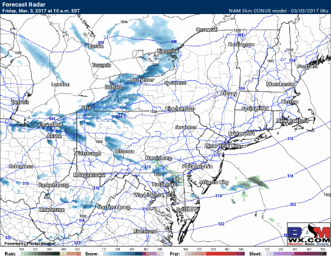
The big story will be a secondary cold front moving through with snow squalls this morning across PA, moving eastward into the Hudson Valley and southern New England for the afternoon and evening commute. These squalls will greatly reduce visibility and may cover the road in a quick coating to half inch of snow making things briefly treacherous. Here’s the expected radar through this evening.
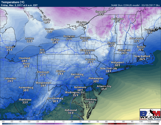
Temperatures today will be cold, and will fall further behind the secondary cold front.
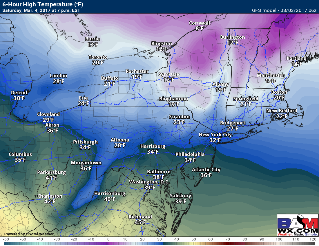
Saturday will be a dry, but very cold day especially in New England. Temperatures may not escape the 20s!
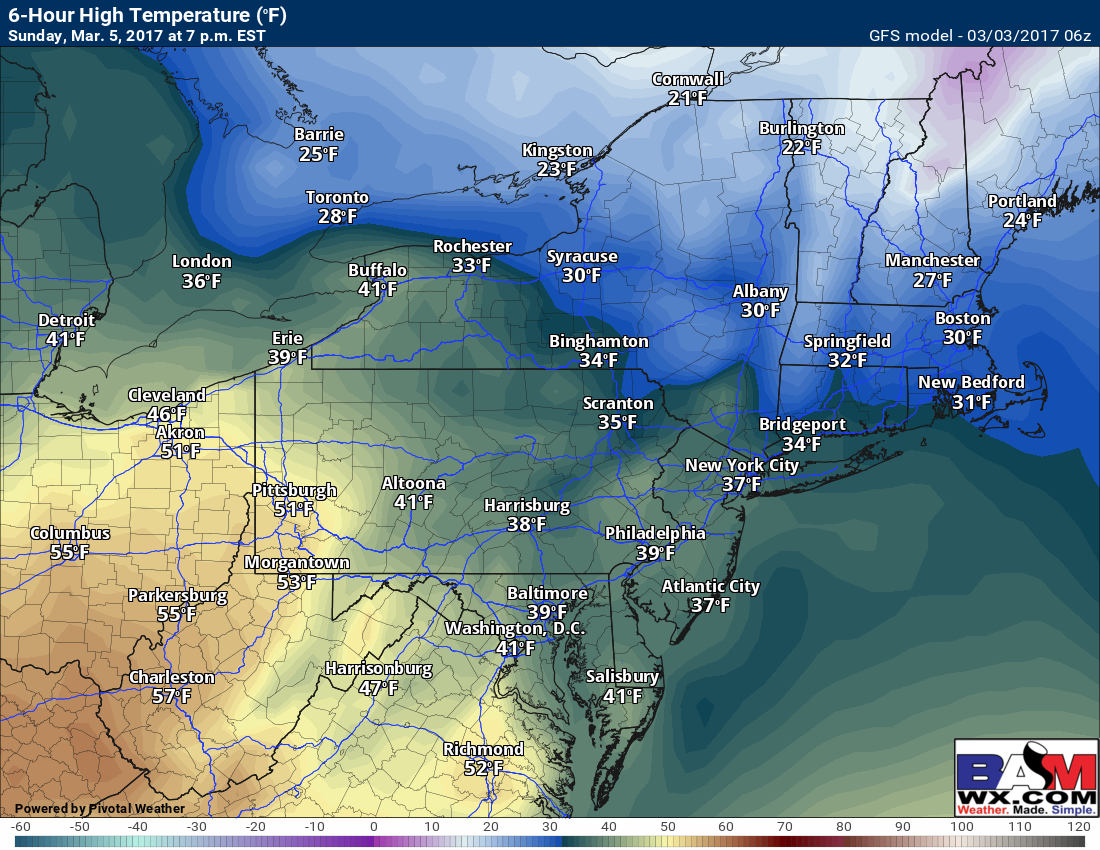
Sunday looks a bit warmer as flow shifts out of the southwest especially across western areas.
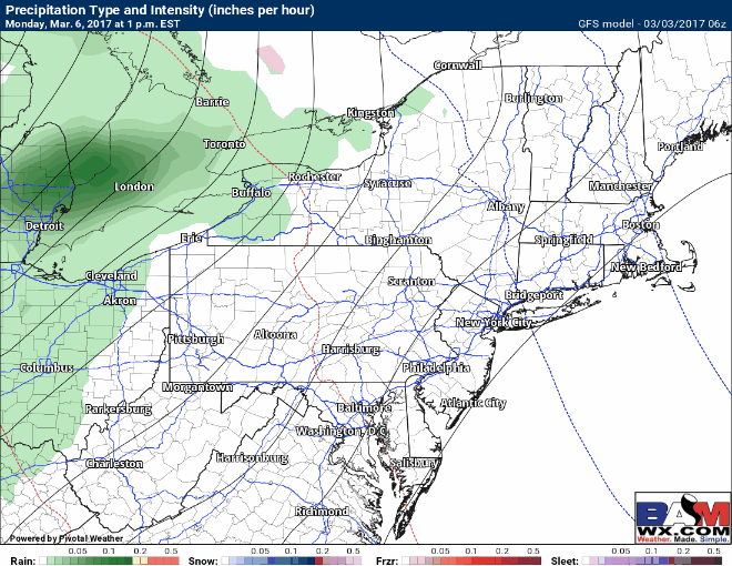
Warmer air will arrive Monday and Tuesday with some showers as a storm cuts through the Ohio Valley once again. Here’s a look at the GFS Monday through Tuesday night. Some thunderstorms are possible with this system across Ohio and western PA Tuesday afternoon. Details remain a bit uncertain regarding timing and intensity.
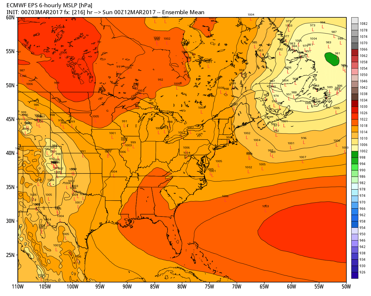
Above normal temperatures look to continue through next week. Our next weather maker may come early next weekend. Guidance remains very uncertain as to the evolution of this system, ranging from some snow next weekend to a warm rain event. The latest Euro Ensemble is below for next Saturday. Notice solutions range from Iowa to south of New England – very uncertain! Stay tuned!
Confidence and Risks:
- High confidence on treacherous snow squalls this afternoon and cold weekend!
- Moderate to high confidence on warmer conditions early next week ahead of a storm system.
- Very low confidence on any storm threat next weekend. Stay tuned!
Today’s video covers it all! Have a great weekend.