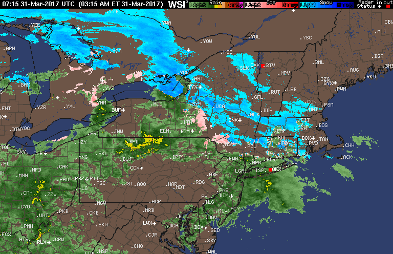
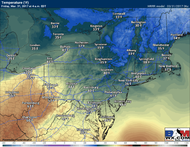
Good morning! We are tracking rain, sleet and snow this morning across the region with temperatures mainly above freezing. Here’s the latest radar!
Our QuickCast revolves around the upcoming storm today into tomorrow (including the snow map).
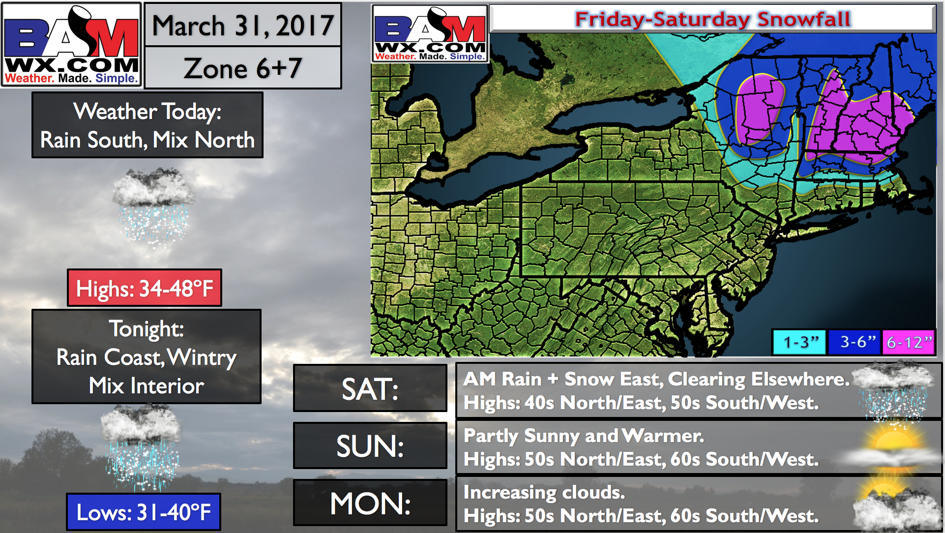
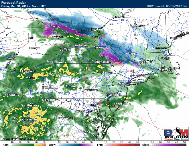
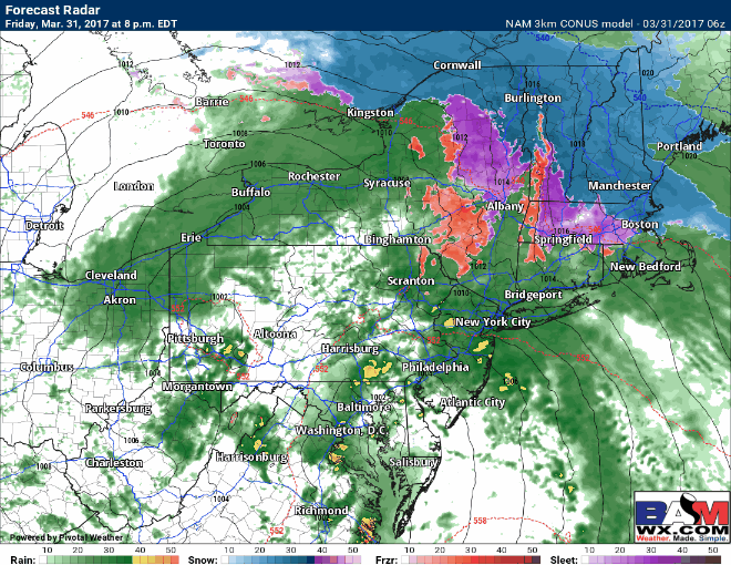
Precipitation will fill in and change to plain rain across PA, NYC, and coastal southern New England today, with mixed precipitation and some snow continuing in northern CT, northern RI, and most of MA through the evening. Here’s the projected radar.
Temperatures today will remain above freezing, so accumulation on roads looks minimal where it does stay all snow.
Rain continues tonight near the coast and slowly ends across Ohio and PA through the evening. As the area of low pressure approaches, snow will change to sleet across much of southern New England with the exception of northern and northeast Massachusetts. Where it stays all snow is where the heaviest accumulations will occur.
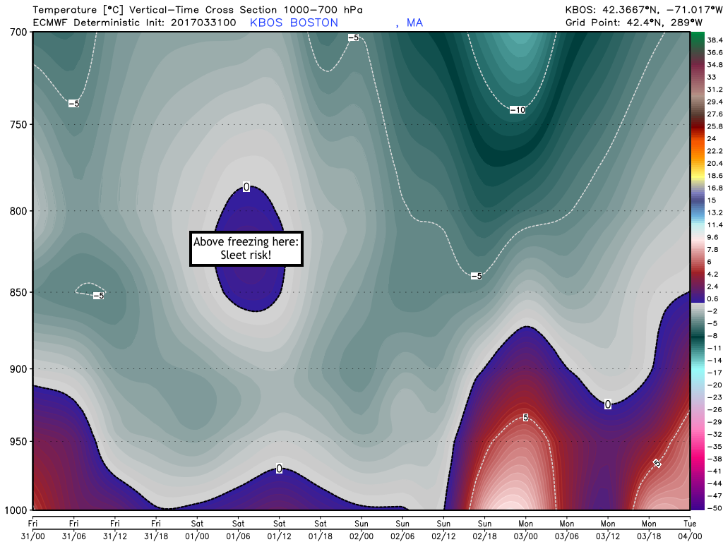
The sleet risk is shown well in model guidance temperature profiles. Notice Boston gets above freezing tonight, illustrating the risk for some sleet.
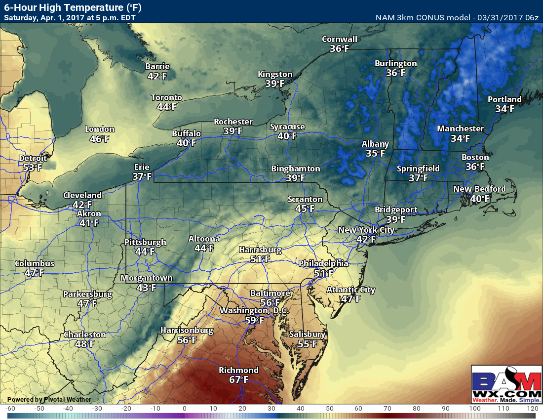
Precipitation winds down Saturday with some sun across Ohio and PA and leftover clouds across New England. It looks to be a chilly day for April 1st!
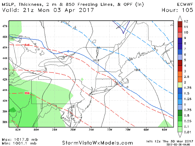
Sunday looks to be the pick of the weekend with some sunshine. The next chance for rain and perhaps more mixed precipitation in northern MA comes Monday night into Tuesday.
Confidence and Risk:
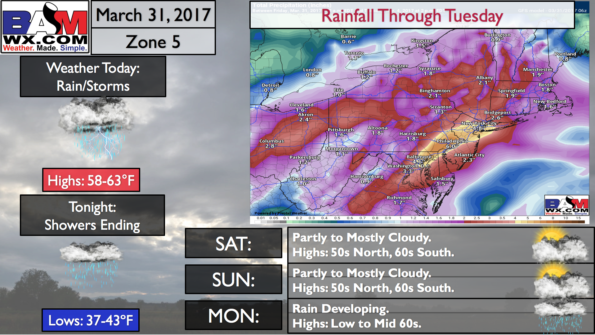
- High confidence in significant rainfall across much of the region through tomorrow. High confidence on snowfall, possibly mixed with sleet, across northern MA.
- Moderate confidence in transition to sleet and rain in northern CT and along I-90. This is the most uncertain part of the forecast.
- High confidence on another system bringing rain and mixed precipitation Monday night and Tuesday.
The video breaks it all down!