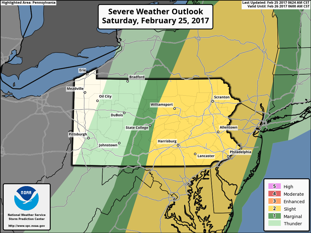
Good morning. Thoughts from yesterday remain largely unchanged, and as discussed last evening, the threat for severe thunderstorms has increased and expanding northward and eastward according to the SPC. Here’s the latest outlook. Notice much of eastern PA, New York, and New Jersey are under a “slight risk” for a line of thunderstorms this afternoon.
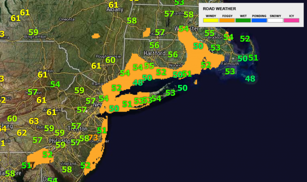
Currently, as of 8 AM, there is some dense fog impacted coastal areas. This will actually help lessen the severe threat across these areas later today and tonight.
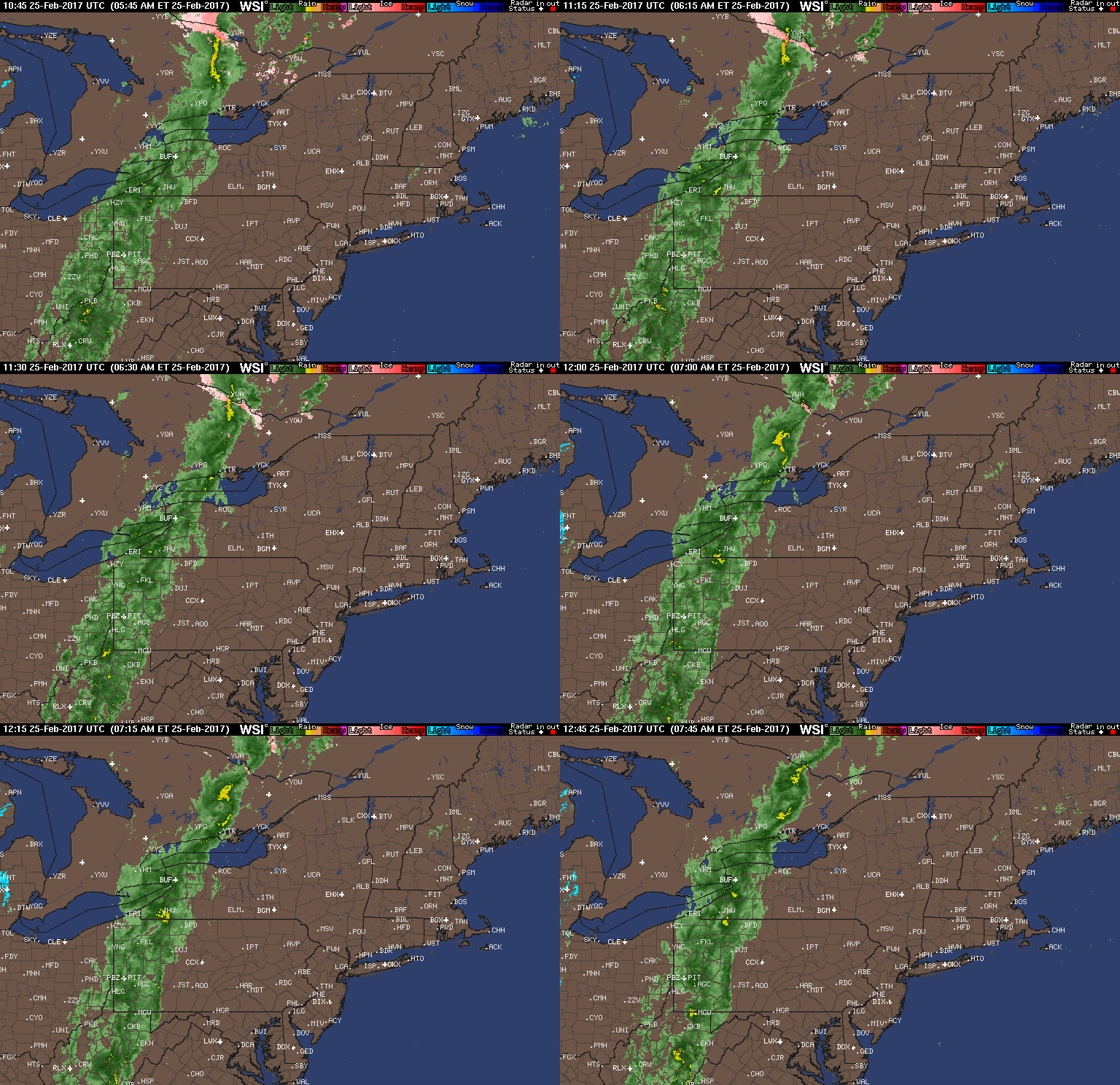
We in the weather world talk about needing three main ingredients for strong storms: a “trigger”, available atmospheric energy (instability), and moisture. Today we have all three as a strong disturbance and cold front moves through into an unstable and moist environment. Latest radar shows a strong cold front moving through western and central PA with some rain and thunder this morning.
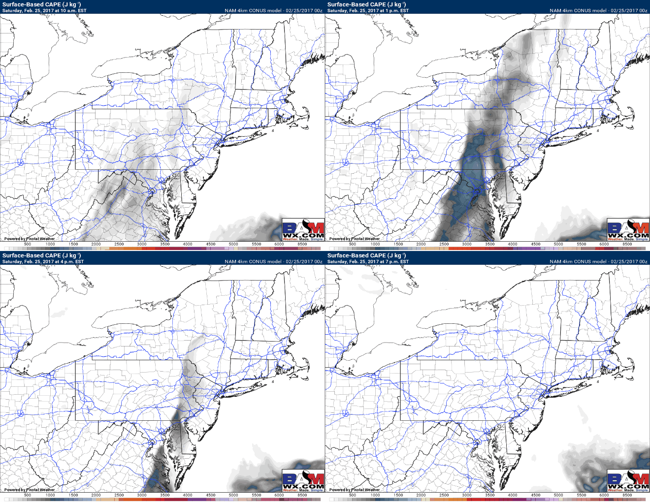
As it moves eastward and temperatures warm this afternoon, instability will increase dramatically across the I-81 corridor eastward toward the Hudson Valley and far western southern New England. Here’s a look at the available instability (CAPE) this afternoon. Notice it is strongest closer to the I-81 corridor where temperatures warm the most. As the line pushes east this afternoon, instability lessens and so does the severe threat. A weakening line is likely across coastal New Jersey, NYC, Long Island, and southern/eastern CT, RI, and MA this evening.
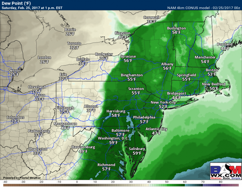
With respect to moisture, dew points will be in the upper 50s to lower 60s from the southern tier of New York southward, plenty moist enough for some strong storms, especially with the strong front coming through. Here’s a look at 1 PM dew points – this is incredible for late February.
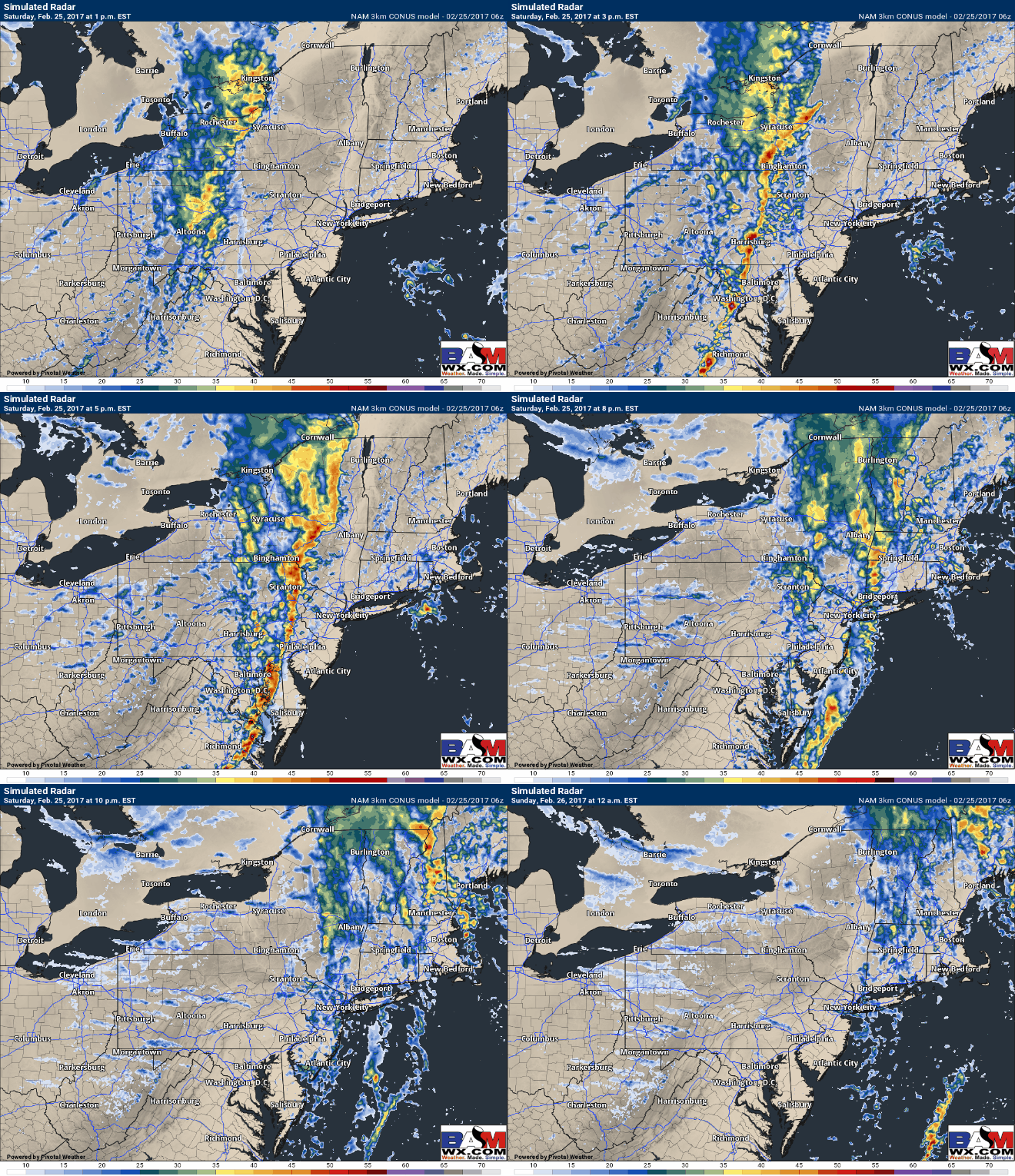
Here’s an idea for timing of these storms, mainly this afternoon and early this evening from eastern PA into far western southern New England. As stated above, the line will weaken quickly across southern New England as the line encounters a cooler, more stable environment.
Timing looks close to the model shown above with storms impacting eastern PA 2-6 PM, then the Hudson Valley and NJ 6-8 PM before weakening across CT and MA after 8 PM.
*The main threats from these storms will be strong winds in excess of 60 mph, torrential rain, and large hail.*
The video (6 minutes) covers it all. ~Ed
