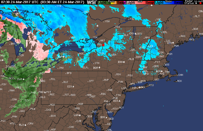
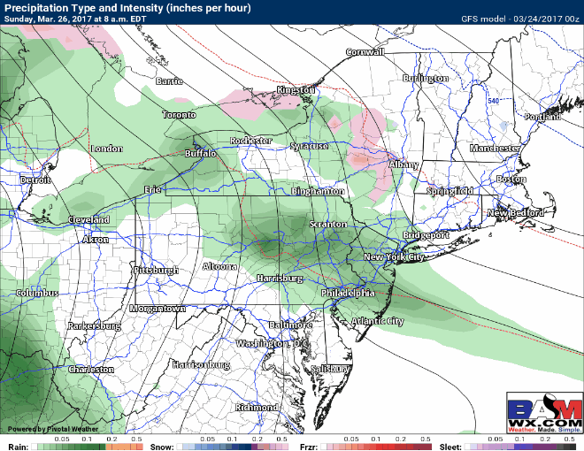
Good morning! We are tracking a warm front moving through the region this morning with some rain across Ohio. With this, we will see some sleet and freezing rain overspreading central and eastern PA with temperatures close to freezing. Here’s the latest radar as of 5:45 AM.
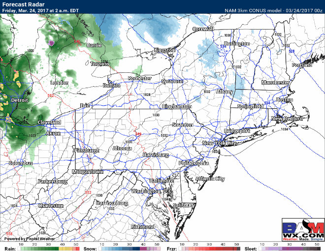
With temperatures close to freezing, some slick spots will be possible this morning, but roads should mostly just be wet. Further east some light snow will overspread the Poconos, Catskills, and Berkshires and change to sleet and rain this afternoon. Precipitation will wind down from west to east this afternoon and evening. Plain rain is expected closer to the coast with temperatures above freezing. Here’s the projected radar through this afternoon.
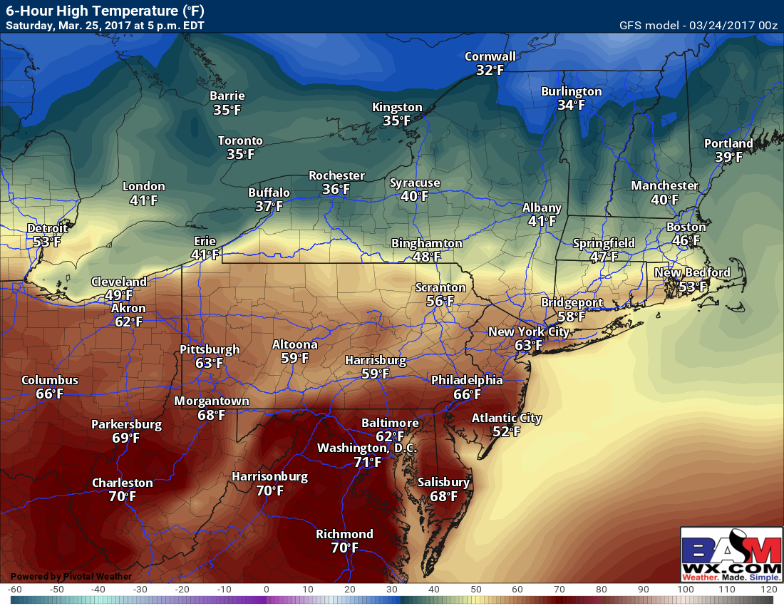
With the warm front nearby Saturday, we will see a large spread in temperatures from north to south. Here’s a look at the possible temperature spread.
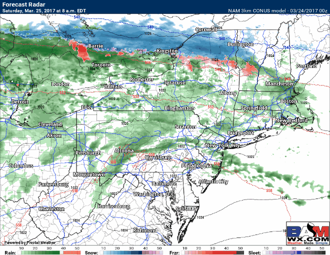
A few showers will be along the front as well with plenty of clouds.
Unsettled conditions with plenty of rainfall chance will last into next week as well with temperatures near to slightly above normal.
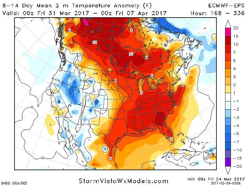
Warmer conditions look to last into week 2 as well. Here’s the latest week 2 temperature departure from normal forecast.
Confidence and Risks:
- High confidence in some wintry precipitation today from central PA to western MA. Road impacts should be minimal.
- High confidence in wet conditions through the middle of next week with near to slightly above normal temperatures.
- Moderate to high confidence in warmer conditions lasting into week 2.
The video covers precipitation timing and impacts. ~Ed