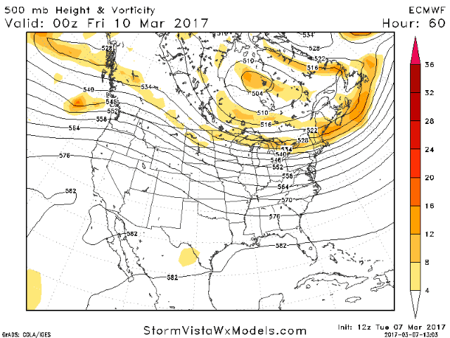
Good afternoon! Midday data has arrived and the overwhelming trend is clear regarding both the Friday and Sunday event. As discussed this morning, typically one wave becomes dominant and the other gets influenced by the dominant wave. Well, we are seeing model guidance trend northward with the *Friday* wave, while the Sunday wave gets shunted southward. Here’s the latest European model’s track for the energy responsible for the snow Friday. Notice how the energy tracks right over the region, allowing for a favorable track for some snow. However, some uncertainty in exact track exists, so check back often this week!
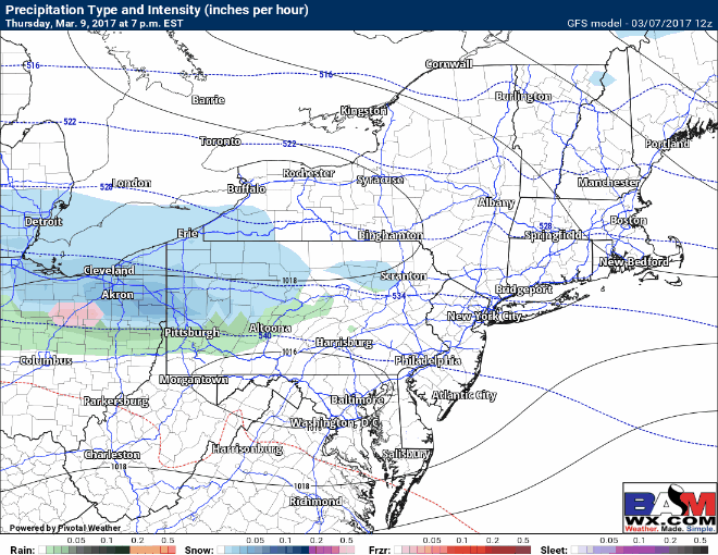
Here’s an idea of the radar Friday. Notice the snow winds down by afternoon across most areas.
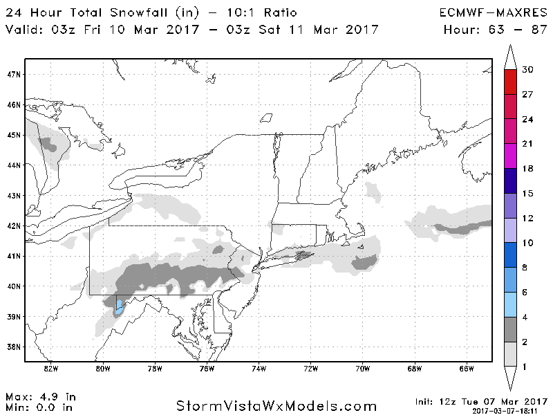
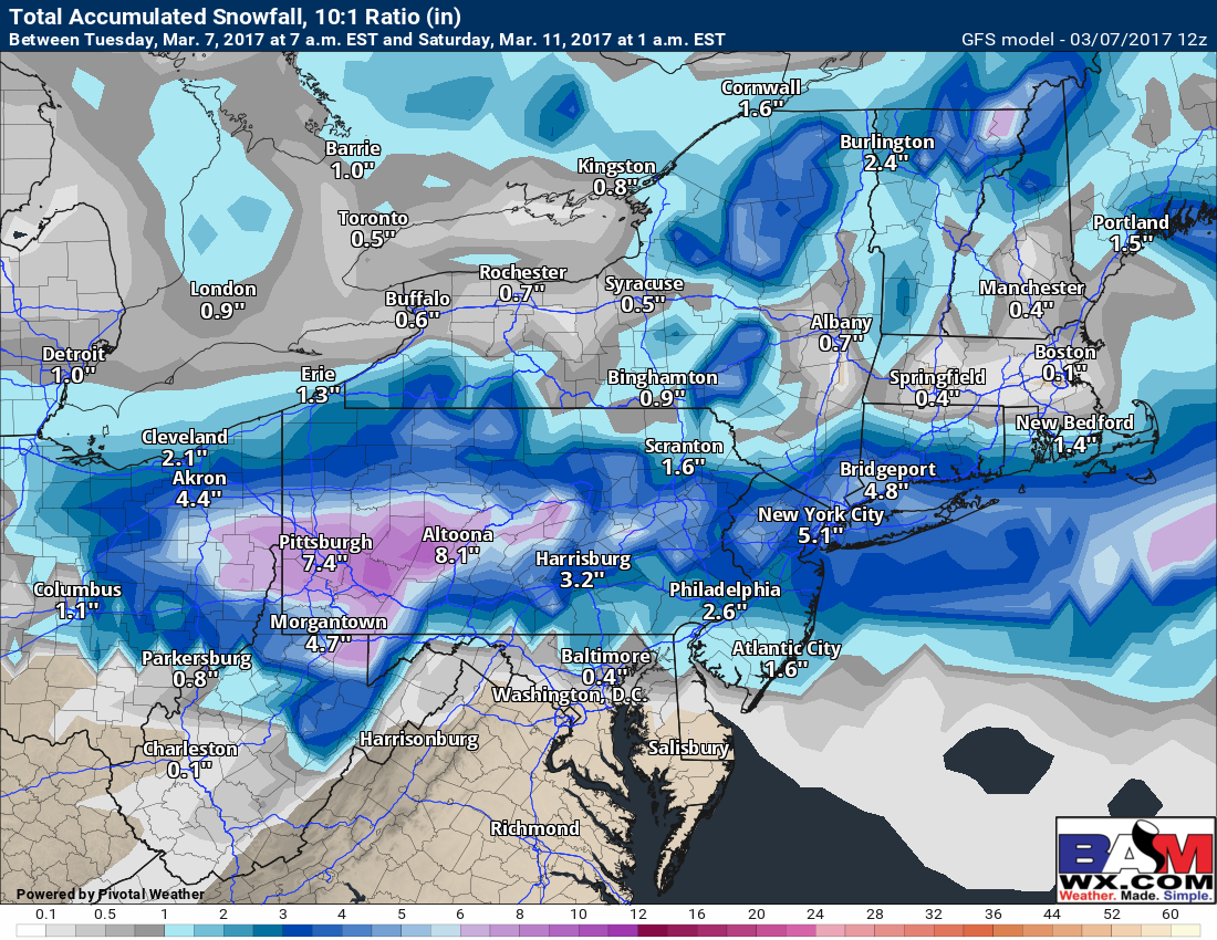
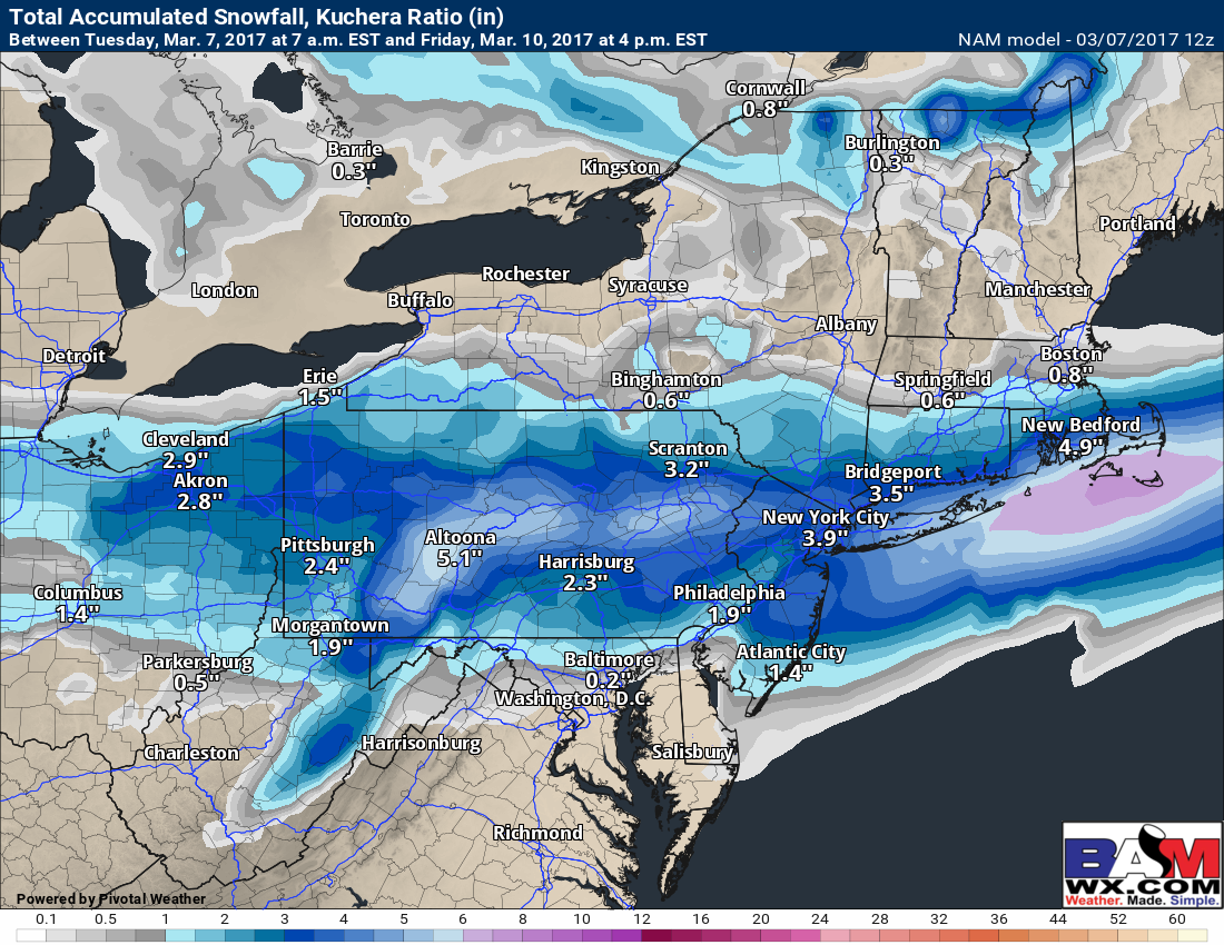
Snowfall doesn’t look like a blockbuster storm, but some accumulation appears likely. Here’s some snowfall forecasts from various modeling. Notice they all focus accumulating snow along I-80 and I-70.
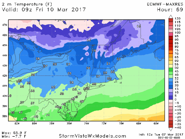
Temperatures will mainly be in the 20s during the snowfall, perhaps closer to 32 right along the coast. *This may allow pavement accumulations to be lighter pending intensity of the snow, so stay tuned for more as new data comes in*. Once the snow stops during the afternoon Friday, temperatures likely will rise above freezing before dropping back below freezing Friday evening and into the teens Friday night. Here’s a look at temperatures Friday into Friday evening.
Confidence and Risks:
- Moderate confidence on track/intensity of this system
- Low to moderate confidence on surface temperatures…some of the snow may melt initially with marginal temperatures.
- Moderate to high confidence in brutal cold (and possible refreeze) Friday night into Saturday.
The video covers this in better detail below. I’ll have a full update early tomorrow morning by 7am along with a snow map if guidance remains similar to how it’s looking now. Have a great evening! ~Ed