Good afternoon! New data is streaming in this afternoon and thoughts really haven’t changed too much with respect to snowfall accumulations and timing. I will hit all the exact timing and accumulation info for specific regions in the video below so make sure to check it out!
Overall, a wave along an arctic front will produce some snowfall across the region starting late Thursday evening west and late Thursday night east. Temperatures will be marginal at first, but should fall below freezing once the snow starts coming down. Here is a look at the latest 3km (high resolution) NAM for the event.
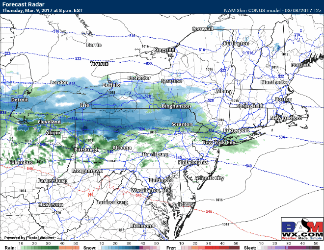
It should be noted that there remains some uncertainty with how far north the snow gets. This will be determined by how far south the front can penetrate before the wave forms. For example, the RGEM model is further north.
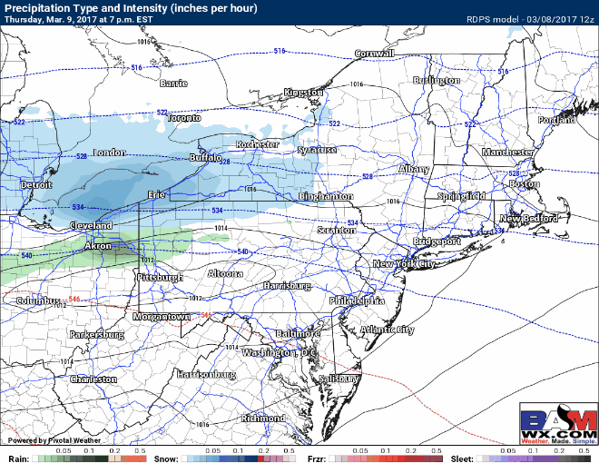
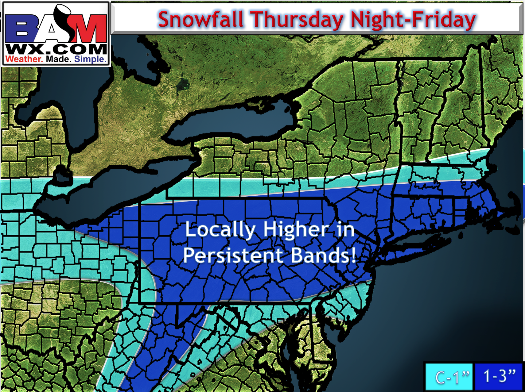
With that said, a majority of the model guidance we have suggests a further south track is more likely, including the European, GFS, RPM, and NAM. I’ll go over this a bit more in the video. I did not make many changes to the snowfall map, but note there can be locally more than 3″ in the more persistent bands. Right now I think the best chance for that is right along I-80 into southern CT, especially just away from the water.
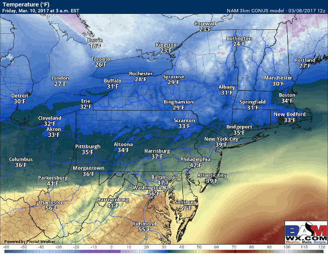
The other important factor we’ve been discussing is temperatures ahead, during, and after the storm. Initially, we will be above freezing ahead of the wave, but as the snow falls and cools the atmosphere, temperatures will drops to near or just below freezing. This warm initial air may save some of the snow from accumulating on pavement, but the fact that snow will begin to fall pre-dawn will allow for accumulation to still occur. Temperatures will rise after precipitation ends, then crash well below freezing at night, raising the risk for a refreeze overnight into Saturday.
If all of this wasn’t enough, models are hinting at another storm system capable of producing significant precipitation Tuesday. However, let’s get through this system first before trying to cover details for Tuesday. I’ll have more on that system tomorrow morning!
Confidence and Risks:
- High confidence on snowfall occurring late tomorrow evening through midday Friday.
- Moderate confidence now on track and intensity of the snow. Someone will likely see more than 3″, but we need more data to pinpoint where that will be.
- High confidence on temperatures warming above freezing Friday afternoon, then crashing into the teens Friday night, creating a flash freeze risk.
The video below covers it all. Have a great afternoon. ~Ed