Good afternoon! New data is in regarding the storm toward the end of the week and it still looks messy. However, model guidance is quite variable with respect to precipitation type. The blog and video below break it all down!
Precipitation will move into the region early Friday morning, likely as a mix of rain and snow at the coast and some snow inland. Temperatures through Friday will be in the 30s and 40s – largely ABOVE freezing, so accumulation during the day Friday looks unlikely outside perhaps the higher elevations of northern CT and western MA. Some accumulation is possible on colder surfaces, but roads will likely be wet.

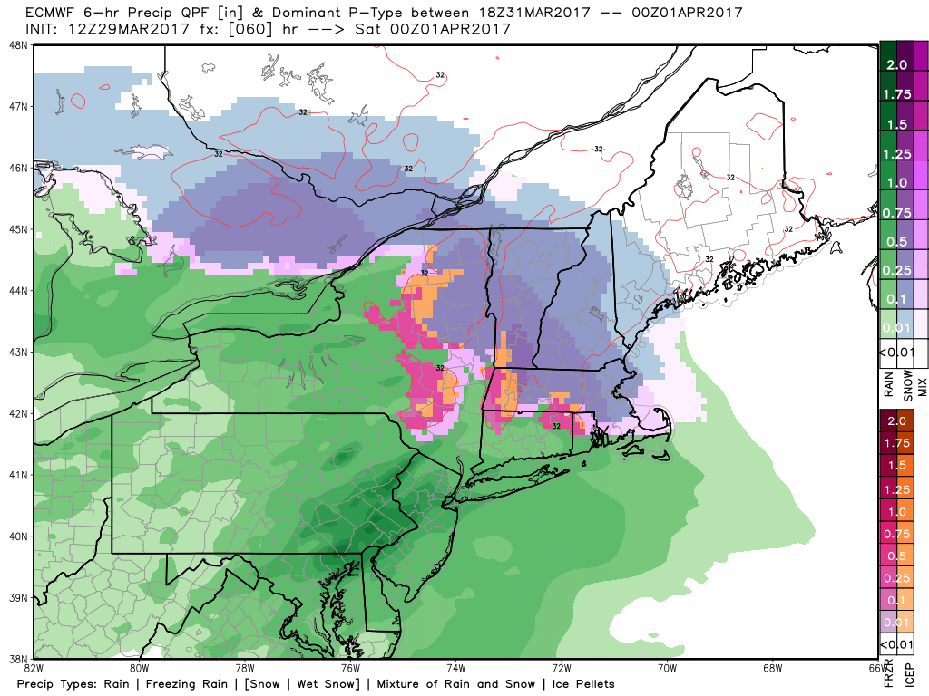
The uncertainty grows by 8 PM Friday as an area of low pressure strengthens and passes south of New England. Here are the GFS, NAM, and European model at that time – notice the large differences!
European: Warmer, snow mainly north of I-90.
GFS: colder, snow/ice into northern CT.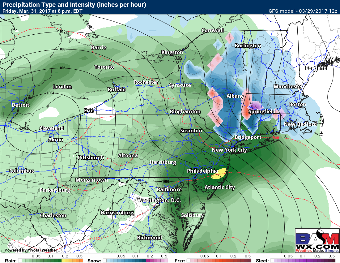
NAM: warmest, sleet into northern New England!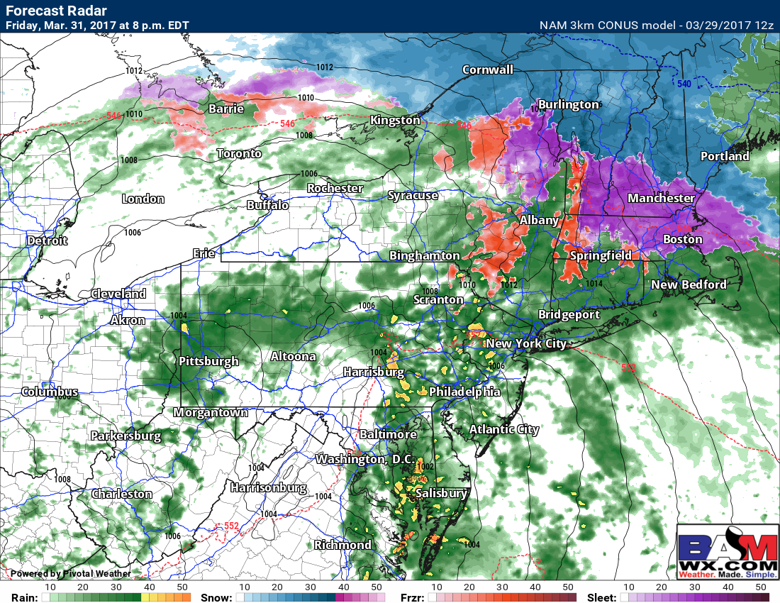
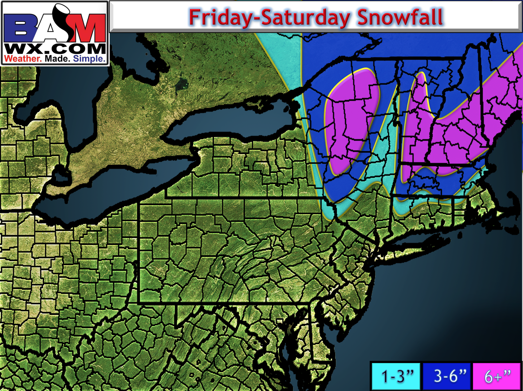
With these uncertainties, some shifts to the storm track will be crucial to precipitation type. Also, the fact this is occurring at night will add to the impacts where it does snow. To add to that, the worst impact will over overnight into Saturday morning as this aligns with heaviest precipitation and no April sun angle to deal with. Latest snow map:
Risks and Confidence:
- High confidence in a mix of rain and snow going to plain rain near the coast Friday-Saturday.
- Moderate confidence on accumulating snowfall in interior southern New England, especially north of I-90.
- There will be changes to the forecast given the forecast uncertainty so definitely check back tomorrow morning!