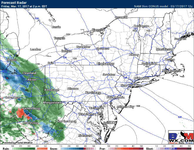
Good afternoon. Wanted to update some thoughts about the weekend forecast as new data continues to roll in. The forecast through Saturday afternoon looks very similar to this morning with mixed precipitation changing to rain across eastern Ohio, WV, and western PA. Here’s the updated projected radar through 8AM Saturday.
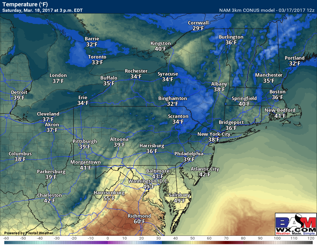
Beyond this, Saturday looks like an unsettled day with temperatures mainly in the 30s. This will cause any snow that falls to struggle to stick. Here’s a look at projected temperatures tomorrow at 3 PM.
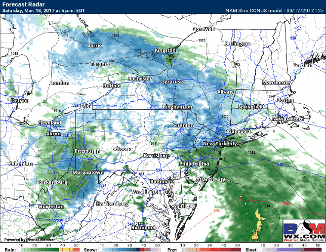
Later Saturday afternoon through Sunday morning is where the greatest uncertainty lies. The *potential* exists for some accumulating snow especially north and east of NYC across Long Island, southern CT out east toward SE Massachusetts. Here’s the latest 3km NAM’s interpretation of the event. Notice it is a narrow area of heavier snow and very dependent on where the system tracks.
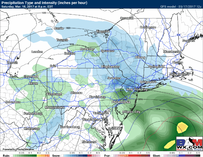
The GFS model is similar, spreading accumulating snow into the region Saturday evening and Saturday night…
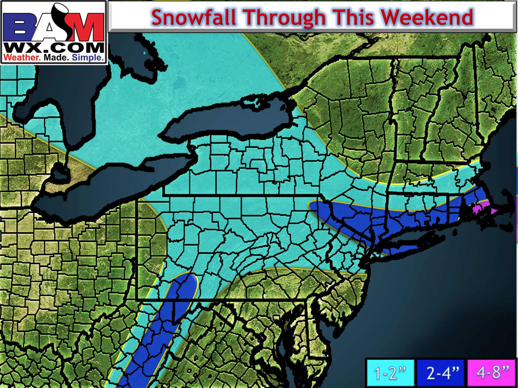
Here’s the latest snow map. This will be looked at again early tomorrow morning when new data arrives. This is a VERY tough forecast!
Confidence and Risks:
- The location of the developing storm will be EXTREMELY crucial to where accumulating snow occurs. This will be resolved over the next 12-24 hours and may be a “nowcasting” type situation.
Sunday will feature slow clearing, depending on how this Saturday night feature comes together. I cover the risks and timing in the video below! ~Ed