#PAwx #NYwx #NJwx #CTwx #MAwx #RIwx Afternoon Storm Update: Details Here! E.
Good afternoon. I continue to track the storm system for Friday into Saturday and new model data continues to trend slightly warmer. Precipitation will overspread the region overnight in the form of a light mix of rain and snow at the coast and some snow inland. This will continue through the day on Friday with temperatures mainly above freezing. Here’s the projected radar through Friday evening.
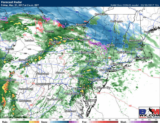
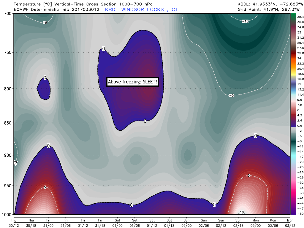
Overnight Friday, the heaviest precipitation will fall, mainly as rain near the coast with rain, sleet and snow inland (north of I-84 and I-90). However, I am not expected much snow accumulation in CT or RI thanks to a warm layer above the ground.
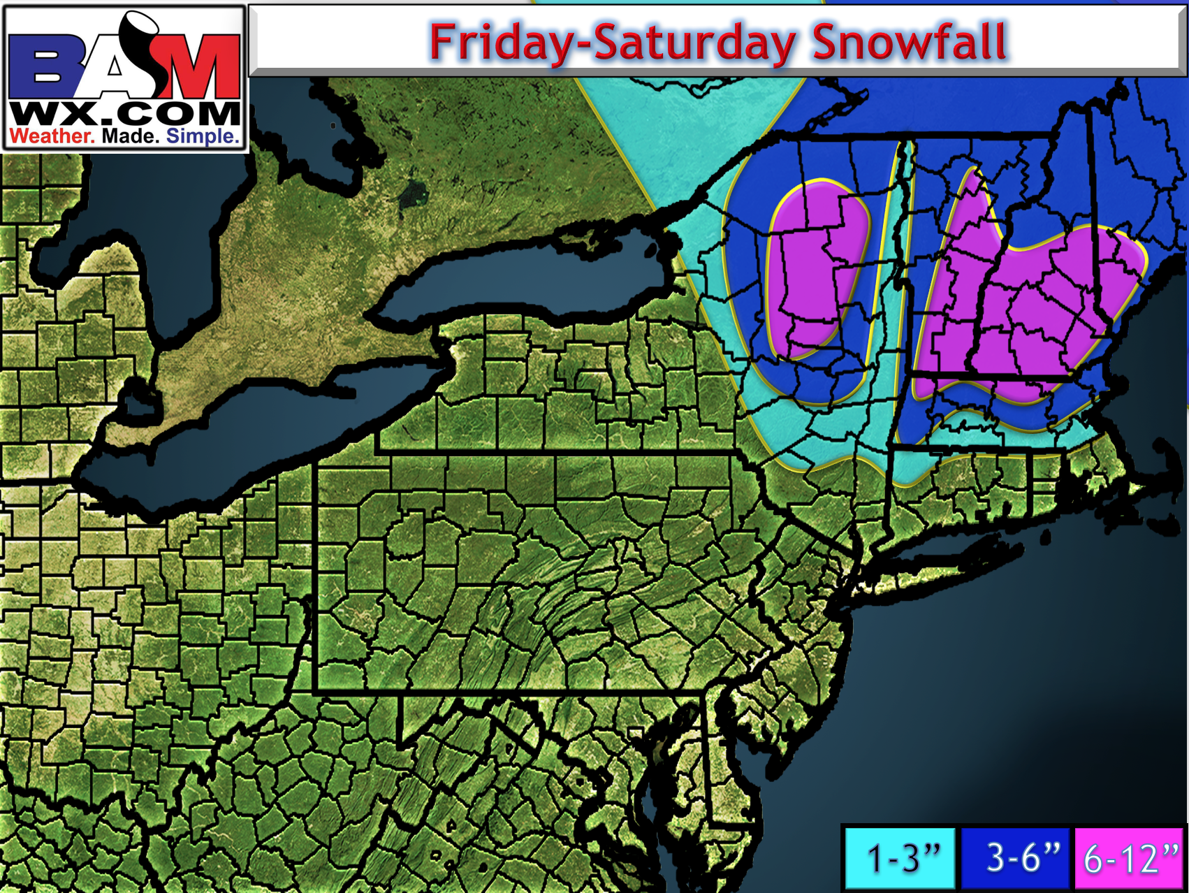
I dive into details and uncertainty in the video so make sure to watch! Here’s an updated snowfall map as of 4:30 PM Thursday afternoon.
This afternoon’s video is about 6 minutes. Have a great evening and I will have a full update tomorrow morning- check back! ~Ed