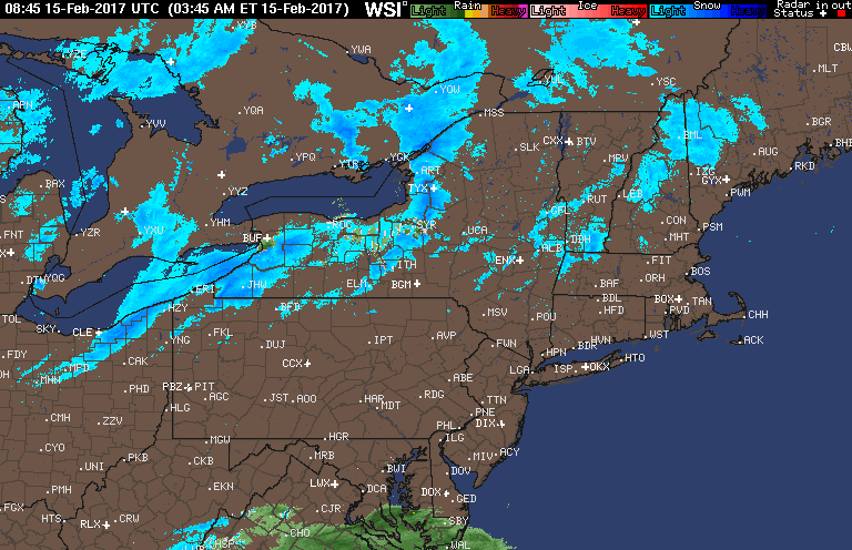
Good morning! A few snow squalls are pushing through western PA this morning dropping a quick coating to a few inches of snow and reducing visibilities at times. Some rain is also pushing into south Jersey this morning. This will move into southeastern New England later today. Here’s the radar as of 6 AM.
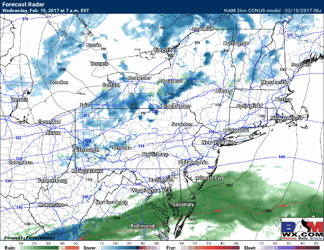
Through today, snow showers will continue across northeastern Ohio and western/central PA as a cold front moves through. Further east another southern stream disturbance will bring some rain across southeastern New England. This will morph into a substantial snow storm for northern and parts of central New England this evening into Thursday. Here’s the projected radar through this evening.
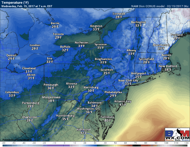
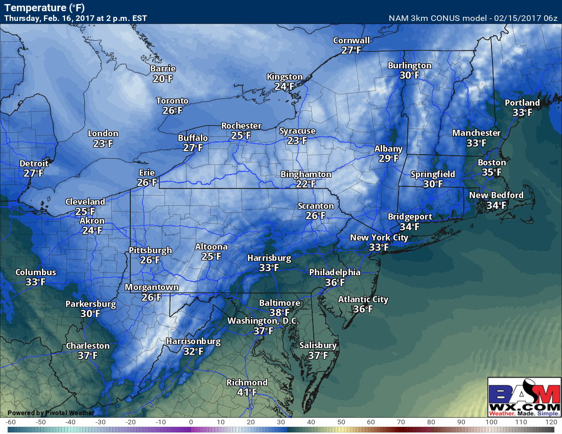
Temperatures today will remain steady or fall across western PA and Ohio behind the front, and reach the lower to middle 40s along the coast ahead of it before falling this evening. Here’s a look at temperatures through the evening.
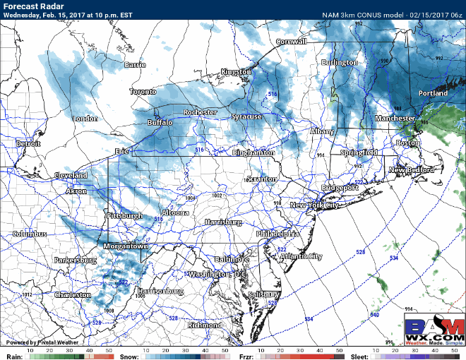
By tonight, the southern disturbance will phase with the cold front allowing a storm to rapidly strengthen in the Gulf of Maine. This will spread snow across northern New England and slowly wrap around colder air into northern Massachusetts as well overnight, changing rain showers over to snow showers. There remains a bit of uncertainty, but latest trends are snowier in northeast Massachusetts and southeastern New Hampshire. These will persist into Thursday morning as the storm pulls away. Here’s the radar overnight into Thursday.
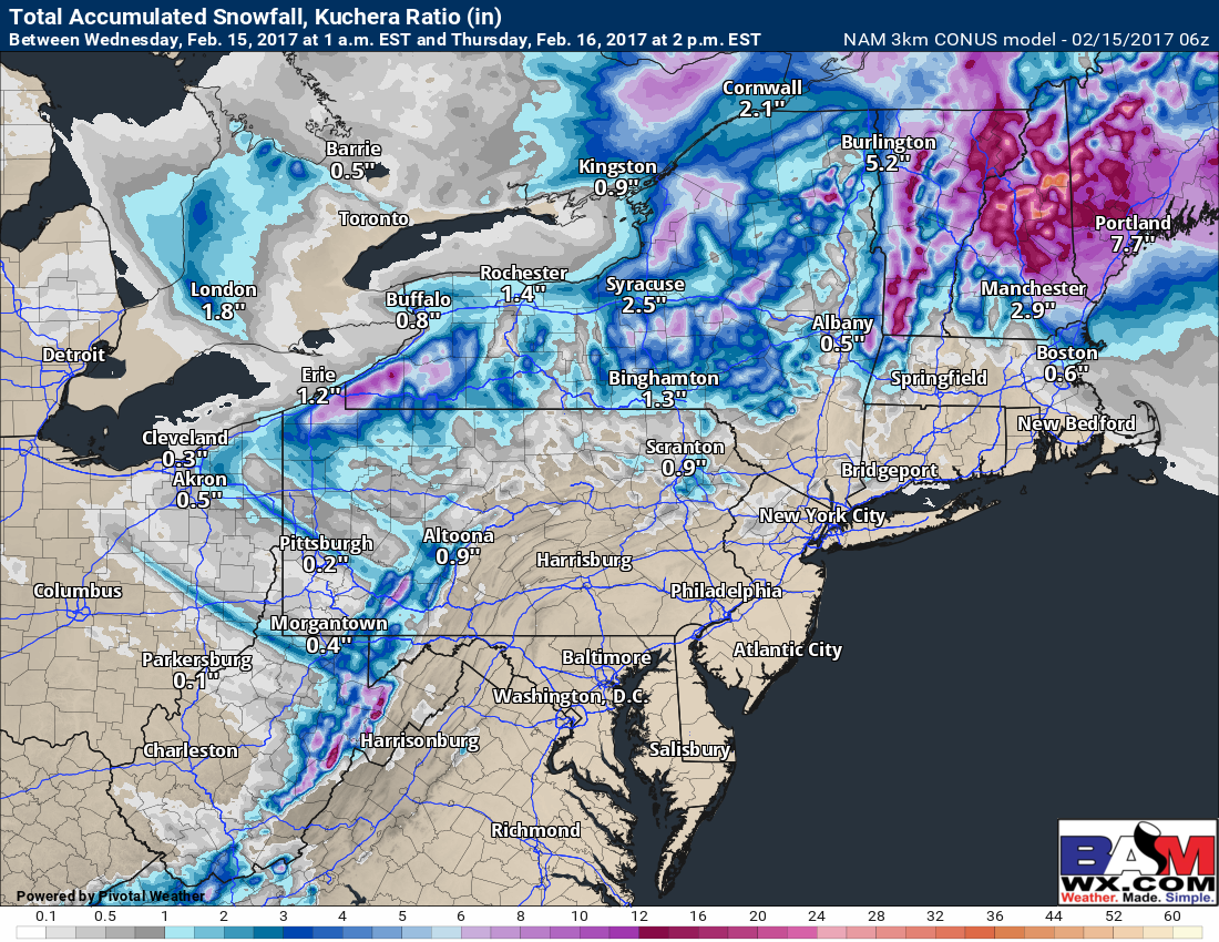
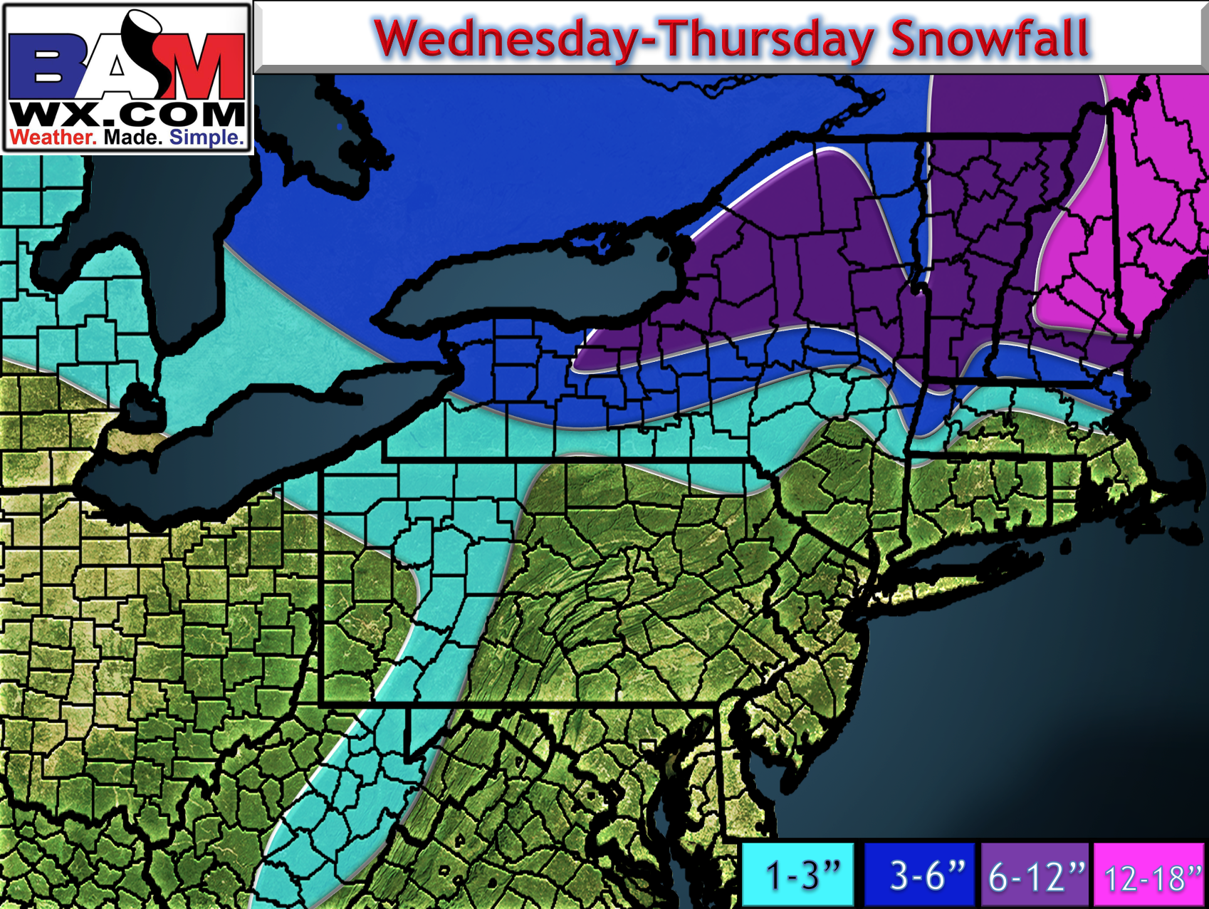
Snowfall from today through Thursday will be substantial in northern New England, and as stated above, is trending snowier in northern Massachusetts. There will likely be a sharp southwestern edge to the snowfall with large snowfall variations over a short distance. A few inches of snow will also fall today into tonight across western PA and northeastern Ohio as well. I think the 3km NAM illustrates the expected snowfall quite well and it is shown below. Notice the tight snowfall gradient in northeastern Massachusetts.
With that, here is our official forecast…
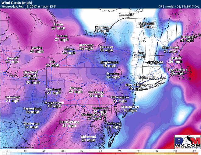
As the storm strengthens, winds will once again become gusty region wide, gusting past 35mph or perhaps even 40 mph at times through Thursday!
Thursday looks like a cold day as temperatures barely make it out of the 20s across much of the region, except perhaps right near the coast.
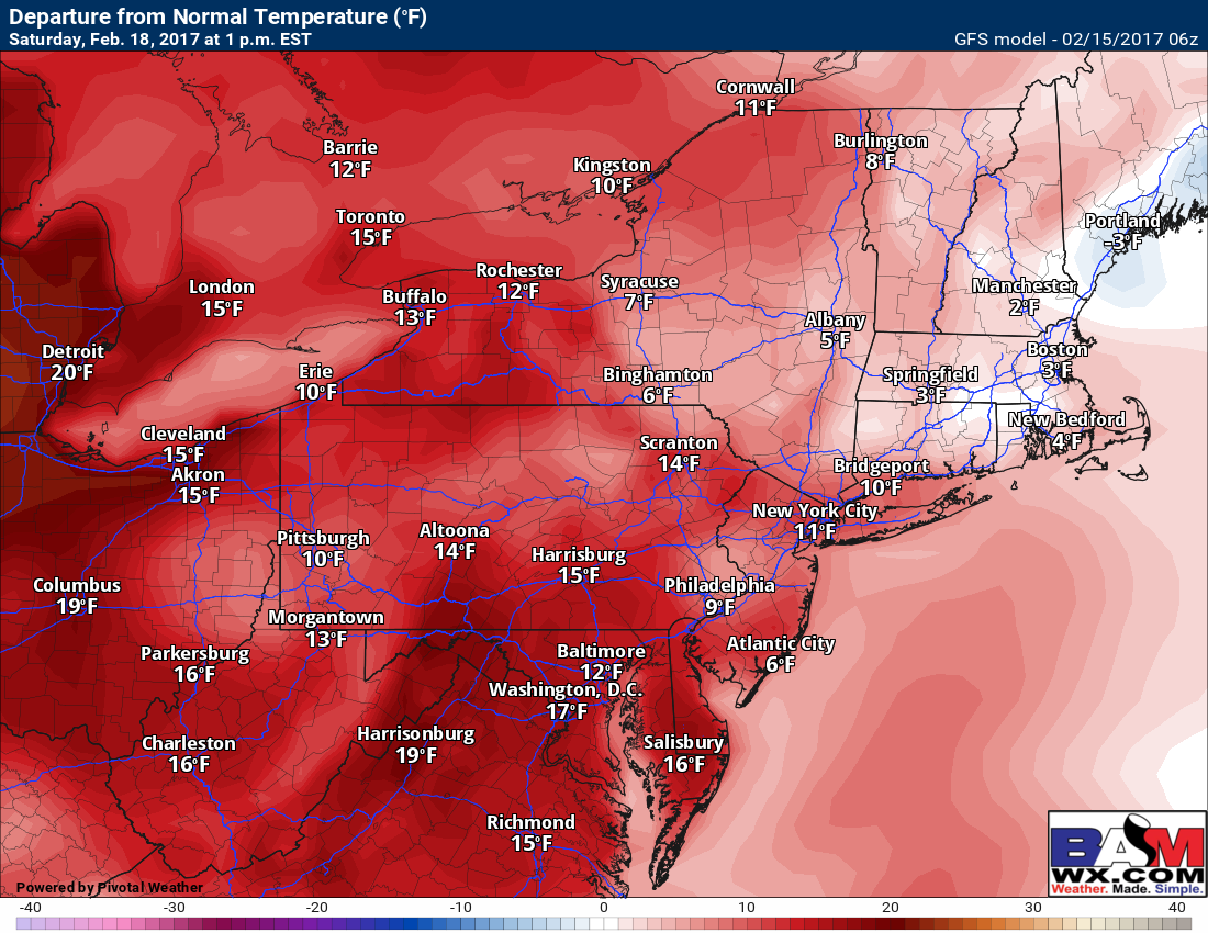
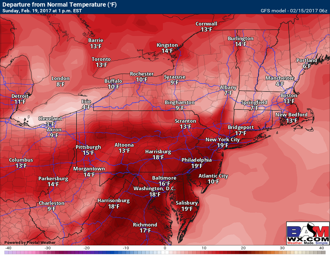
Beyond this system, a warming and drying trend is likely. Here’s a look at the temperatures compared to normal over the weekend both Saturday and Sunday afternoon. Notice western areas will be 10-20°F above normal Saturday and eastern areas will be 0-10°F above normal. Sunday will be 10-20°F above normal nearly region wide. This will equate to widespread 40s, 50s, and even some 60s!
Confidence and Risks:
- High confidence in some accumulating snow in western PA and northeastern Ohio as well as northern Massachusetts through Thursday.
- Low to moderate confidence in how far south the snow gets in Northeast Mass and southern New Hampshire. There can be a large difference in snow amounts over a short distance near the New Hampshire border.
- High confidence on a cold day Thursday, followed by a warming trend through the weekend.
- High confidence on a dry weekend with some sunshine.
Today’s video covers it all. Have a great day! ~Ed