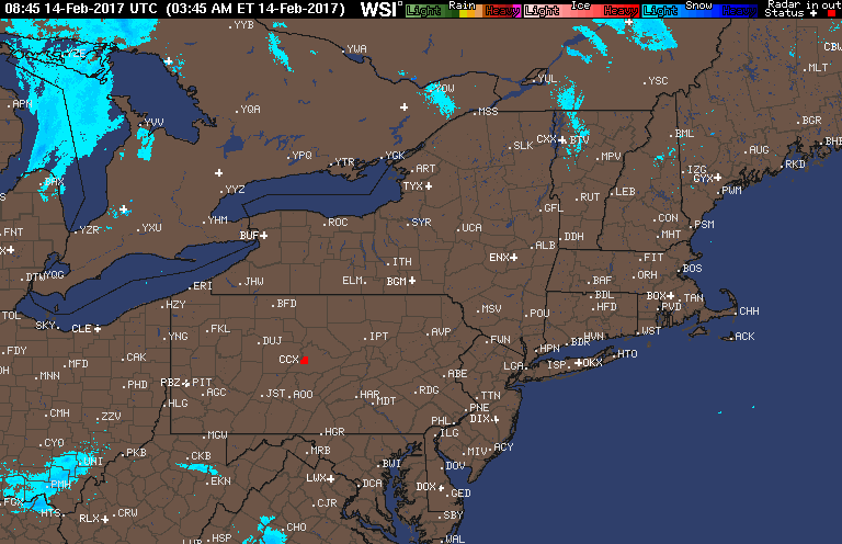
Good morning! Radar is mainly clear this morning with the only activity to be found across extreme southern Ohio and western West Virginia. Much of that is not actually reaching the ground, but a few flurries or sprinkles cannot be ruled out this morning. Radar as of 5:50 AM.
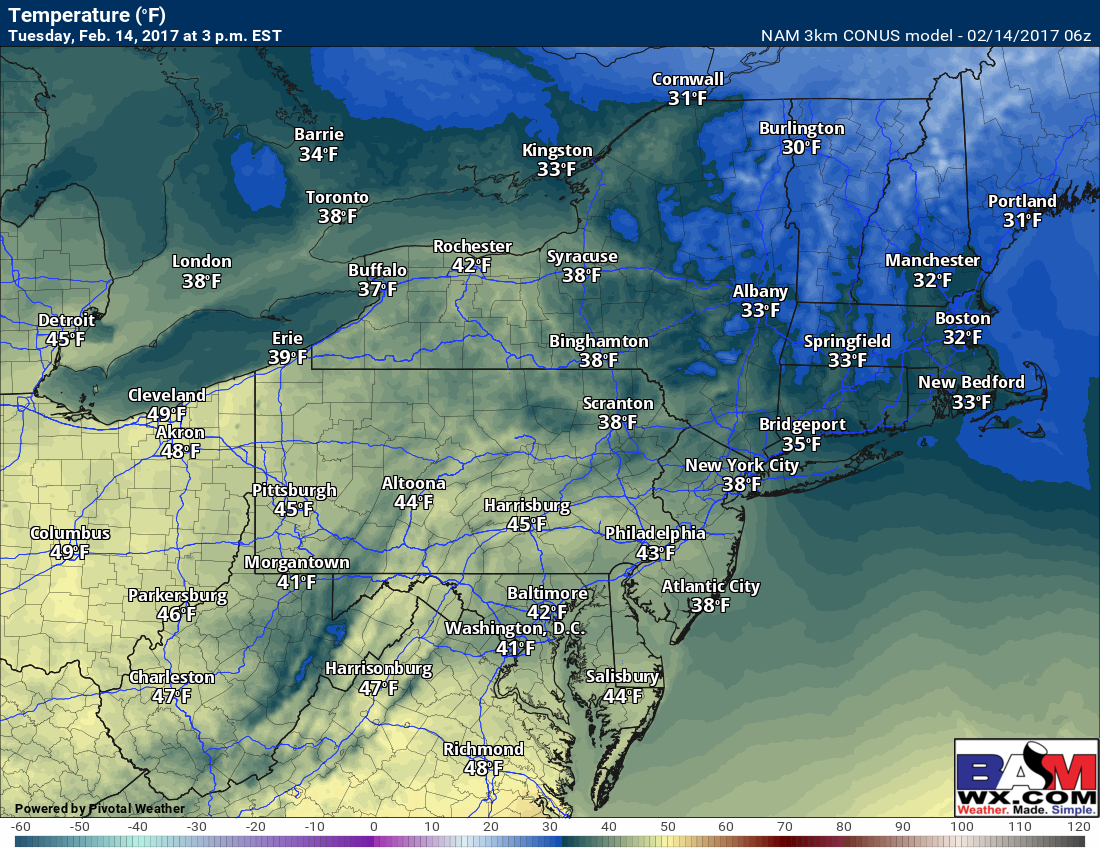
Today will be a dry, mild day across the much of the region with parts of New England a bit chillier due to some fresh snowpack. Heres a look at approximate high temperatures.
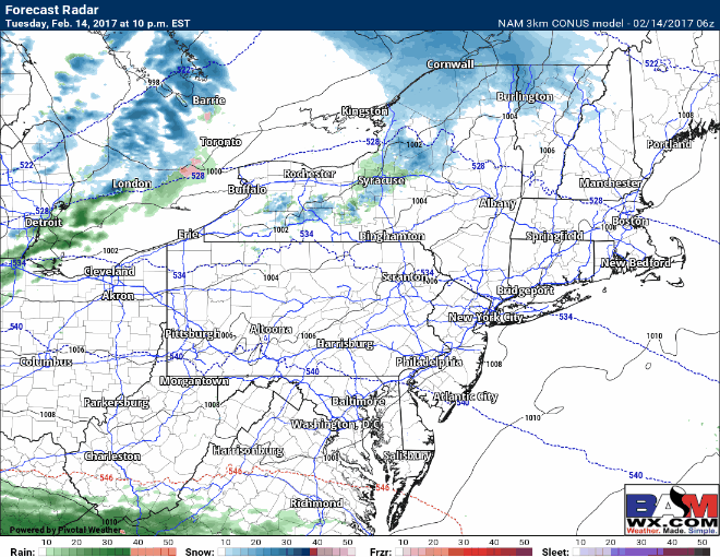
Our next chance for precipitation will come tonight across Ohio and PA in the form of some snow squalls as a cold front pushes through. Here’s the radar this evening through tomorrow afternoon.
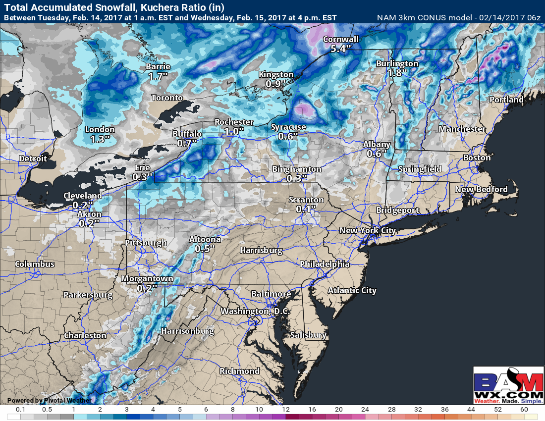
These squall will drop a quick coating to 1″ and will reduce visibility as they move on by. Here’s projected snowfall through tomorrow afternoon.
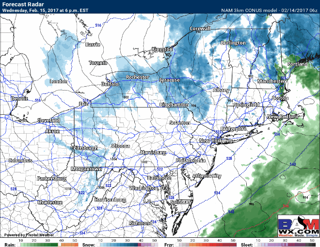
A storm system will rapidly develop east of New England later Wednesday into Wednesday night, leading to another big snow event for northern New England. While much of the forecast region will escape this wintry threat, some parts of Northeast and Northwest Massachusetts will get a bit of snow from this system. In addition, some lake enhanced snow showers will drop a few inches of snow in the lake effect belts of NW PA and NE Ohio. Some of these snow showers will leave a coating to 1 inch in SW PA and northern WV as well. Here’s a look at the forecast radar Wednesday evening through sunrise Thursday.
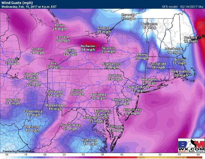
The storm will pull away Thursday afternoon, but winds will remains gusty right through Friday morning with gusts past 30 mph at times. Here’s a look at wind gusts Wednesday through Friday.
High pressure and warmer temperatures will take hold this weekend into early next week with some sunshine. Our next chance of precipitation (likely rain) will come ahead of a cold front by mid-week next week. Have a great day!
Today’s video is 4 minutes.