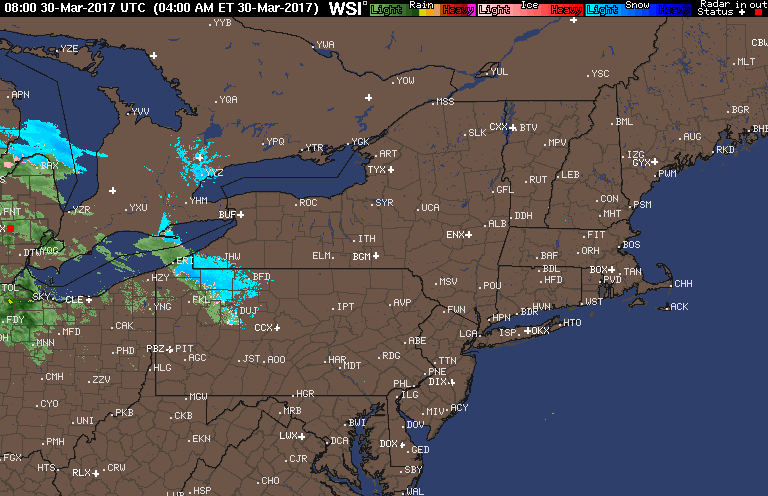
Good morning! We are tracking a warm front moving through Ohio and western PA today as an area of low pressure approaches from the west. Here’s the radar as of 6:15 AM.
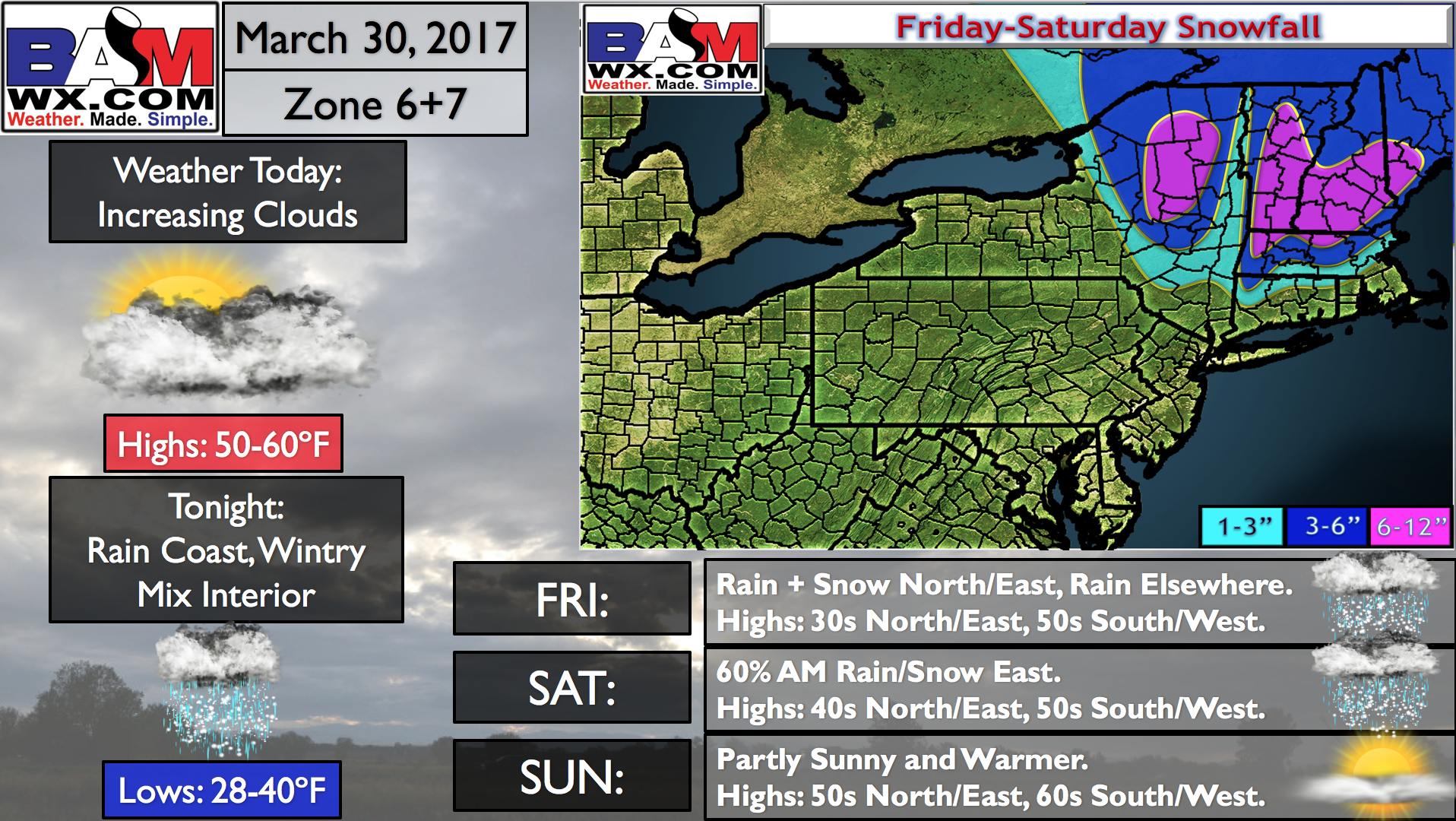
Our weather story revolves around this system, which will bring accumulating snow and ice to interior southern New England.
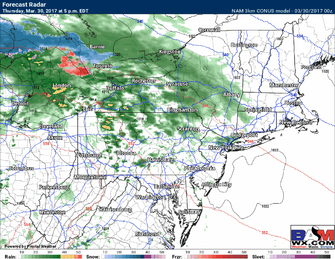
Some showers will spread into eastern PA late this afternoon and this evening. They will spread into southern New England Friday morning as a mix of light rain and snow with rain further south and west. Here’s the projected radar through Friday.
Uncertainty grows Friday evening and overnight with where the area of low pressure tracks and where the rain/snow line sets up. Latest guidance is slightly warmer versus yesterday with the rain/snow line closer to I-90 in Massachusetts during the heaviest precipitation.
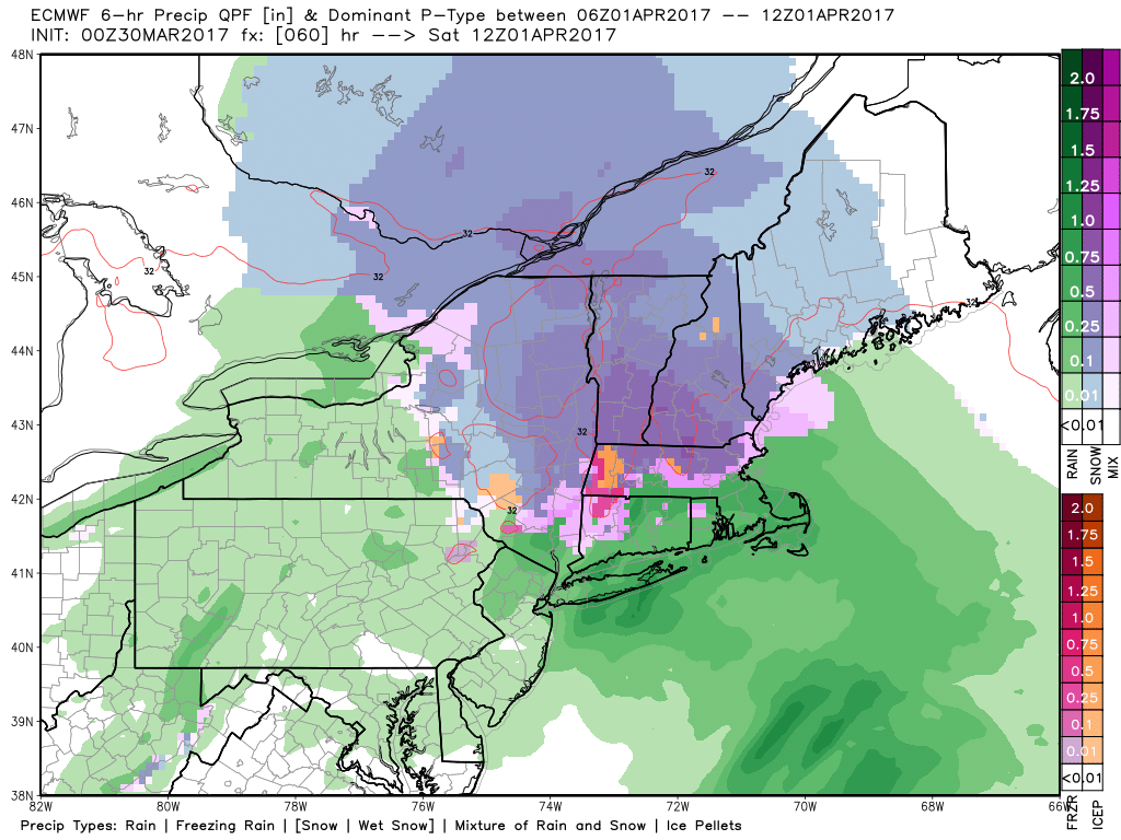
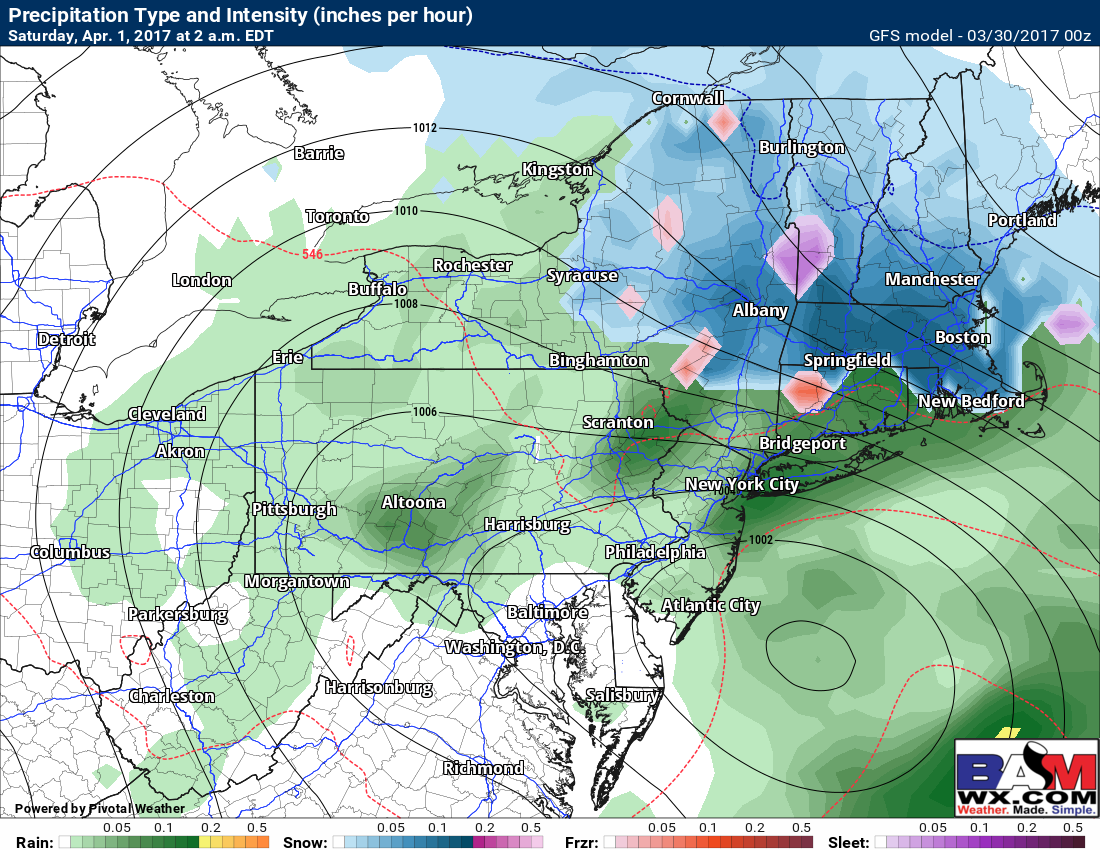
The GFS model is still colder, with snow and ice into northern CT.
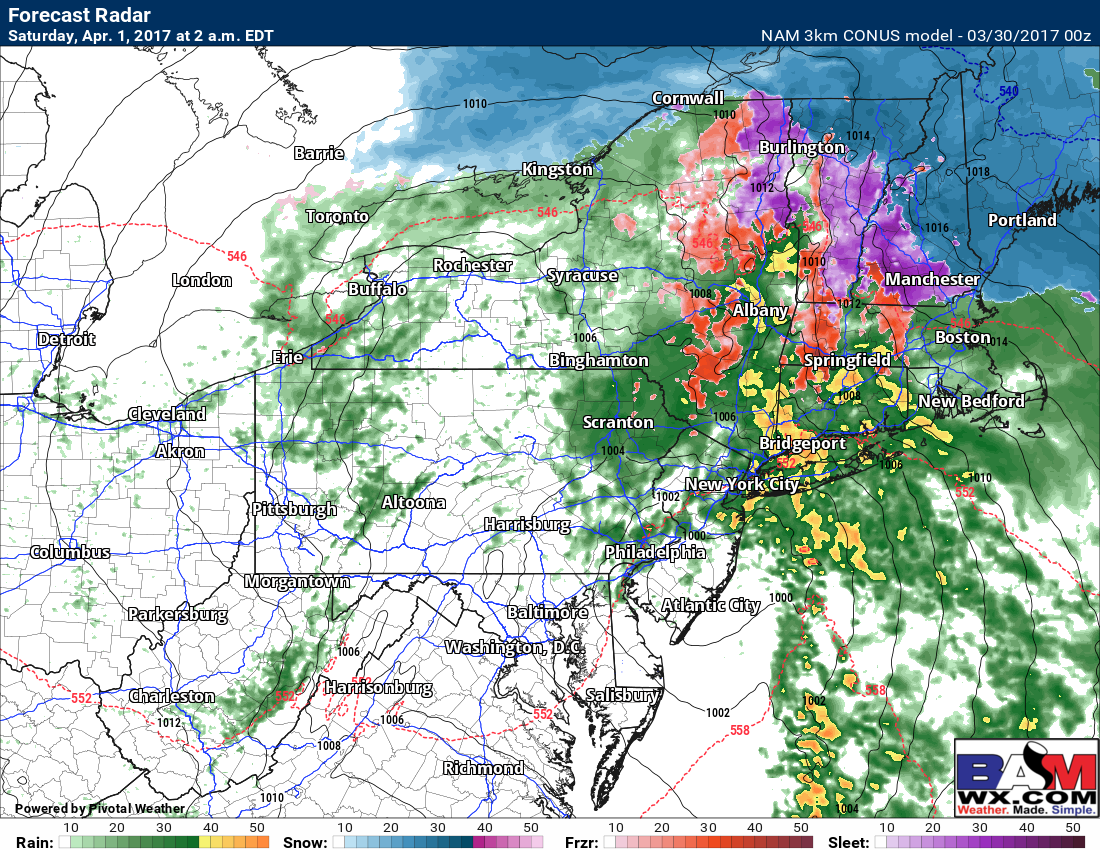
And still, the NAM remains the warmest with mixing and rain into Vermont and New Hampshire.
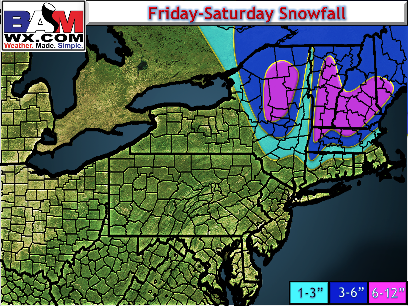
Here’s the latest snow map. I’ll break down timing and uncertainty in the video, so make sure to watch!
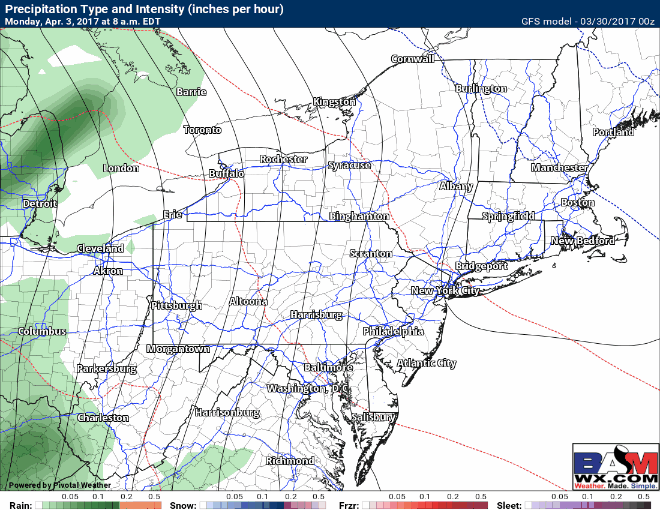
The weekend looks seasonable with some clearing. Our next rain and thunderstorm opportunity comes Monday as an area of low pressure approaches from the west.
Confidence and Risks:
- High confidence in mainly rain from coastal southern New England into Pennsylvania on south.
- Moderate confidence in precipitation type across New England. Some forecast changes are still possible.
Today’s video covers it all. ~Ed