#PAwx #CTwx #MAwx #RIwx #NYwx #NJwx Heavy Rain Today, Very Warm Into The Weekend! E.
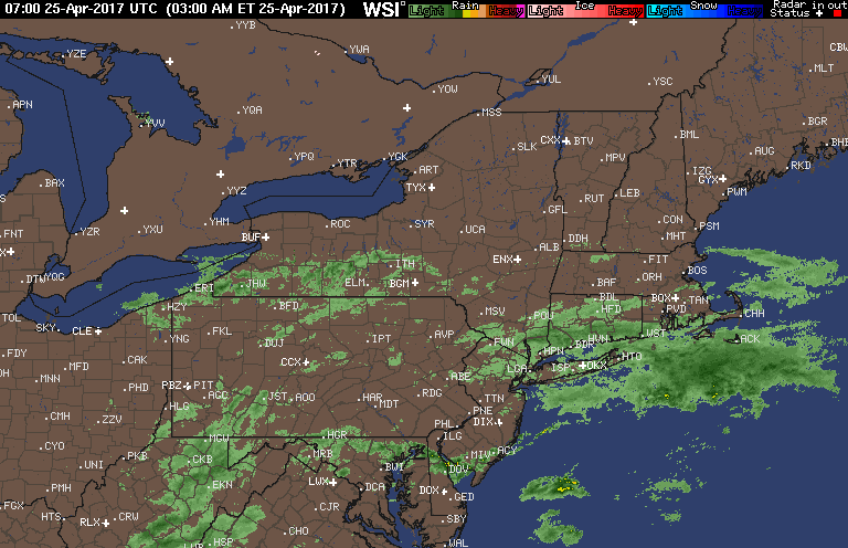
Good morning! We’re watching rain moving northward through southern New England this morning as an area of low pressure moves toward the region. Here’s the latest radar.
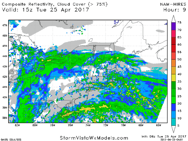
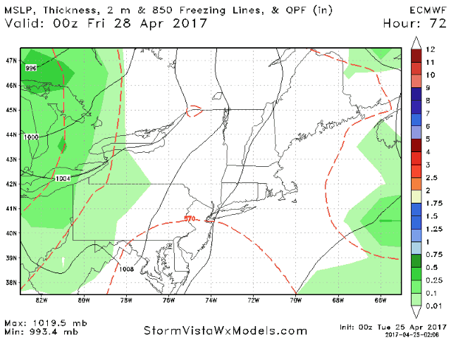
Today looks like a nasty day with rain moving northward through the Northeast. Here’s the projected radar through tonight.
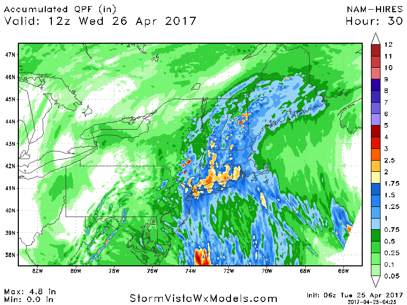
Total rainfall looks to range between 1-2 inches across southern New England tapering to nearly nothing across western PA and eastern Ohio.
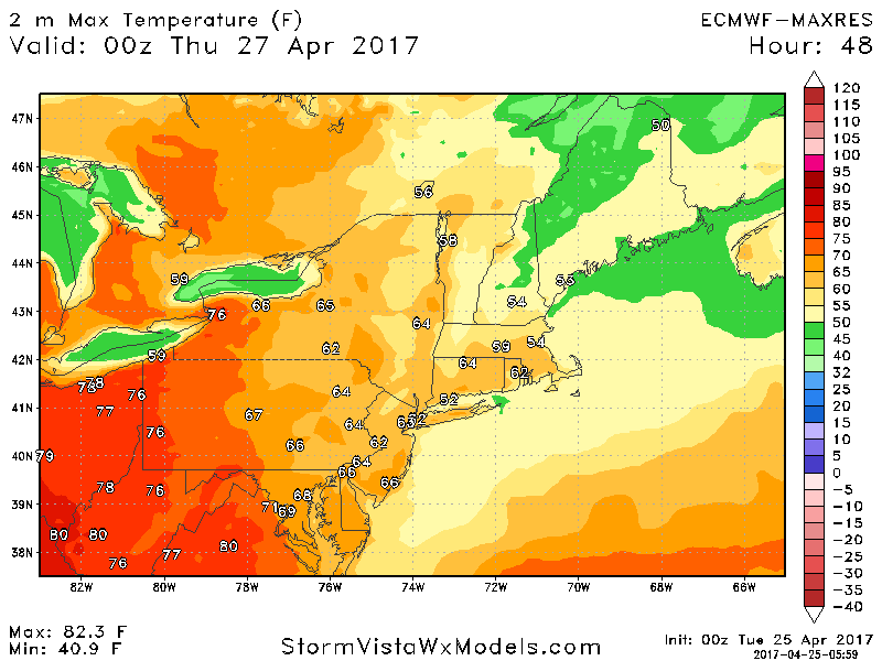
Clouds and showers linger into Wednesday east with warmer temperatures West. Here’s a look at highs Wednesday.
A cold front approaches Thursday across Ohio into northern New England with a few showers and thunderstorms. Some showers may slip south into PA and southern New England Friday into Friday night as well. Temperatures remain warm east through the weekend.
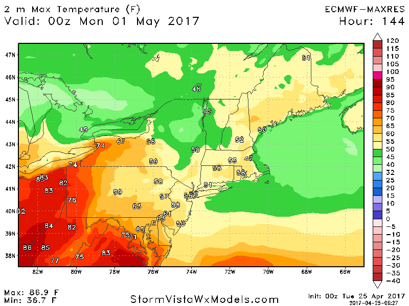
Temperatures remain warm through Saturday, but some easterly flow will lead to cooler temperatures across eastern PA and New England by Sunday shown below.
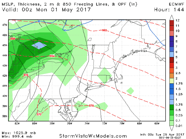
A strong cold front will move eastward through the region early next week with additional rain chances across the region. Here’s a look at the European model.
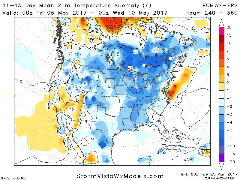
Cooler temperatures are expected behind this front into the 11-15 day period with temperatures 1-3°F below normal.
Confidence and Risks:
- High confidence in heavy rain today.
- High confidence in warmer temperatures to end the week and start the weekend.
- Increasing confidence in a cold front moving through the region early next week with cooler temperatures behind it.
Have a wonderful day! ~Ed