#PAwx #CTwx #MAwx #RIwx #NYwx #NJwx Cool and Active Regime Through the Weekend!
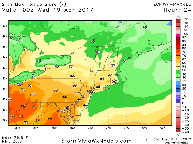
I wanted to give you a quick update on the pattern going forward over the coming week across the region. The main driver in the pattern over the next few days will be a backdoor cold front bringing much cooler temperatures compared to what we saw yesterday and over the weekend. Here’s a look at high temperatures today.
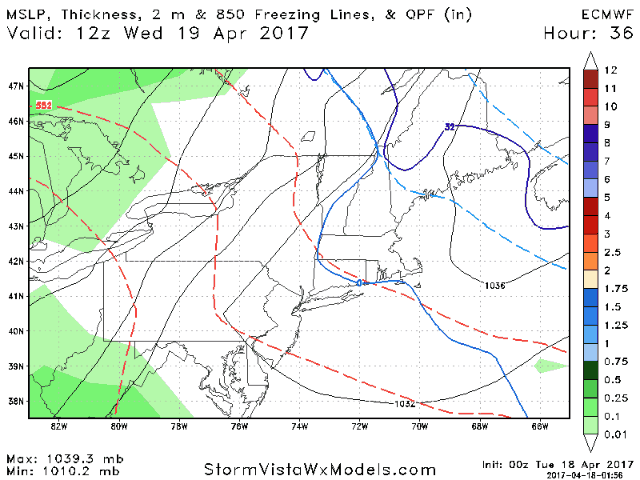
Beyond this, the big story will be unsettled conditions region wide through the end of the week. Here’s a look at the European model Wednesday through Friday.
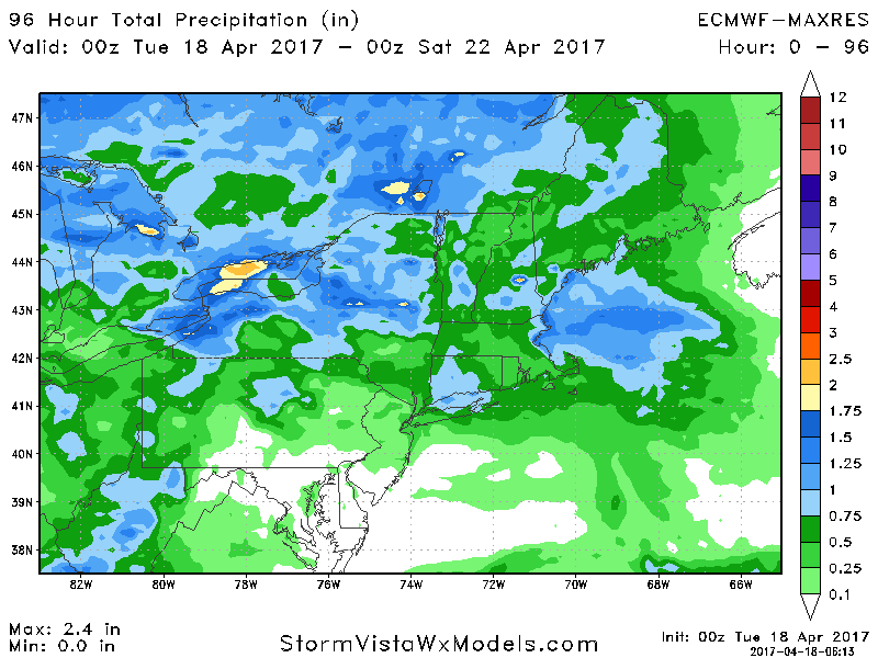
Total rainfall from various disturbances will be significant especially across northern portions of the forecast area. Some places likely see over 1 inch.
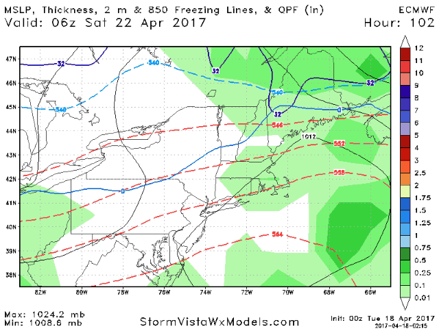
There will likely be a brief break in the rain Friday night into early Saturday, but more rain comes back into the picture later Saturday into Sunday.
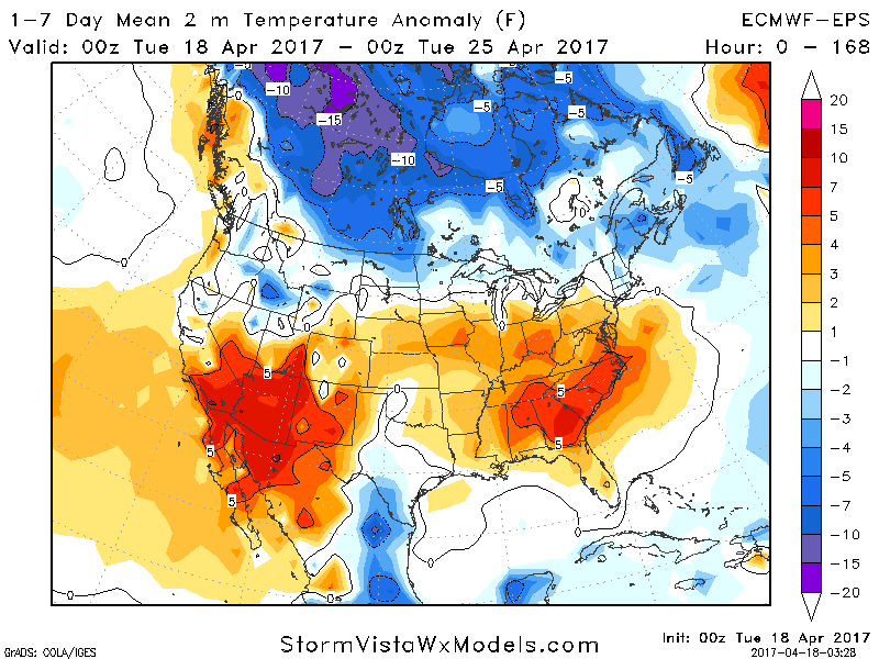
Temperatures over the next week likely end up below average across New England and near to slightly above average farther west.
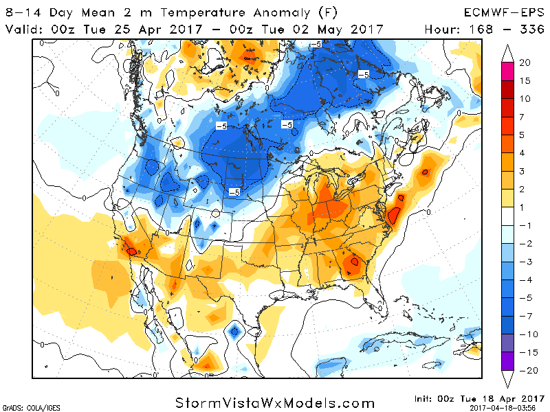
Into week 2, temperatures look to rebound back closer to normal, if not slightly above.
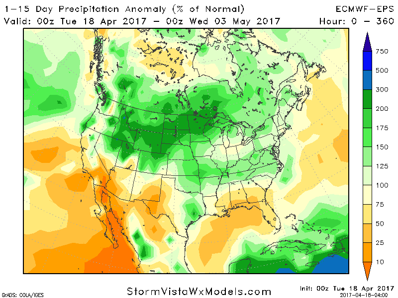
Here’s a look at rainfall compared to normal over the next 15 days. Above average region wide.
That’s all for now as I continue my big move. I’ll be in the main office in Indianapolis on Monday with full updates returning then. Have a great week!