Good morning. Much of the region is quiet this morning, but a warm front is moving through Ohio with a few showers. There’s also a few light showers across CT and MA. Some hill towns of MA are near freezing so watch out for a few slick spots early this morning. Here’s the radar as of 5:30 AM.
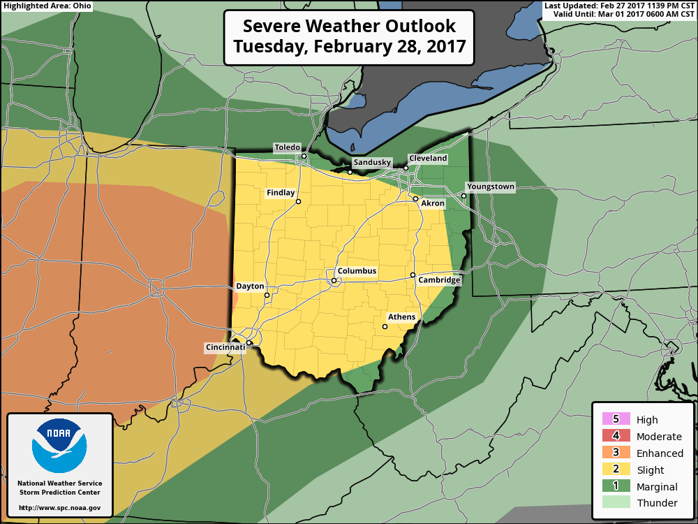
Showers will move northeast and usher in warmer, more unstable air across western areas today setting the stage for some severe thunderstorms across central and perhaps eastern Ohio this afternoon and evening. Here’s the SPC’s latest day 1 outlook. I’ll have the details, timing and threats regarding these storms in the video below.
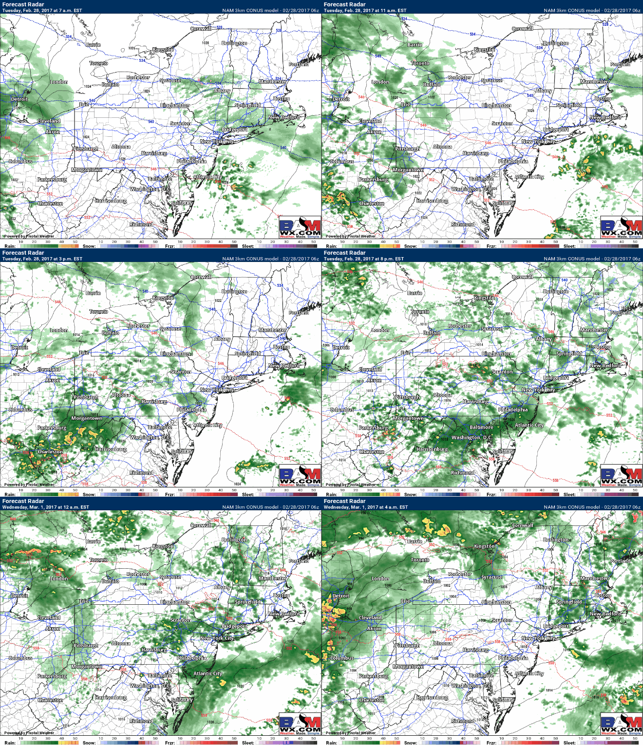
Elsewhere across the Northeast today will be mostly cloudy and mild ahead of a strengthening storm system. Rain and embedded thunder will push from west to east through the overnight. Here’s a look at the projected radar from this morning through the overnight.
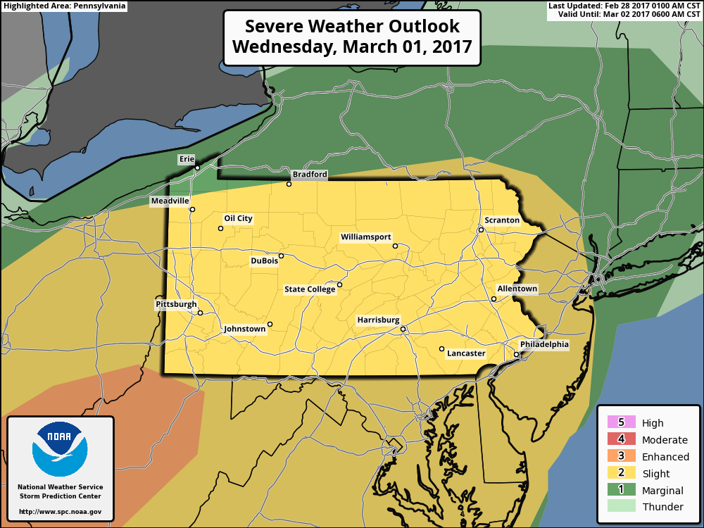
As the storm system moves through Wednesday, a line of thunderstorms will push through Ohio early in the morning then strengthen as it crosses WV and much of PA through the day. Here’s the updated SPC day 2 outlook showing a slight risk across much of these areas. As expected, they moved the slight risk further into NJ, PA, and NY as forcing and moisture look quite good. They also introduced an enhanced risk across far southeastern Ohio and WV.
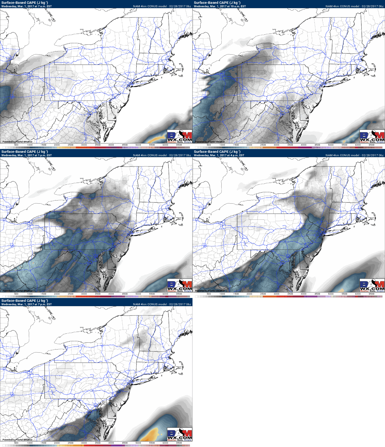
Moisture and instability look fairly modest across the region Wednesday, so severe weather is certainly a good possibility. Below is the projected available energy in the atmosphere (CAPE) during the afternoon. I have details on all the ingredients for the severe weather and timing in the video below so be sure to check it out!
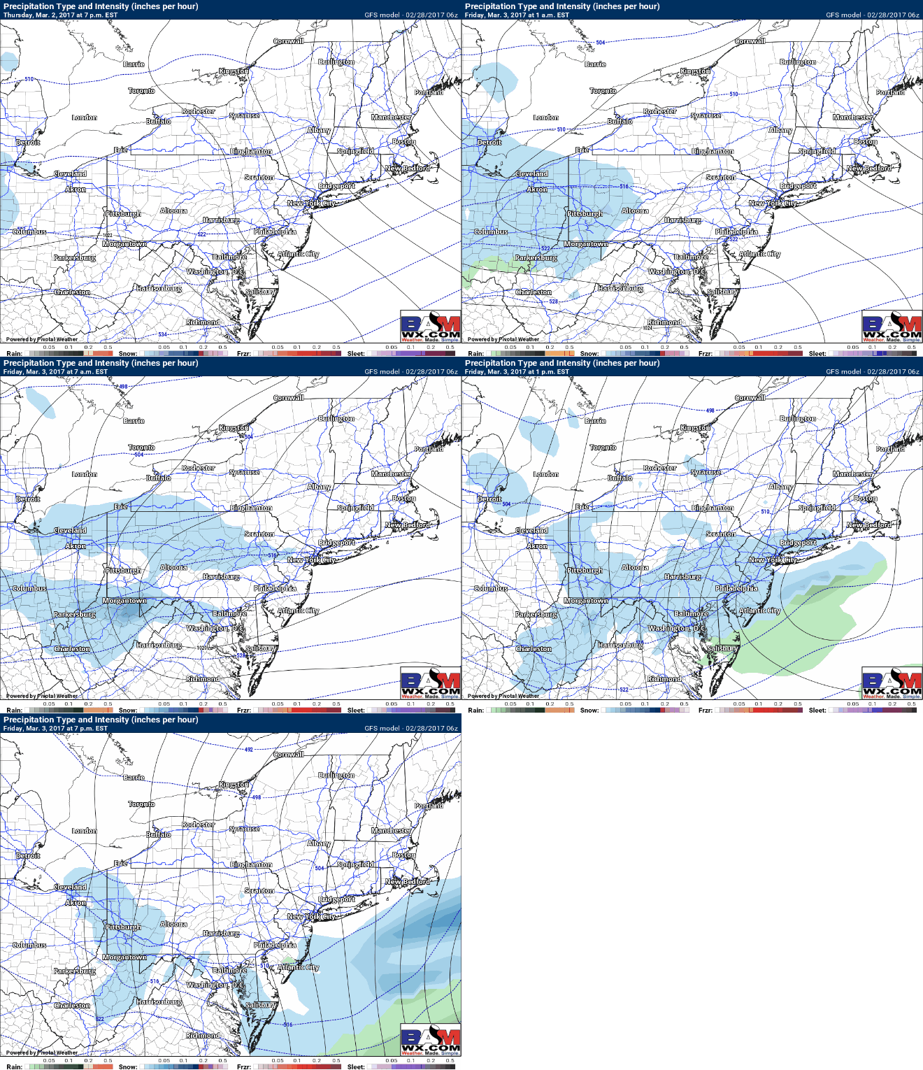
Behind the front, Thursday is much colder in the 30s and 40s with clouds and some sun. Thursday night into Friday the GFS model continues to suggest some light snow is possible mainly north of I-80 as a quick moving system moves through. Here’s a look at the GFS future radar. It should be noted the GFS is finally weaker compared to previous runs, lining up closer to other models.
I have some information on possible outcomes, model variability, and snowfall accumulations in the video!
Confidence and Risks:
- High confidence in warmth coming back into the region through Wednesday ahead of a cold front.
- Moderate to high confidence in thunderstorms, some severe, Tuesday across Ohio and far western PA.
- Moderate to high confidence on the severe threat for Wednesday afternoon and evening across PA, NJ, the Hudson Valley, and far western New England ahead of a cold front.
- High confidence on colder conditions to end the week.
- Low confidence on snow occurrence and accumulations Friday. Track and intensity remain very uncertain.
The video (9 minutes long) is jam packed with info so make sure to watch!

