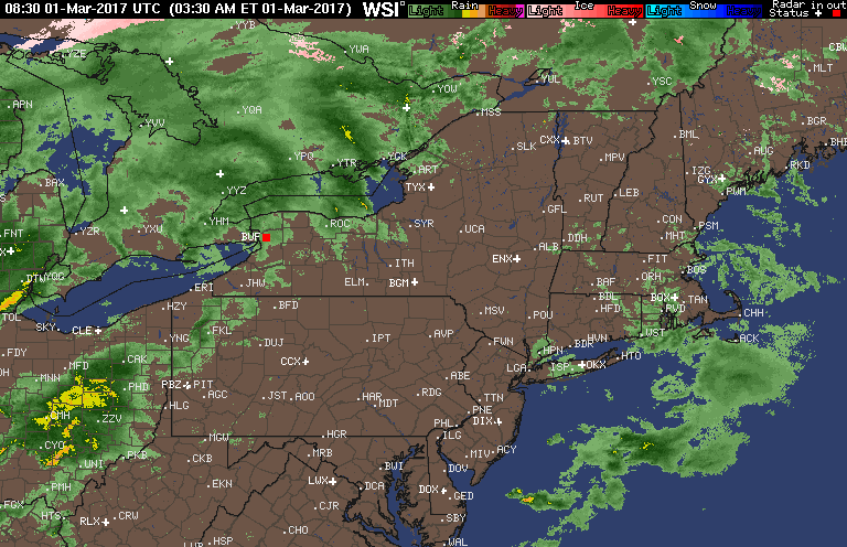
Good morning. We are tracking severe thunderstorms across Ohio this morning as a strong system moves through the Ohio Valley. These thunderstorms will continue to march across PA and southern New England through this evening. Here’s the current radar as of 5:30 AM.
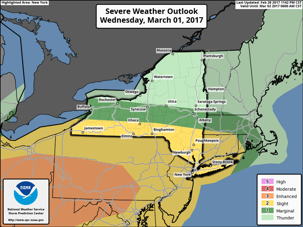
With the threat of severe, the SPC has updated its day 1 convective outlook. Here’s the latest- notice they have shifted the enhanced risk further into PA as expected.
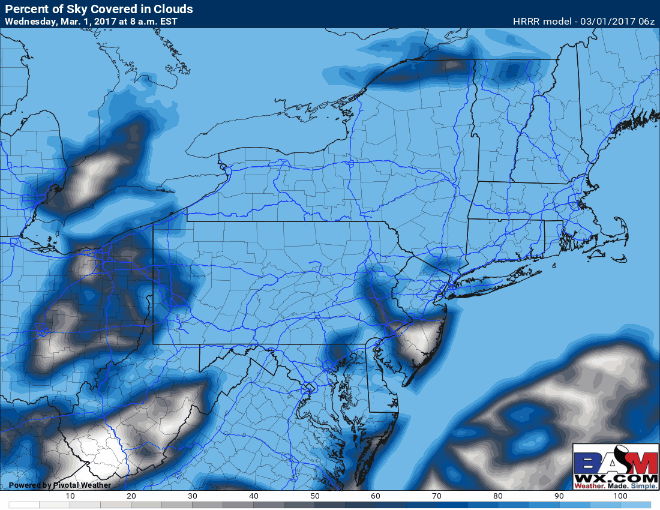
We will watch a batch of showers and storms move through PA later this morning and how fast these move through will dictate how much instability will be available this afternoon. Here’s a look at the latest cloud cover forecast from the HRRR. Notice some sunshine will be available across the Mid Atlantic later this morning, allowing things to become unstable. This may not be the case across southern New England, limiting the severe threat. It will be a “nowcast” situation.
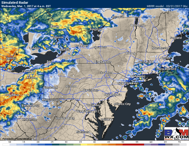
With that, here’s the latest radar forecast. I’ll discuss the ingredients for this afternoon’s forecast in the video, so make sure to watch!
Video Analysis (8 minutes):
I’ll have an update this afternoon regarding a few snow showers possible Thursday night into Friday as well as an update on the ongoing severe weather. ~Ed