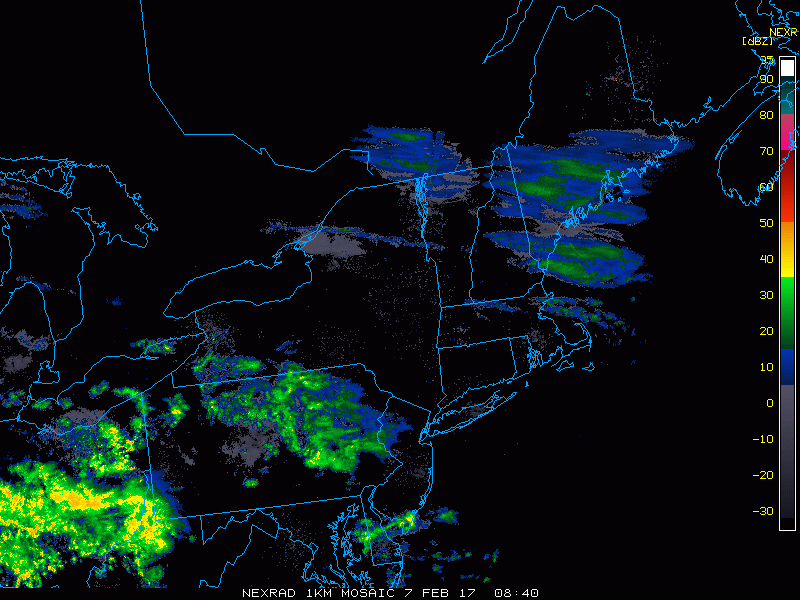
Good morning. Rain continues to enter Ohio and western Pennsylvania this morning as an area of low pressure pushes into the Ohio Valley. Further east, cold surface air is leading to pockets of freezing rain from the I-81 corridor in PA into interior southern CT. here’s the radar as of 5:40 AM.
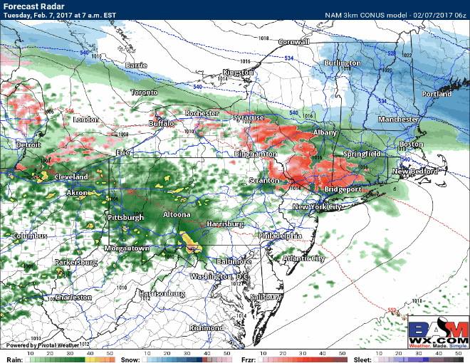
Precipitation will push eastward this morning with heavy rain across Pennsylvania and pockets of freezing rain across the Hudson Valley and interior southern New England. Temperatures will slowly warm this morning allowing any ice to transition to rain outside the highest elevations in southern New England. Here’s the projected radar throughout the day today. Notice the highest elevations of NW CT and MA stay icy through the afternoon, but elsewhere turns to plain rain.
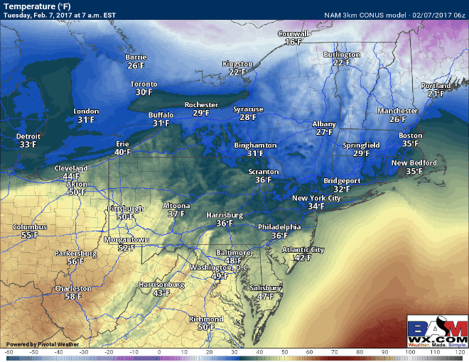
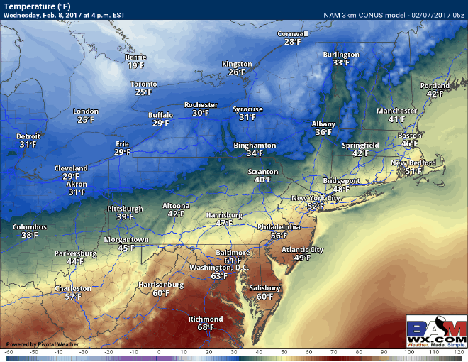
Temperatures today will slowly rise across southern New England, the Hudson Valley and eastern PA, but will quickly rise further west where warm air will rush northward.
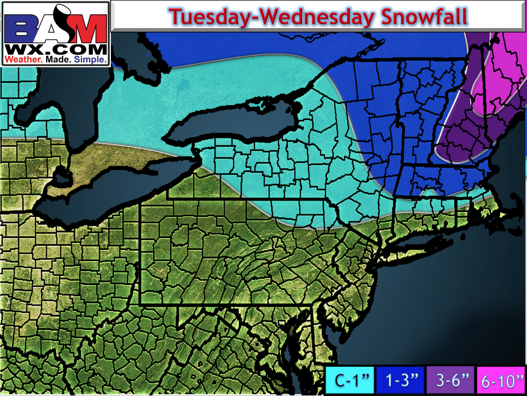
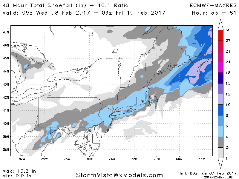
The newest and final snow map continues to trend lower with snowfall as sleet mixes in earlier.
Precipitation will end early Wednesday morning from west to east as a cold front sweeps through. Temperatures Wednesday will fall during the day across western areas and during the evening further east, setting the stage for what looks like a snow event late Wednesday night into Thursday.
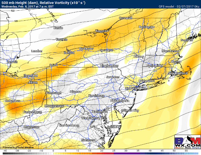
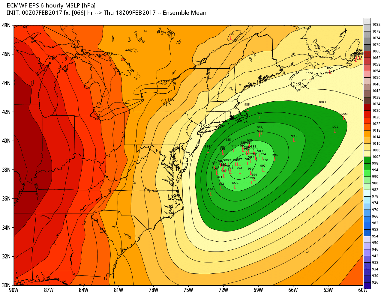
A strong piece of energy will move through the Mid-Atlantic into Thursday spawning an area of low pressure. Below is the latest GFS upper level energy. This type of evolution is classic for a moderate snow event for much of the Northeast.
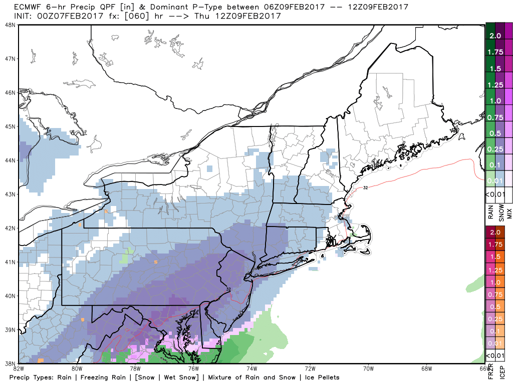
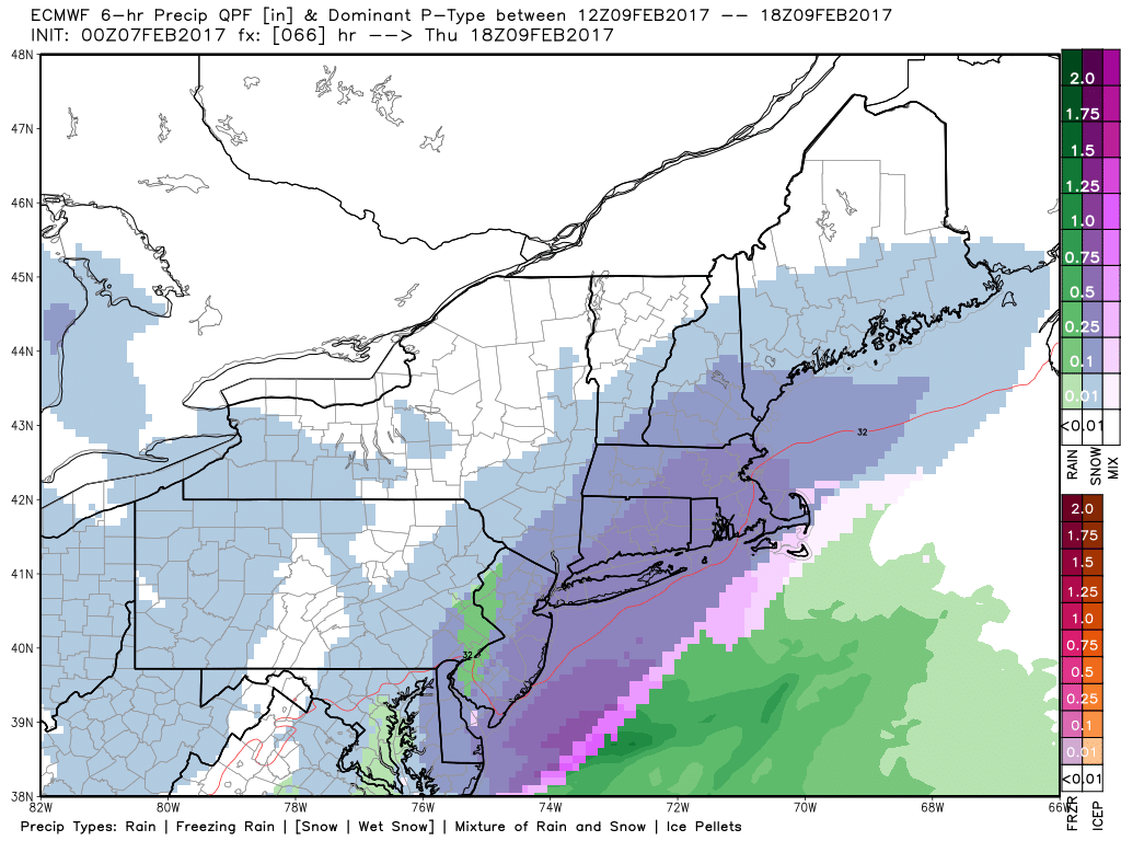
Here’s the latest GFS animation as well as the European below it. Both solutions have impactful snowfall across much of the I-95 corridor north of Philadelphia during the day Thursday. Some snow also will fall across northern WV, western PA, and eastern Ohio, but amounts will be lower with less moisture available.
Snowfall amounts will be highly dependent on the exact track of this system. For example, the latest European ensembles (51 different model members) are in good agreement in a storm passing just southeast of the 40°N, 70°W “benchmark”. This indicates higher confidence in some plowable snowfall.
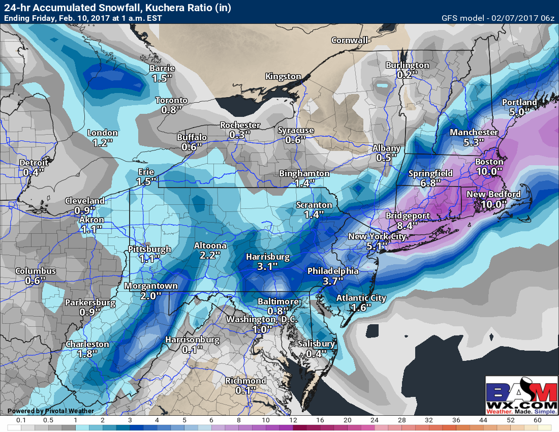
With respect to snowfall, here are the latest GFS and European model forecasts, both showing a moderate snow event for many from PA to MA.
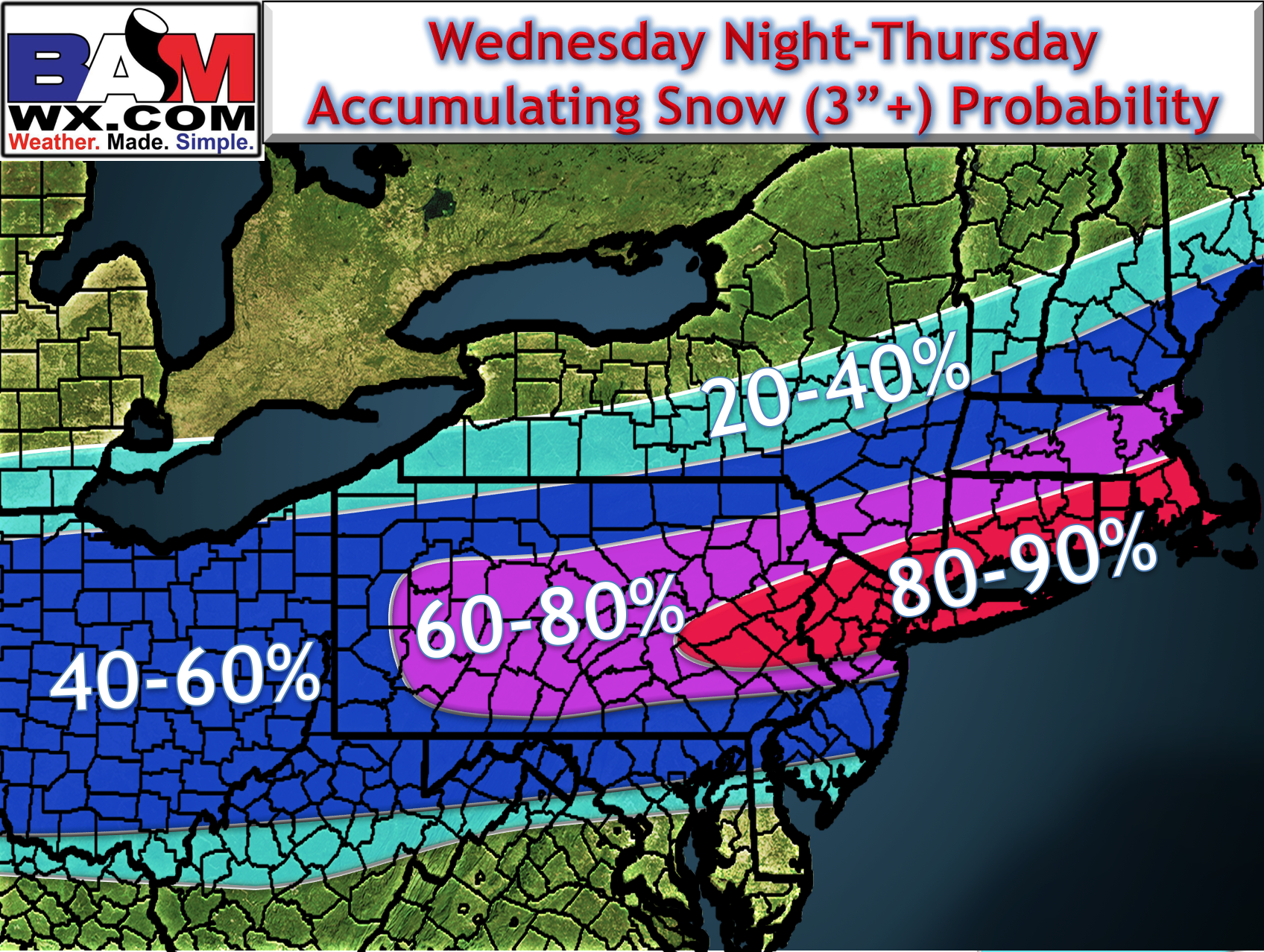
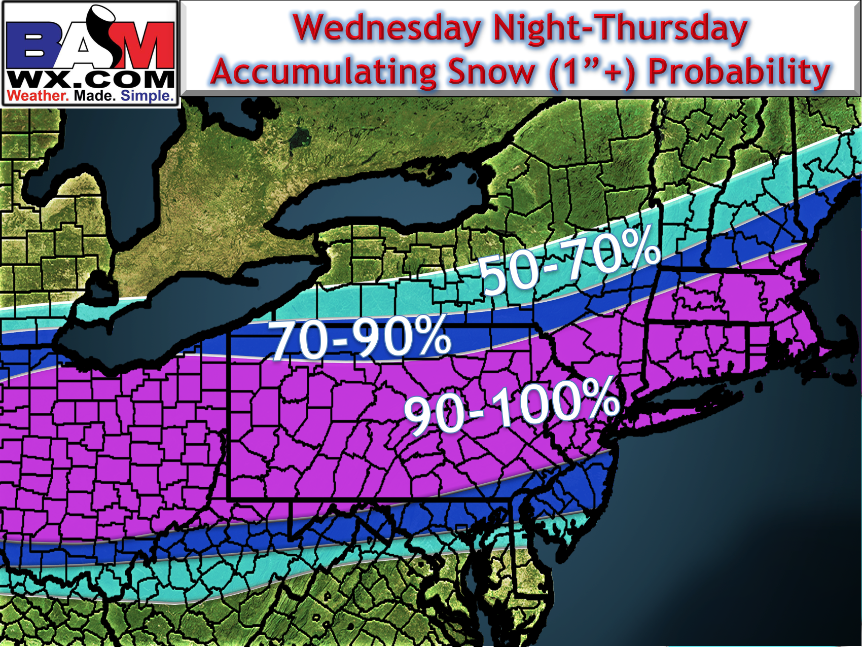
Here’s some probabilities of 1″ and 3″ or more of snow for wherever you live. I will have a snow map out this afternoon.
Today’s video covers it all. ~Ed