Key Points – Monday, August 7, 2017:
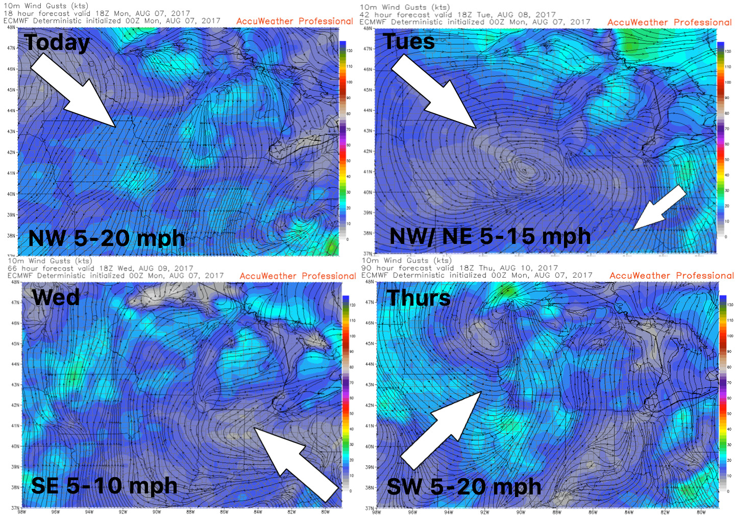
Synopsis: Good Monday morning! A few light showers moving across southern IN and southern OH today that will continue to push east throughout the day…winds will shift out of the north and west into Tuesday morning as the cold front passes, it’ll feel pretty chilly waking up tomorrow morning as well. High pressure sets up shop Tuesday and Wednesday (not expecting much in the way of precipitation here), next chance of showers is Thursday evening into Friday as another front moves through from west to east. Targeting another disturbance later Saturday into Sunday especially I-70 south. In terms of rainfall this week, the majority of the coverage will be to the south as well. All the details in the video, if you have any questions let us know…have a blessed day!
Today’s video (7:30 min):
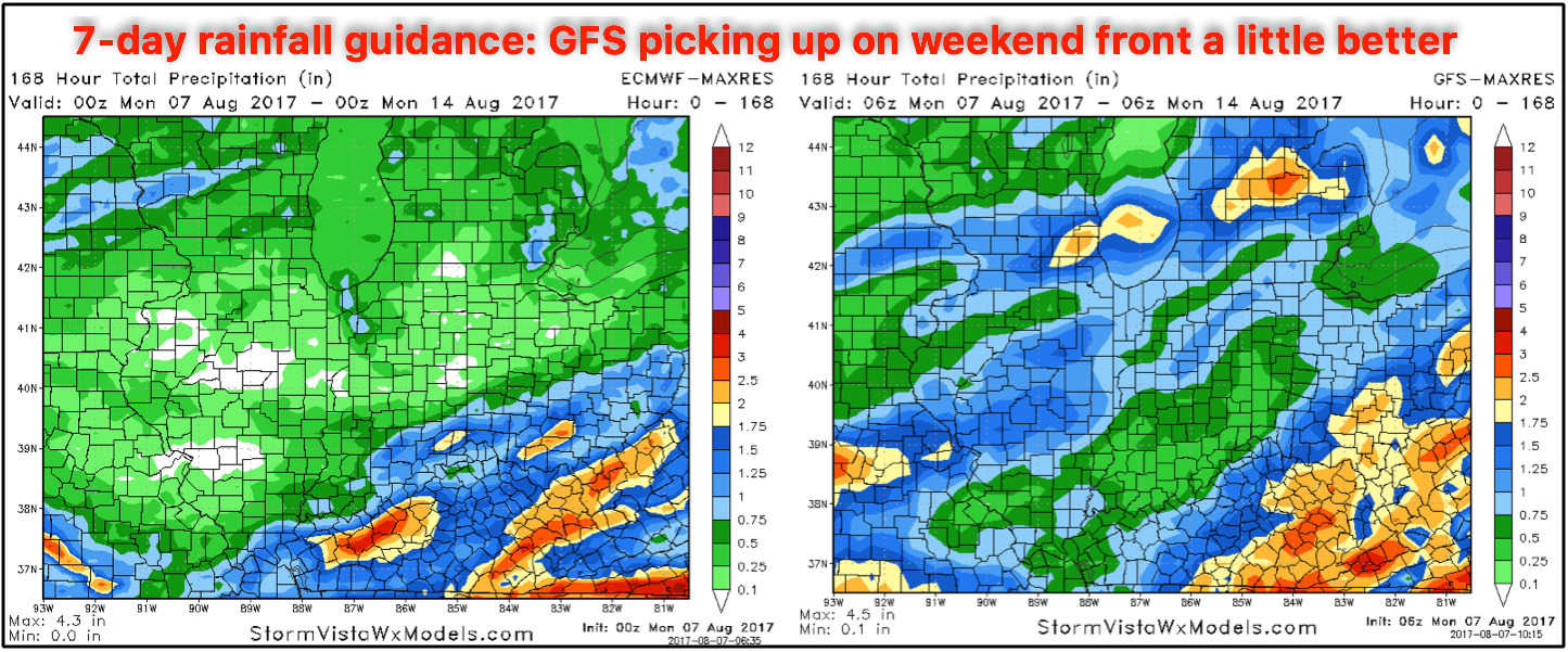
7-day rainfall guidance comparing the European and GFS models…the GFS we feel is picking up on the weekend front moving through a little better. Overall, not a very wet week ahead.
Wind forecast of the next 4 days:
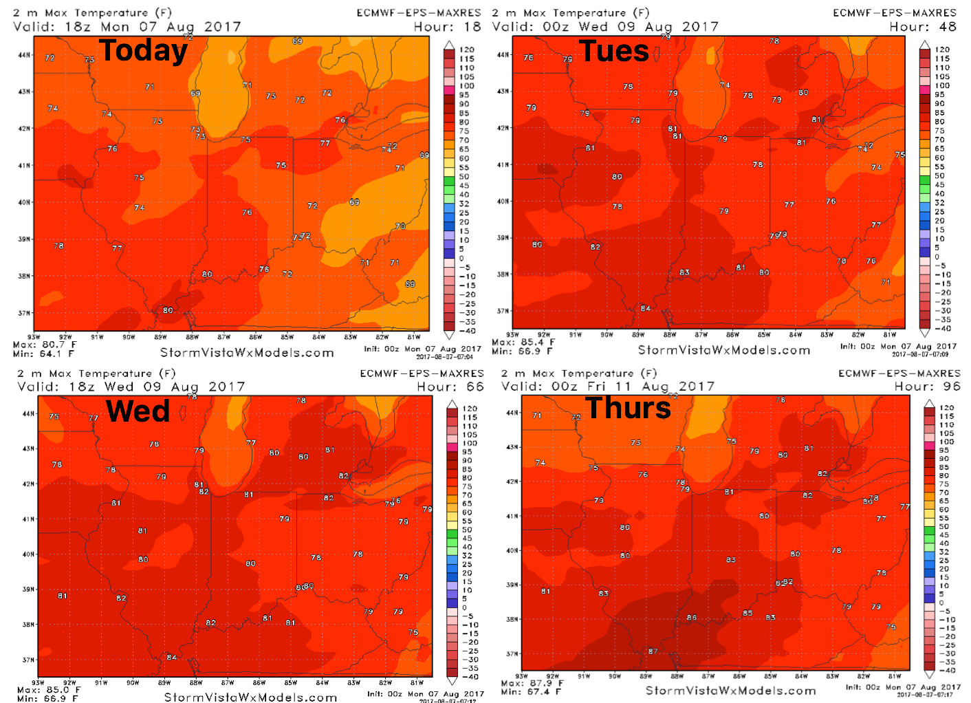
High temperature guidance into mid-week:
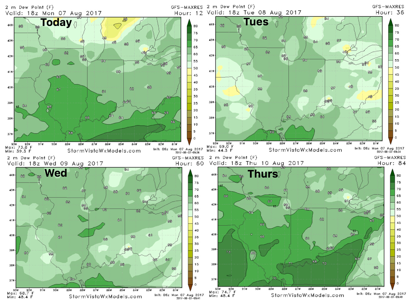
Overnight low temperature guidance is below…chilly the next 2 nights for sure: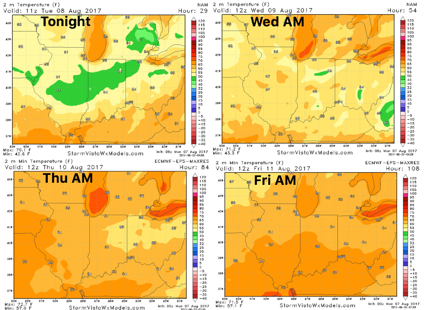 Dew points forecast here as well will mainly be in the mid 50s to lower 60s…not bad for early August: