Key Points – Thursday, August 10, 2017:
***Hope you’re having a great week! As a reminder, you will receive all of our products via email, just make sure you’re looking at the right forecast locally; remember, the advantage of having a team of meteorologists at your fingertips can be priceless. With our service you will have access to our team of meteorologists 24/7. Also, make sure to watch the videos in their entirety to get a true sense of the information we provide and how it can be of value to you.
At anytime this week you feel like you have seen enough to make a decision and you’re ready to sign up we will offer you a 20% off discount if you sign up BEFORE your trial expires August 11th. Please do not hesitate to reach out to us at anytime if you have any questions. Have a blessed week! -BAM staff.***
Synopsis: Good Thursday morning! Watching for a redevelopment of storms ~4/5pm across north-central IL, some of which could be strong. The cold front slowly moves east on Friday, sparking additional scattered storms ~40% coverage across the forecast area, exiting east late Friday night. This will pave the wave for another nice weekend ahead, it is of note that a few areas of patchy fog will be possible as we head into the weekend each day that will dissipate by mid-morning as the sun rises. Chance for additional showers/storms late Sunday night/Monday morning, but right now we feel the best forcing is south (similar to last weekend)…stay tuned on this as we go forward. If you have any questions please let us know, have a blessed day!
Today’s video (6:50min):
Can’t rule out a few strong storms across eastern Iowa and north/west Illinois later tonight into early Friday morning:
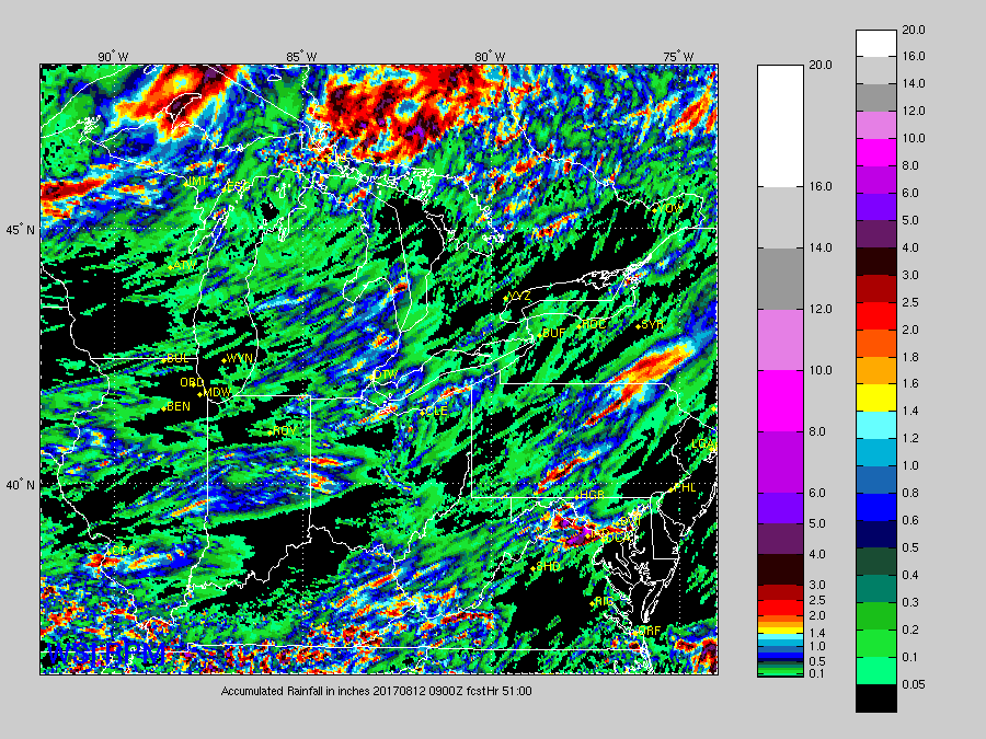
Rainfall guidance over the next 2 days is below, which we feel is handling storms ahead of the cold front the best as we move through Friday from west to east. Current thoughts are where it storms, 0.5-1.5″ with isolated higher amounts possible if a stronger storm were to pop up. It’ll be very hit or miss.
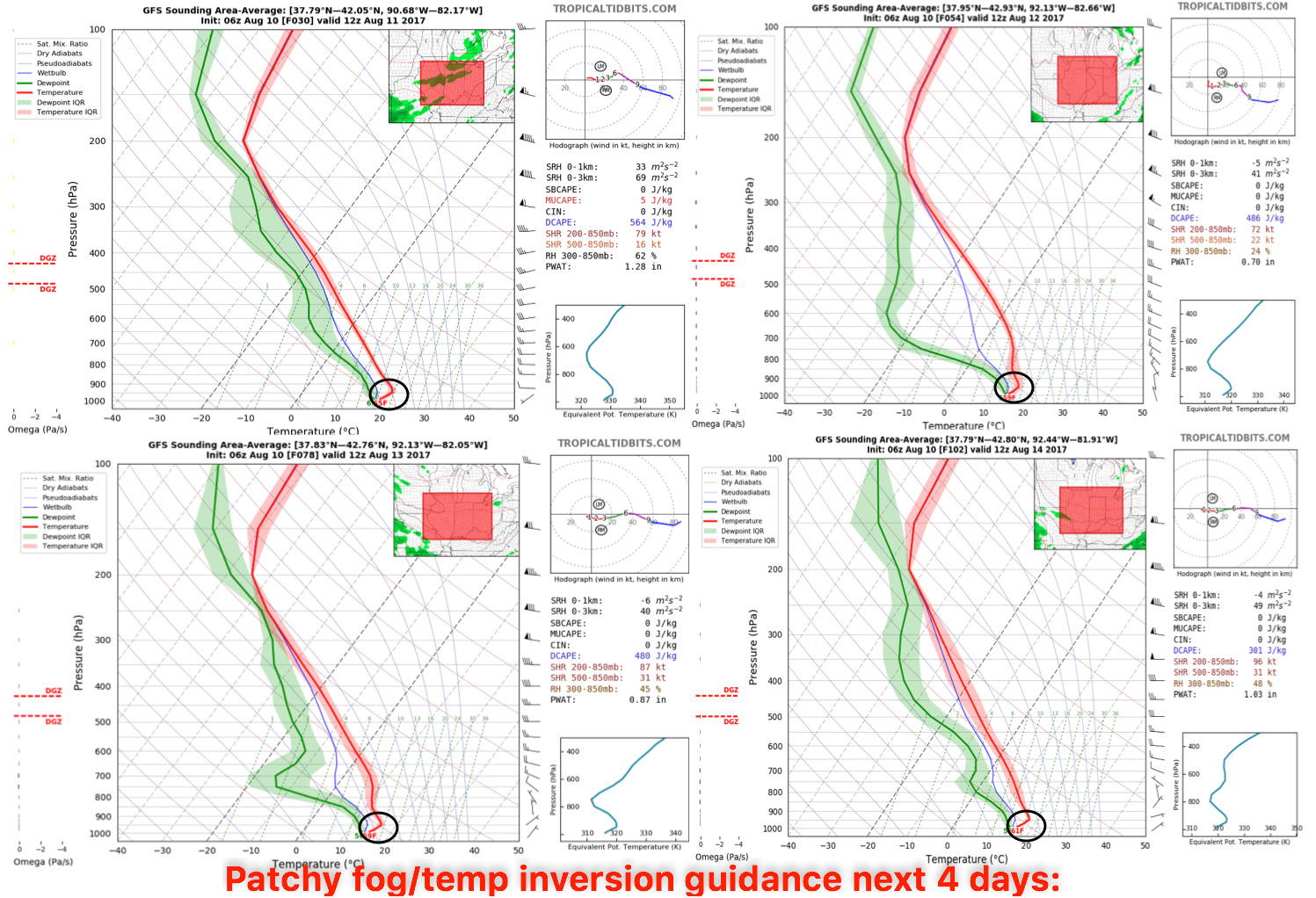
Still watching for potential temperature inversions/patchy fog across the Ohio Valley over the next 4 days…these won’t be widespread and won’t last past mid-morning as the sun rises:
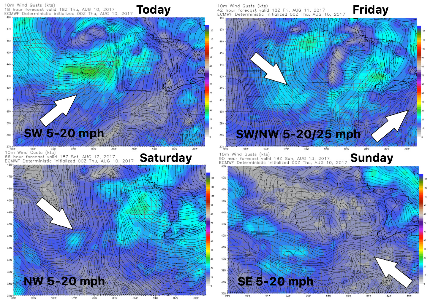
Wind forecast guidance as we head into the weekend…not expecting much trouble with windy conditions overall:
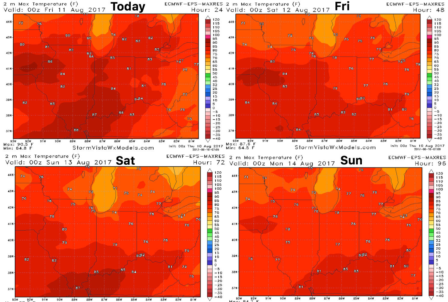
High temperature forecast guidance is below…overall staying cooler than normal:
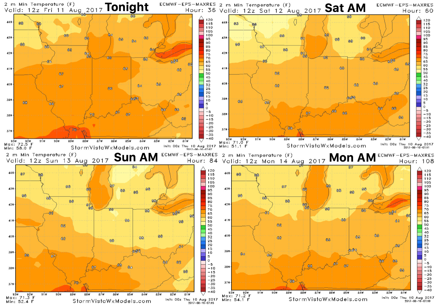
Overnight low temperature guidance over the next 4 days:
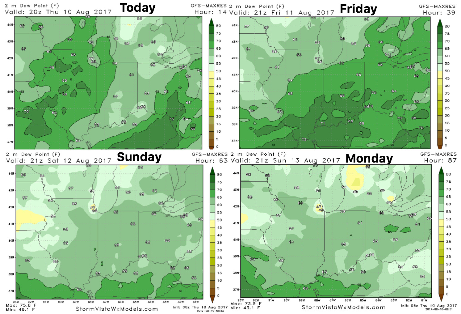
Dew point forecast as we head into the weekend is below: