Key Points – Wednesday, September 6, 2017:
Synopsis: Good Wednesday morning! Waking up to very cool temperatures into the 40s across the region. It will feel very fall-like over the next several days. A few scattered showers are expected to develop today mainly across the northeast half of Indiana, Ohio, and southern Michigan. A similar theme can be expected Thursday. Sunny and very nice conditions are on tap for the upcoming weekend. Latest details in today’s video. Have a blessed day, and let us know if you have any questions!
Today’s video (4:50):
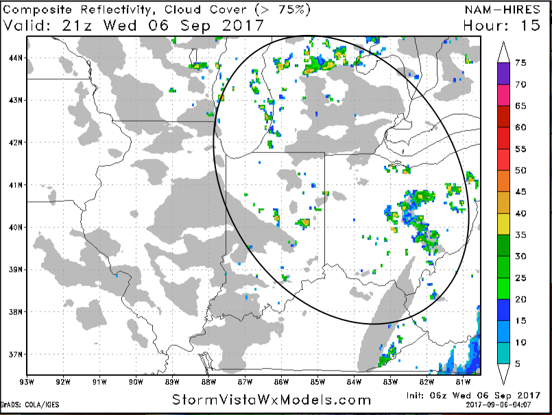
After sunshine this morning, skies become mostly cloudy with 30-50% coverage of showers popping up this afternoon into early evening across much of northern Indiana and Ohio – these showers being enhanced by northwest winds off Lake Michigan. Areas further southwest should remain dry with a bit more sunshine. These showers will quickly diminish after sunset.
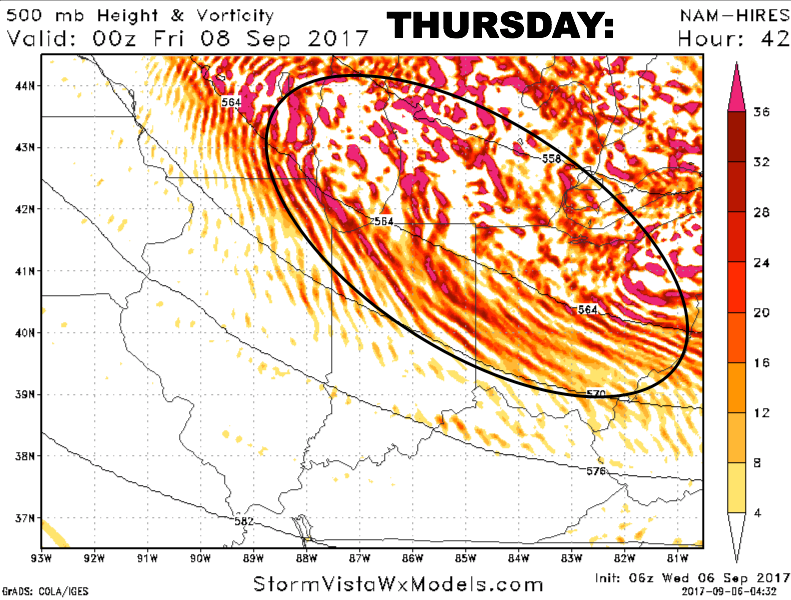
A similar set-up on Thursday as an upper level trough gradually lifts out of the area. Areas further south and west should see a decent amount of sun tomorrow, while areas further northeast (in the black circle) see more clouds and a few scattered showers, better chances the further northeast you travel.
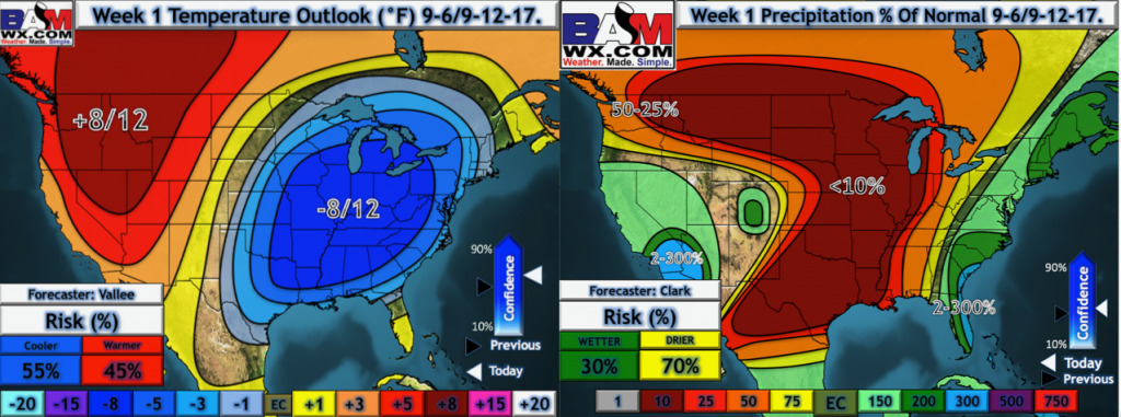
Our latest week 1 temperature and precipitation outlook:
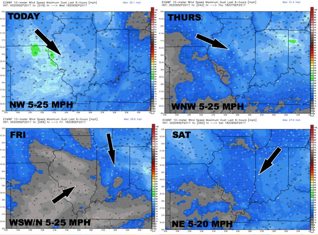
Wind forecast over the next 4 days:
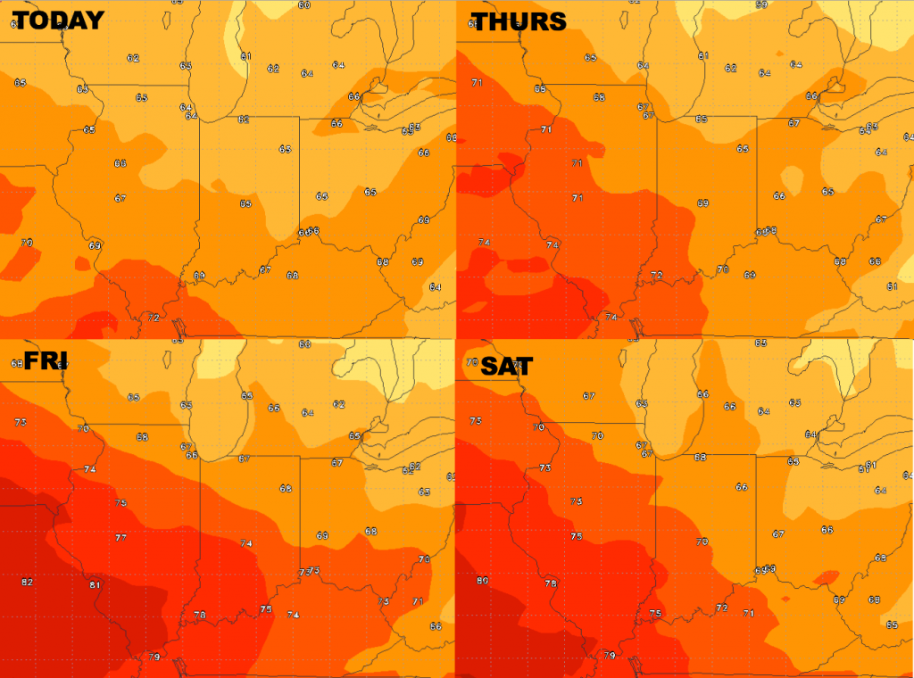
High temperature guidance over the next 4 days:
Low temperature guidance over the next 4 nights:
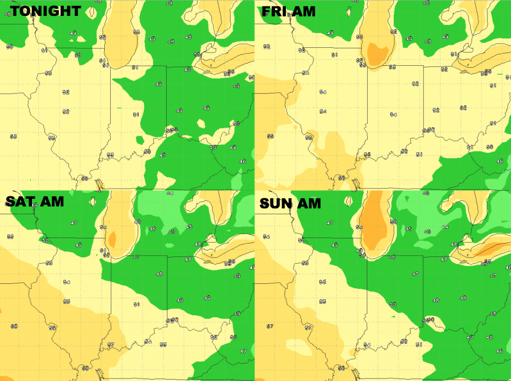
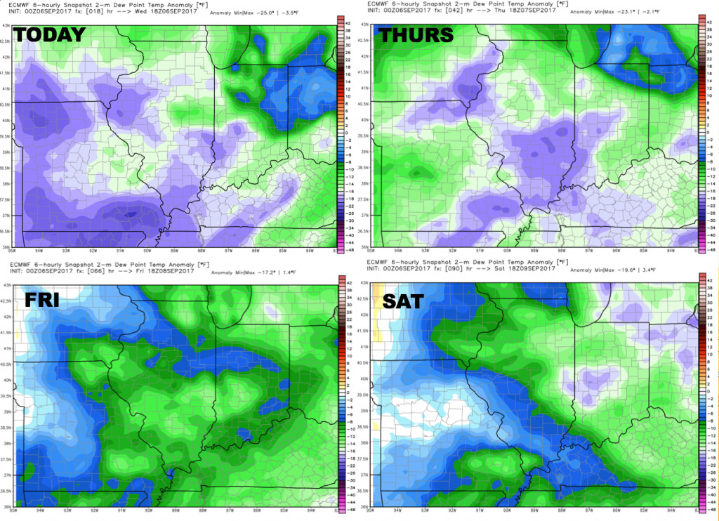
Dewpoints from normal: very dry and fall-like air mass through the weekend.