Key Points – Wednesday, August 9, 2017:
***We are so excited for this week and all of you that have signed up for our open house! As a reminder, you will receive all of our product via email, just make sure you’re looking at the right forecast locally; remember, the advantage of having a team of meteorologists at your fingertips can be priceless. With our service you will have access to our team of meteorologists 24/7.
Throughout the week we really want you to take advantage of the content we put out and use it to your advantage! At anytime this week you feel like you have seen enough to make a decision and you’re ready to sign up we will offer you a 20% off discount if you sign up BEFORE your trial expires August 11th. Please do not hesitate to reach out to us at anytime if you have any questions. Have a blessed week! -BAM staff.***
Synopsis: Hey good Wednesday morning! Not overly concerned for any rainfall today, starting off the day anywhere from 5 to 15º below normal with some patchy fog (will dissipate as the sun comes up each day this week). A few passing showers far to the south in the forecast area late tonight possible and isolated storms on the day Thursday. Heading into Friday the front continues to trek east which we think has the potential for additional thunderstorms across the Ohio Valley. Friday night into Saturday coverage increased to ~40/50% for rainfall, not expecting a widespread rainmaker…in the video we discuss the confidence and risks to the forecast into the weekend as there are some slight discrepancies in the data. If you have any questions please let us know, have a blessed day!
Today’s video (8 min):
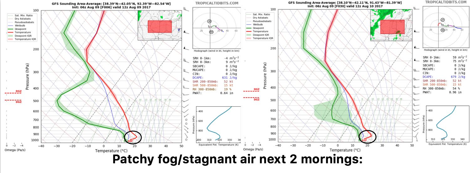
Had a few outlying areas of patchy fog and stagnant air this morning but is already starting to dissipate…expecting similar conditions over the next two mornings where the reduced visibility will clear by mid-morning:
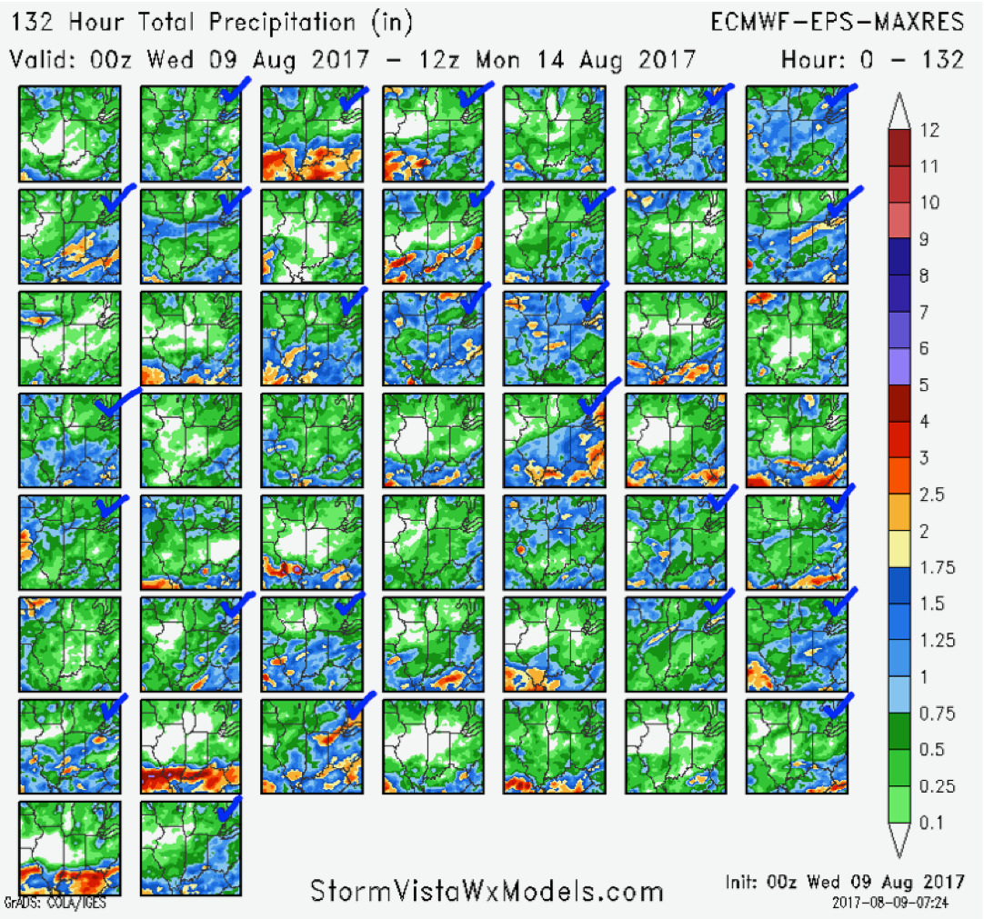
A few scattered chances of rainfall Thursday into the weekend…in the video we discuss the spread in data in terms of total rainfall. Below is a look at every European ensemble member through Monday, the blue check marks represent the members that have ~0.5-1.0″. It’s a difficult forecast, check back often…but it’s key to remember not everyone will cash in on the rainfall here, some locations will stay drier.
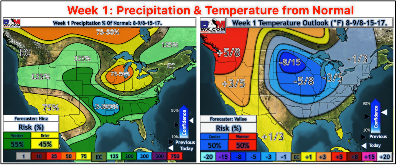
Precipitation and temperatures from normal over the next week…the cooler regime continues while we feel overall the Ohio Valley stays below normal in precipitation as well.
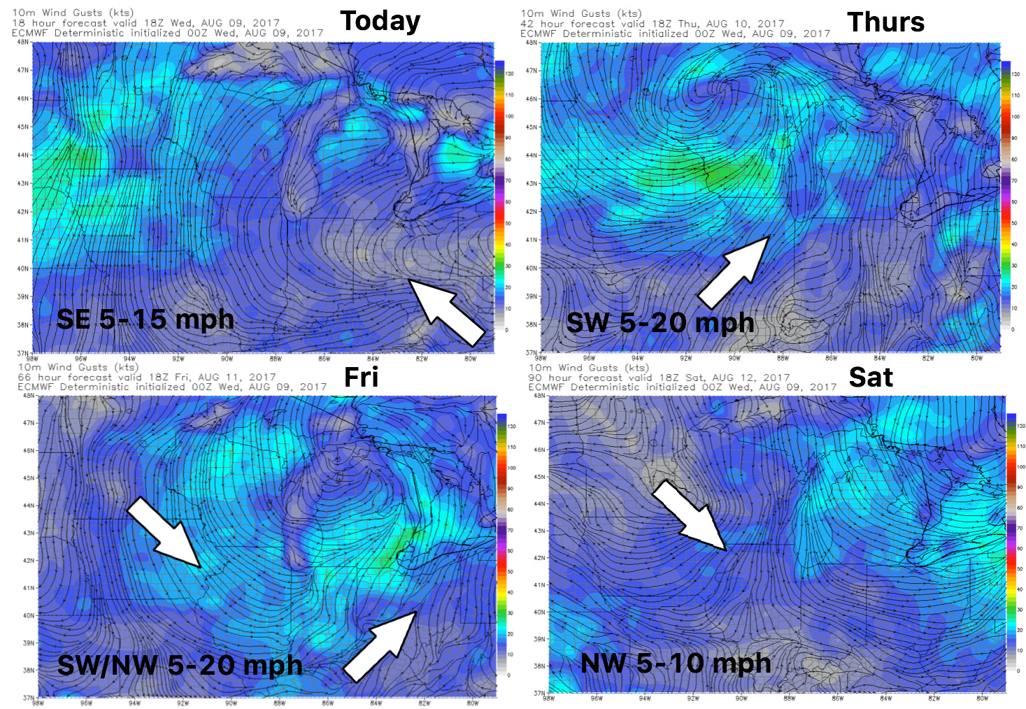
Wind forecast into the week is relatively calm:
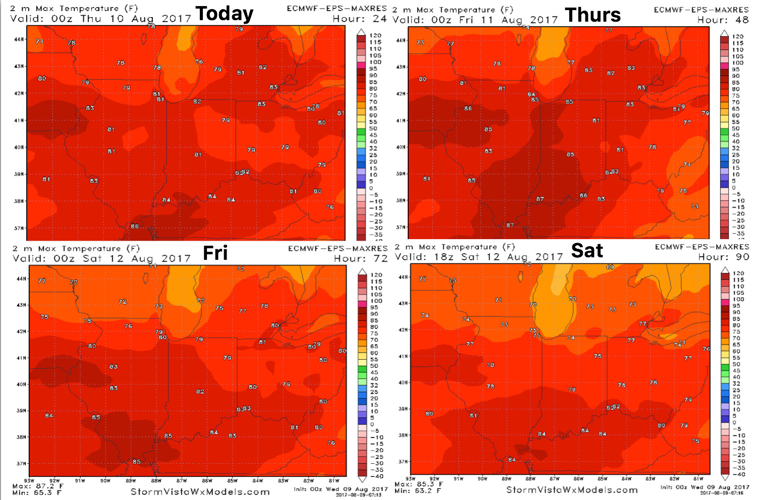
High temperature guidance over the next 4 days:
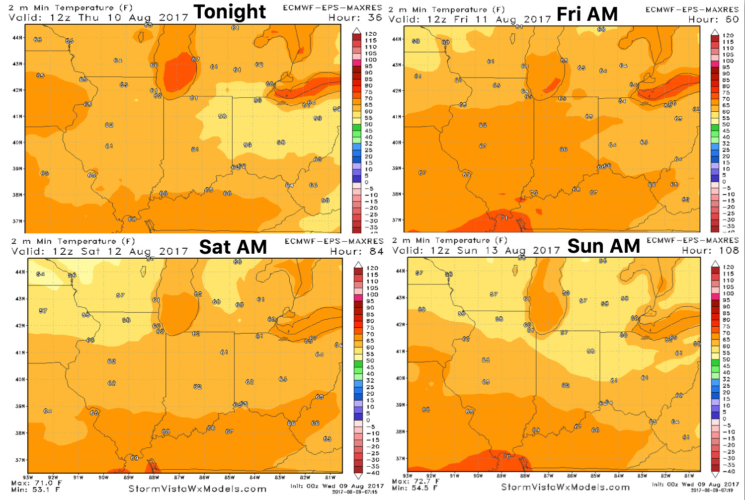
Overnight low temperature guidance over the next 4 days:
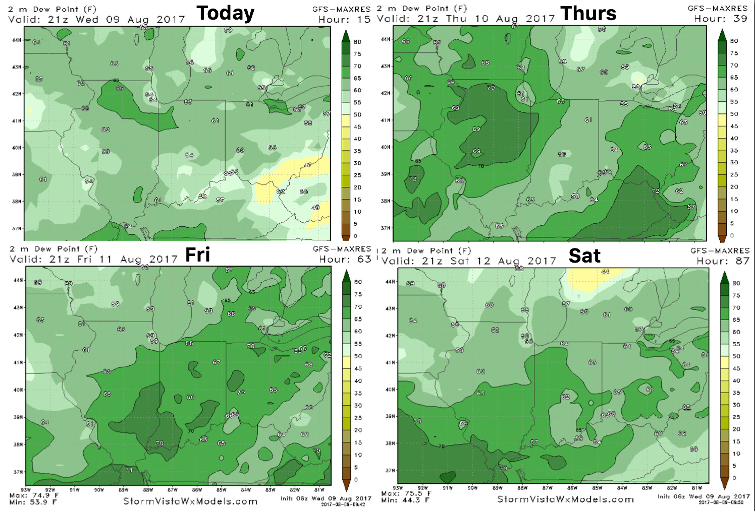
Here’s your dew points forecast guidance below is well…humidity rising as we close out the work-week: