Key Points – Tuesday, August 15, 2017:
Synopsis: Good Tuesday morning! Today we discuss the patchy fog this morning now giving way leading to another overall nice day across the Ohio Valley. Need to continue to watch overnight into Wednesday and Thursday for storm coverage to increase from west to east along a frontal boundary, some of these being strong to severe potentially with localized heavy rainfall. We also touch on a storm chance this weekend and begin to look at the forecast for the solar eclipse on Monday as well. If you have any questions please let us know, have a blessed day!
Today’s video (7 min):
Latest guidance on rainfall over the next 2 days…data won’t be perfect in handling exactly where these storms will set up shop, but with elevated atmospheric moisture content it’s a safe bet 0.5-1.5″ with isolated higher amounts is the call for now.

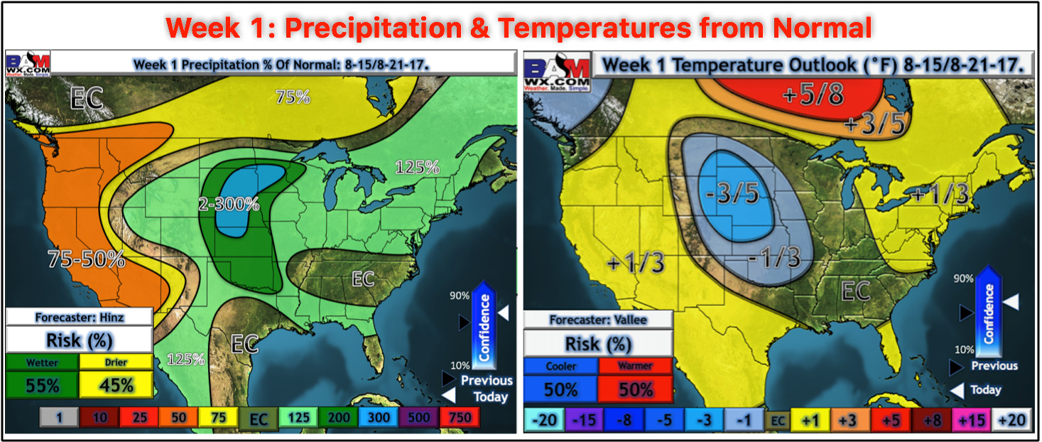
Here’s your updated week 1 precipitation and temperature from normal outlooks adjusted this morning:
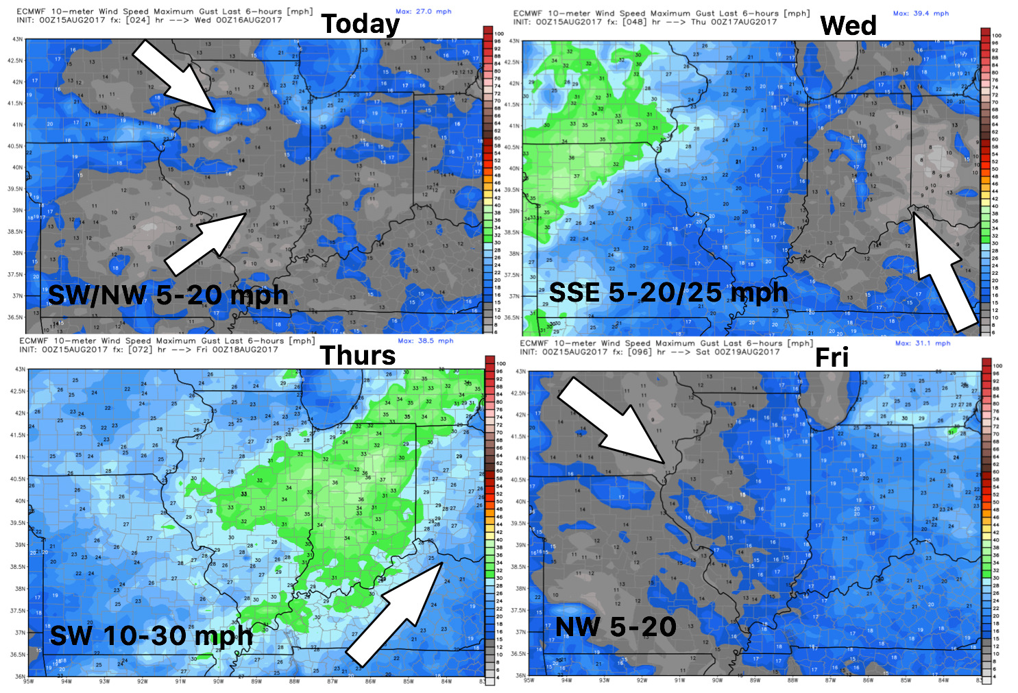
Wind forecast over the next 4 days:
High temperature guidance into late week:

Overnight lows on a steady incline before getting knocked down by the cold front:

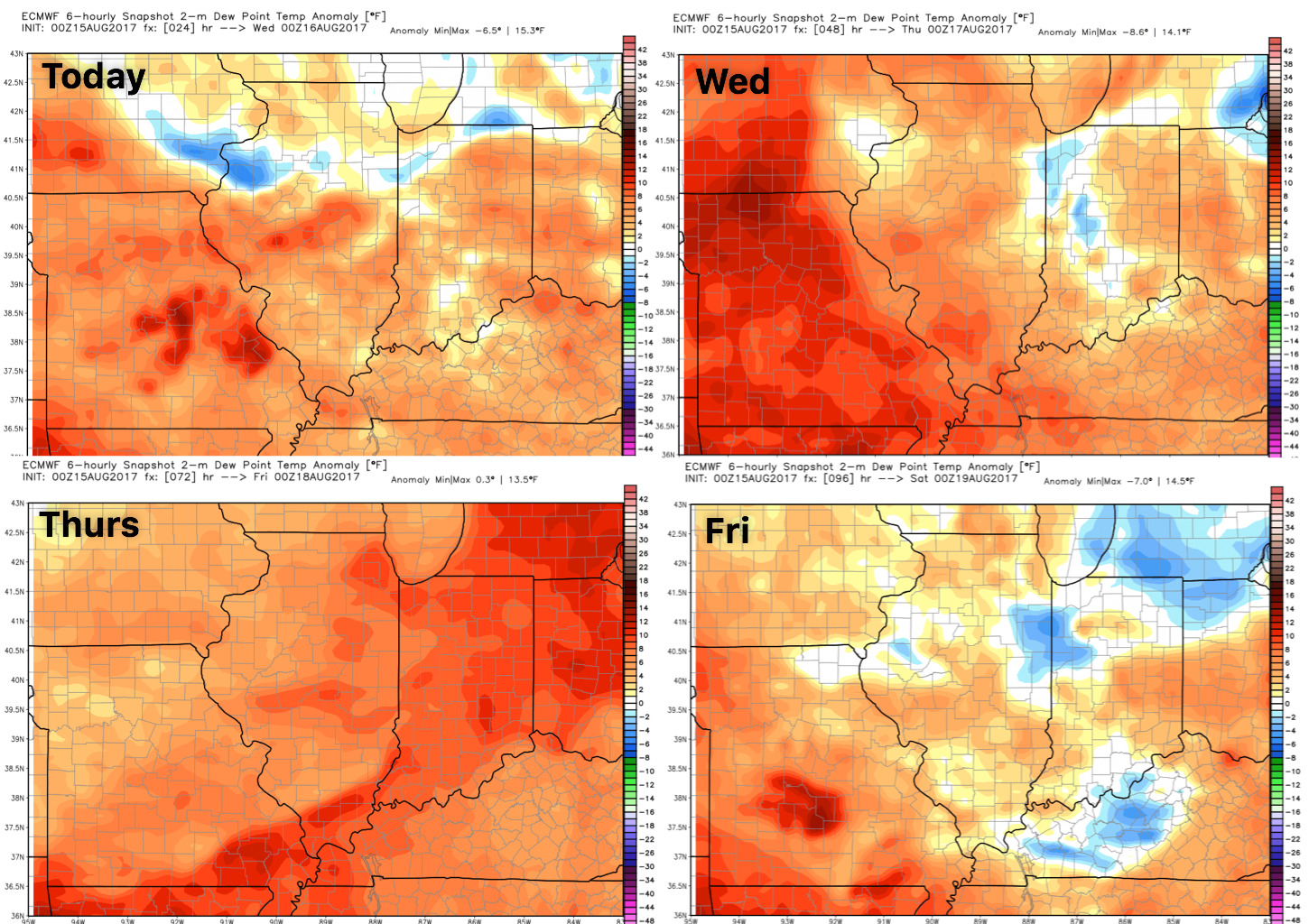
Dew points from normal guidance show the humid air working in over the next 3 days before relaxing behind the cold front as it passes east: