Key Points – Thursday, August 17, 2017:
Synopsis: Good Thursday morning! Today we discuss the remaining storms, some strong with localized heavy rainfall working east along a cold front…we know many desperately need the rainfall as it’s drier, but unfortunately some continue to stay dry here. Very nice day expected overall on Friday with showers working in later tomorrow night through Saturday mainly north of I-70. We also give the latest details on the solar eclipse forecast for Monday! If you have any questions please let us know, have a blessed day! -Kirk
Today’s video (6 min):
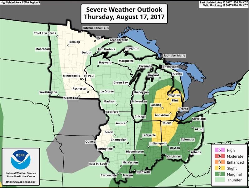
Latest strong storm threat today…I think overall the risk area is good, I slightly question the slight risk still…I do see some isolated strong storms are on the table and localized heavy rainfall will be possible across parts of Indiana, Ohio, southern Michigan and parts of Kentucky.
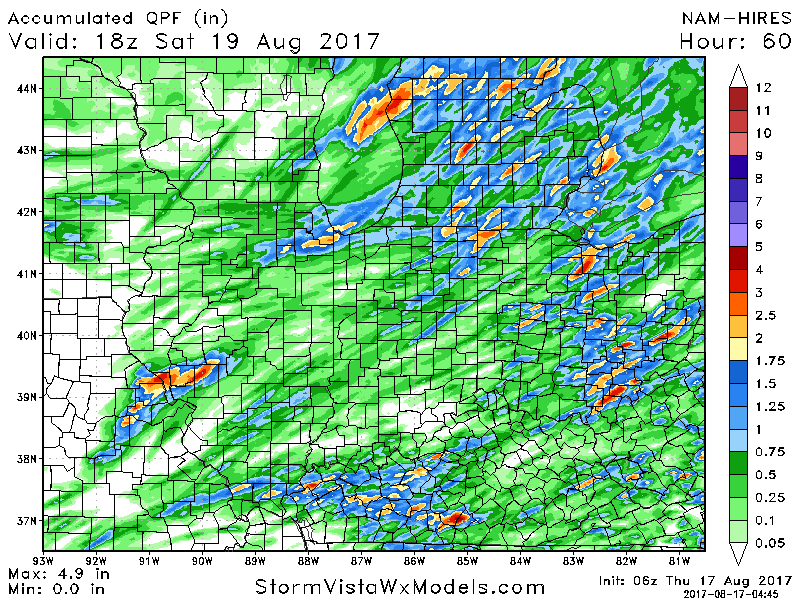
In terms of rainfall accumulation guidance over the next 60 hours, we don’t have a perfect model to use this morning, but believe the NAM-3k shows the risks for 0.5-1.0″ totals in a very scattered nature well…some localized 1-2″ are on the table especially in areas where stronger storms develop.
Next chance for 30-40% coverage of showers and a few storms possible later Friday night into Saturday from west to east mainly north of I-70:
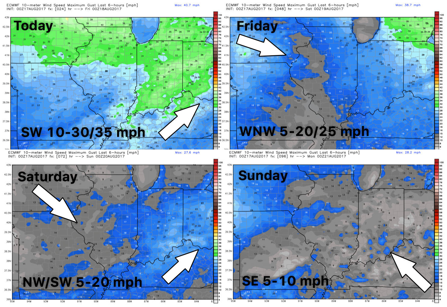
Here’s your wind guidance through the weekend:
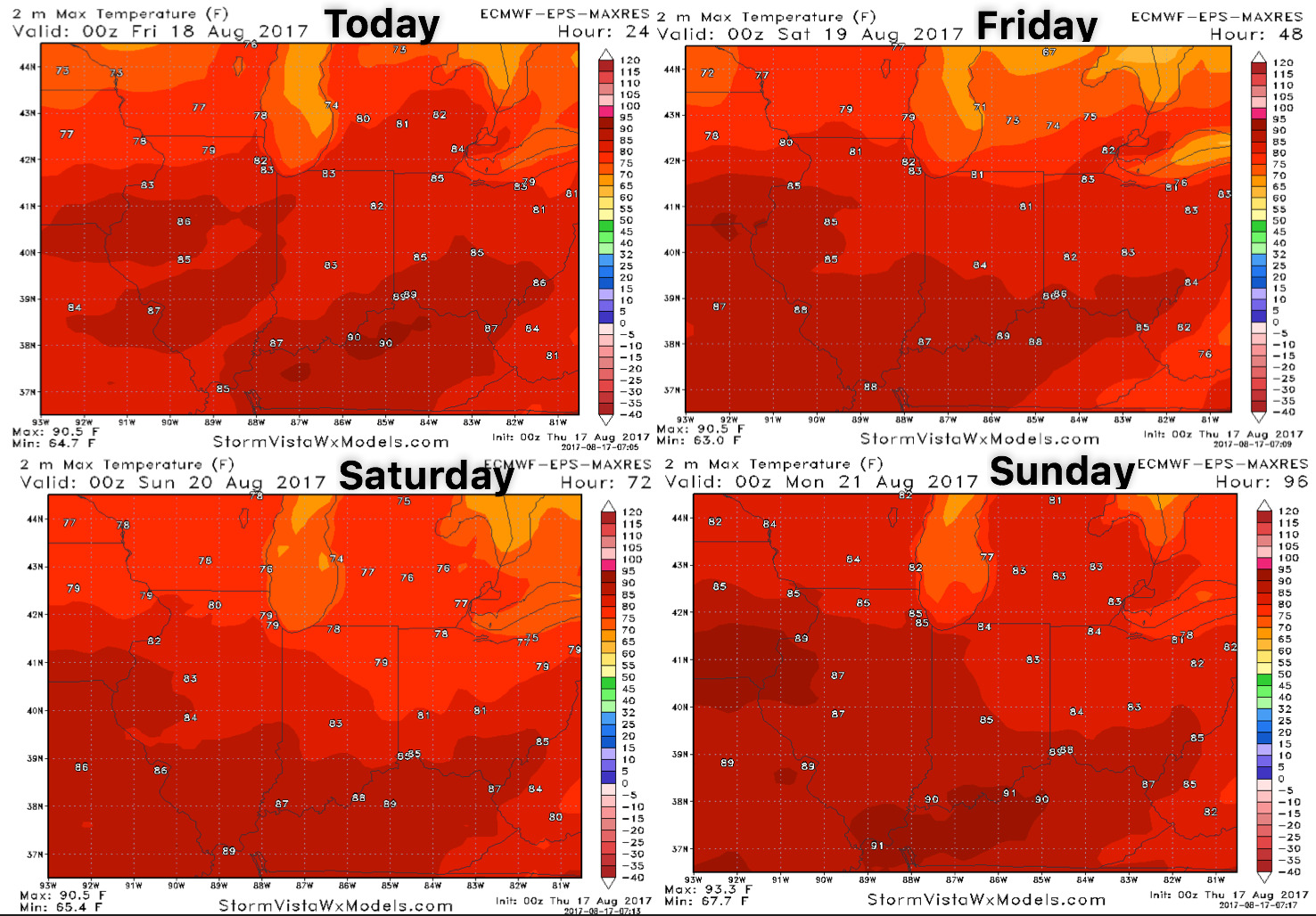
High temperature guidance over the next 4 days:
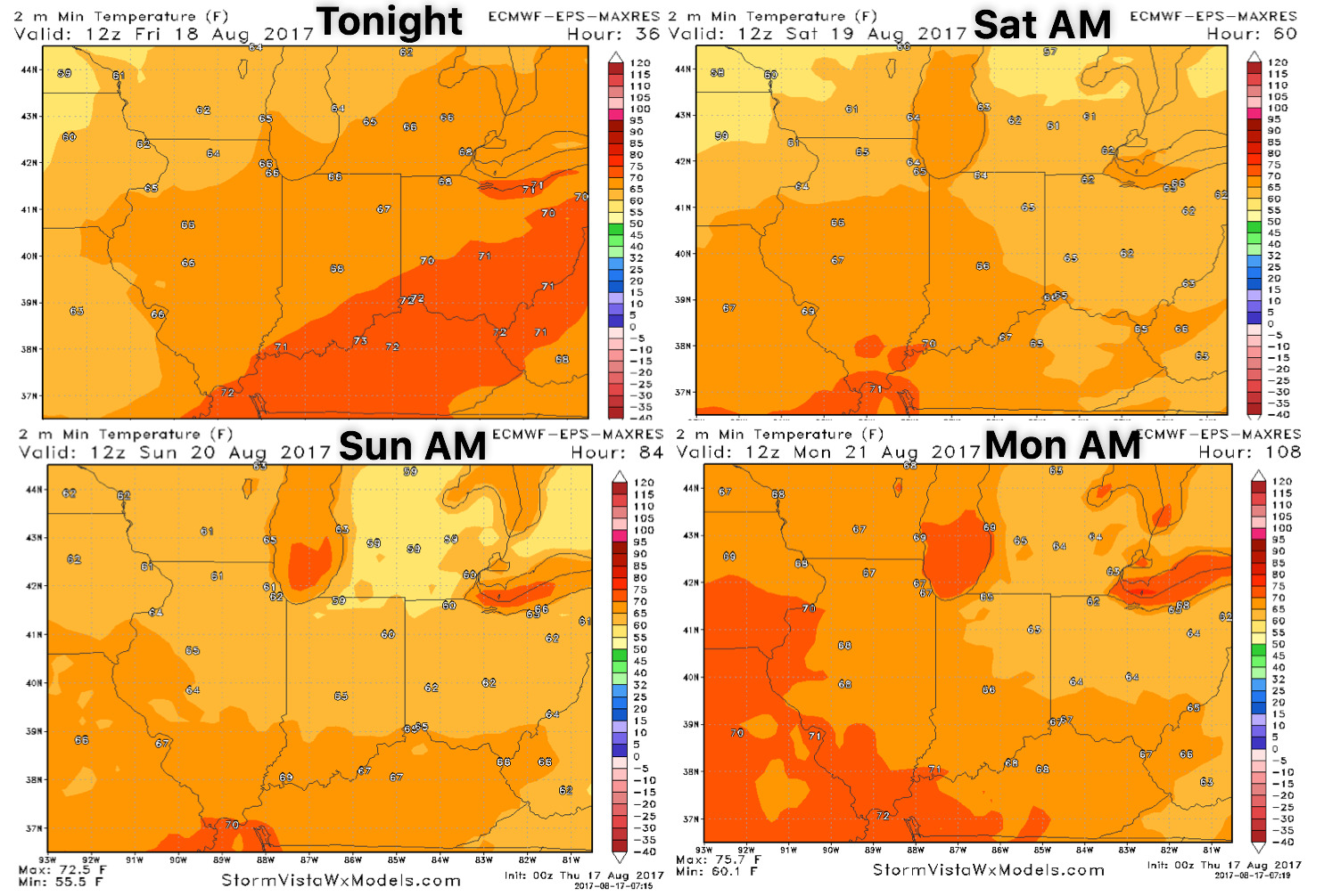
Overnight low temperature guidance here as well:
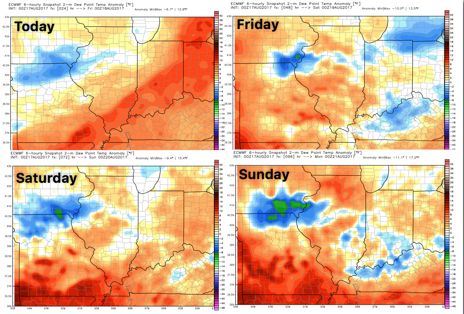
And dew points from normal: