Good afternoon. Model guidance continues to trend more impressive with snow Thursday across the Northeast. In this post we will dig into why, how much, and when the snow will occur.
A strong disturbance will move through the Ohio Valley Wednesday and strengthen as it does so. This will lead to an area of low pressure forming off the Mid-Atlantic coast, which will ultimately be the snow maker through the day on Thursday.
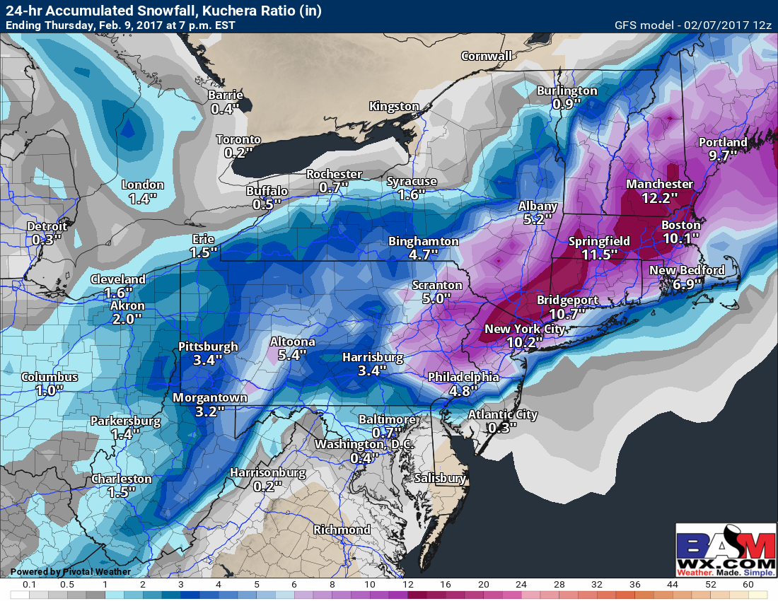
Snow will overspread much of Ohio and Pennsylvania Wednesday evening and spread eastward into New York and southern New England Thursday. There are still some questions as to where this low pressure tracks, but confidence is high now that it will take a favorable track off the coast bringing snow to much of the Northeast. Snow will taper off Thursday morning across Ohio and western PA, then Thursday evening from southwest to northeast in eastern PA, NJ, NY, and New England. Here’s the latest GFS.
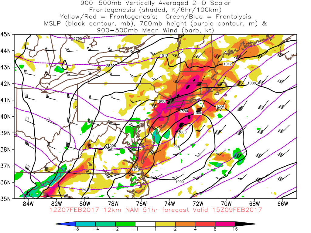
This system will quickly strengthen off the coast with heavy bands of snow likely on the northwest side of the system. Here’s an idea of where those bands may be via “frontogenesis” or “best lift” will be Thursday morning. Most likely this will occur in eastern PA through southern New England.
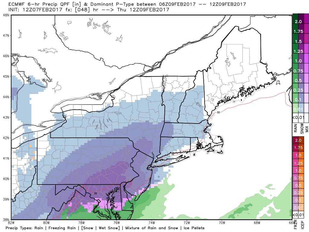
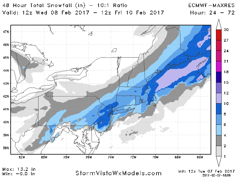
The European is also similar to the GFS and NAM bringing heavy snow into most areas Thursday from south central PA to southern New England.
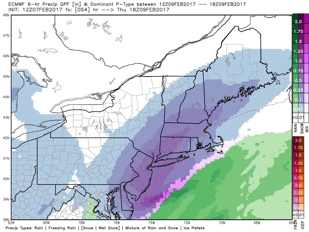
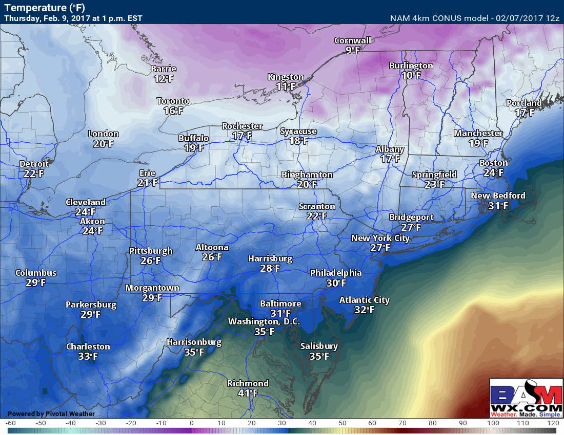
Temperatures will be close to freezing near the coast during the event and may even mix with sleet and rain in southeastern areas. This will make the snow heavy and wet, while interior areas will see a bit fluffier snow will colder temperatures. Here’s an example of what temperatures may look like Thursday midday.
Another aspect of this storm we need to monitor is wind and blizzard potential. Winds will likely gust past 40 mph as the system strengthens Thursday and Thursday night. Here’s the latest GFS wind gusts.
Snowfall amounts will depend exactly where the storm tracks, but here are the latest GFS, NAM, and European forecasts.
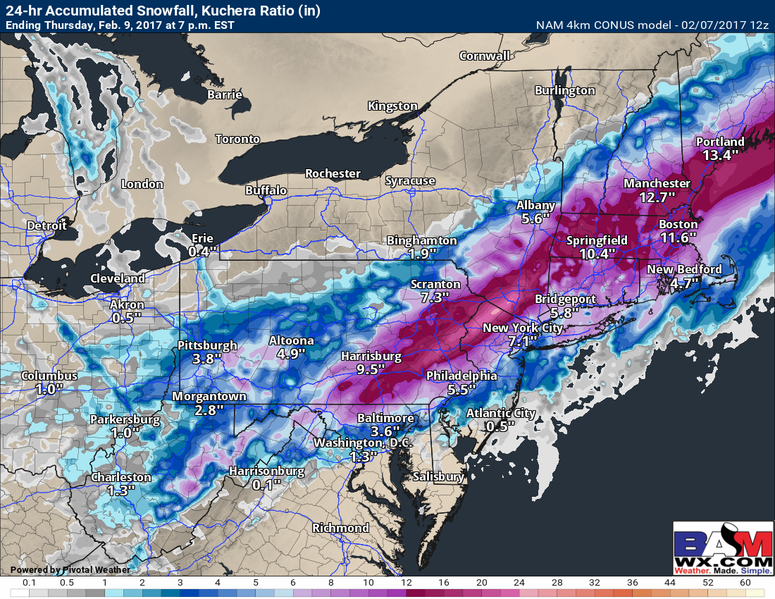
Notice they are in rather good agreement with heaviest snowfall from the Lehigh Valley of PA northeastward into the lower Hudson Valley and southern New England. This adds confidence to my going forecast. Without further ado, here’s my first call snowfall map.
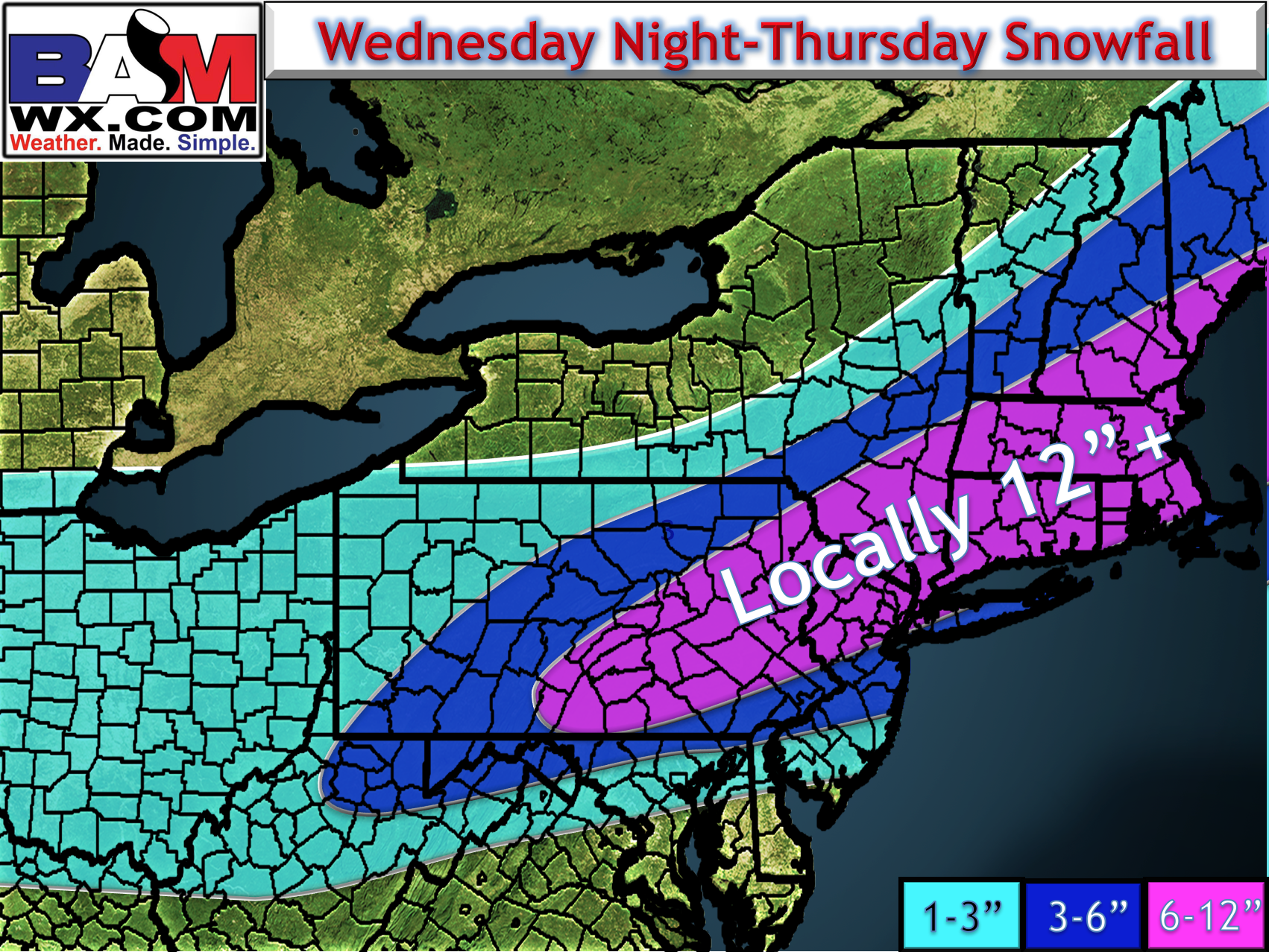
I’ll have a video out later this afternoon documenting the storm’s evolution and impacts. Stay tuned! ~Ed