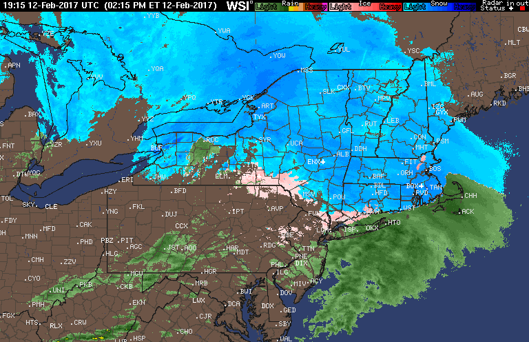
Good afternoon! Quick check of the radar shows snow changing to rain in southern CT and the Hudson Valley as of 4:30 PM as dry air works in from the west. Further north, snow of varying intensities will continue overnight. Here’s the radar:
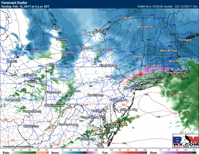
Snow will continue north tonight then swing into southern New England late tonight, just in time for the morning commute. Here’s the forecast radar through the morning. This will lead to a few more inches in eastern Mass, and perhaps a coating to 1 inch elsewhere in southern New England.
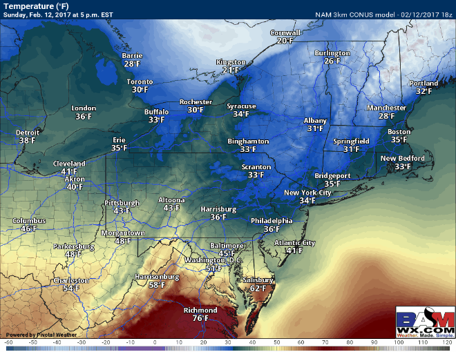
Temperatures will rise slightly then drop late tonight as colder air works in. Here are the forecast temperatures through sunrise.
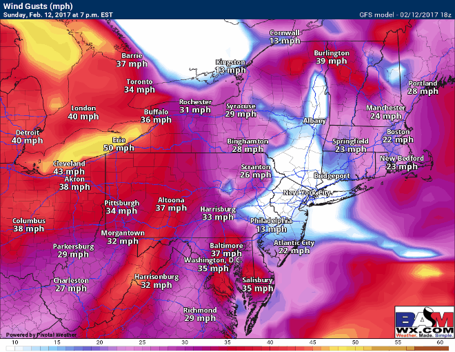
Winds will be the biggest issue overnight, gusting to 50mph for many, and up to 70mph on the Cape!
I’ll have another update early tomorrow morning. ~Ed