Key Points: September 20, 2017
Synopsis: Good Wednesday morning! Quite an active overnight period with multiple severe weather reports and some locations seeing 3-6 inches of rainfall! Good news is that today looks quiet across the region with some sunshine. Active conditions do look to return as early as tomorrow morning across the Dakotas, the will slowly shift south and eastward through the weekend as a strong cold front moves through the region. Temperatures ahead of the front will be hot for September, rising into the 80s to near 90. Behind it, 50s and 60s are expected! Have a blessed day!
Today’s Video (6 min):
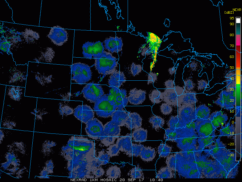
Current radar shows the remnants of the severe weather last night moving through Wisconsin. The remainder of the region is dry.
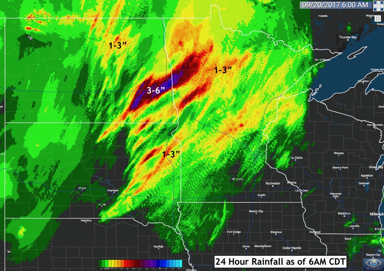
Total rainfall last night was impressive!
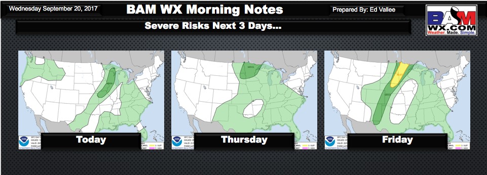
Severe risks over the next 3 days are shown below. Note Friday afternoon and Friday night has the potential to be quite active.
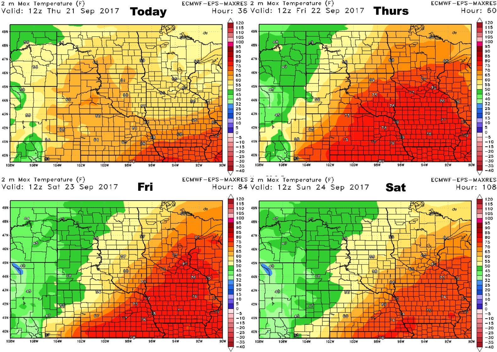
High temperatures over the next 4 days shows the progression of the front well.
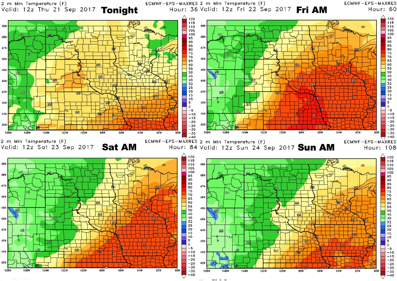
Low temperatures do similarly.
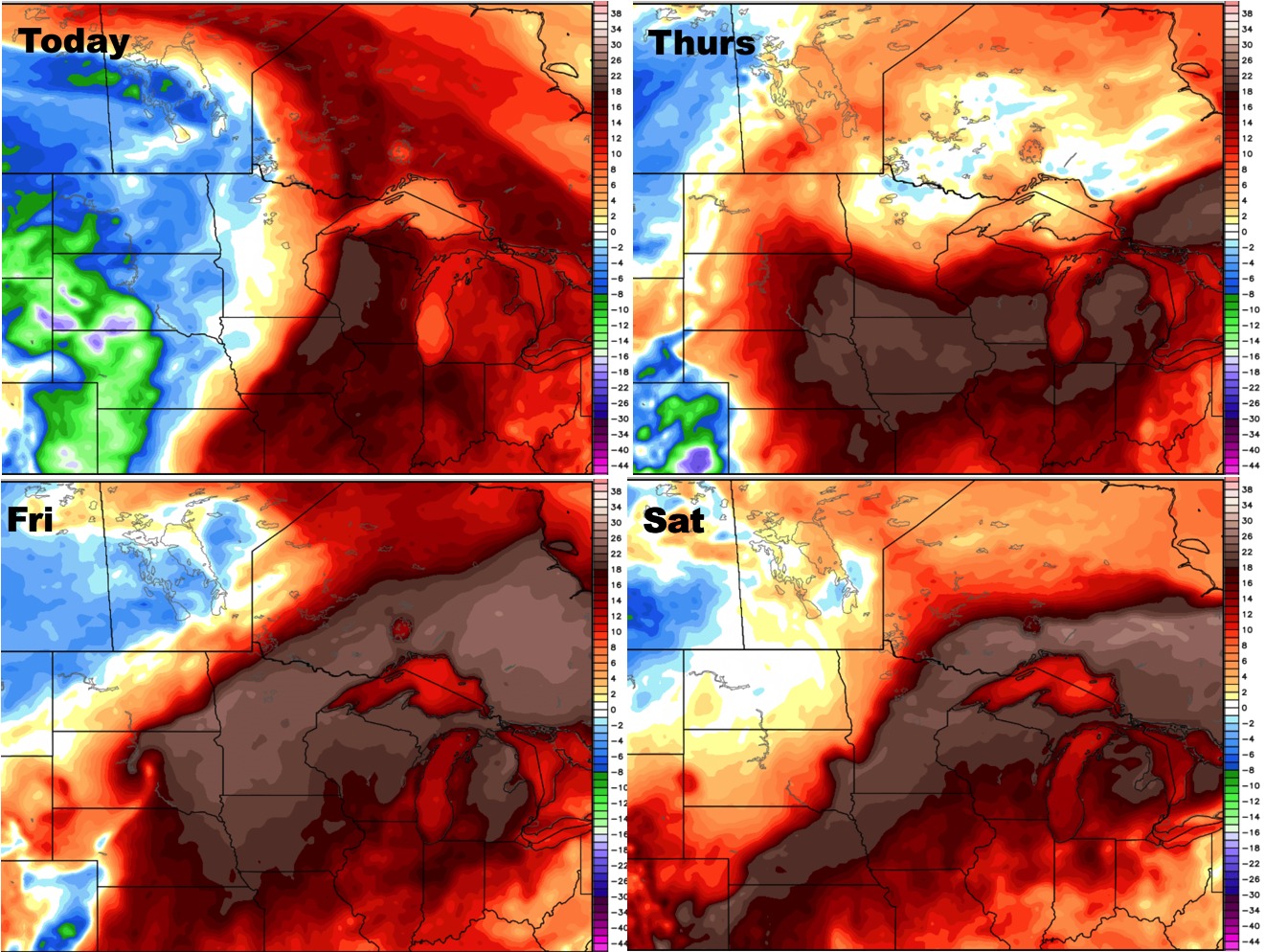
Humidity looks to remain above normal thanks to the front and periods of rainfall expected.
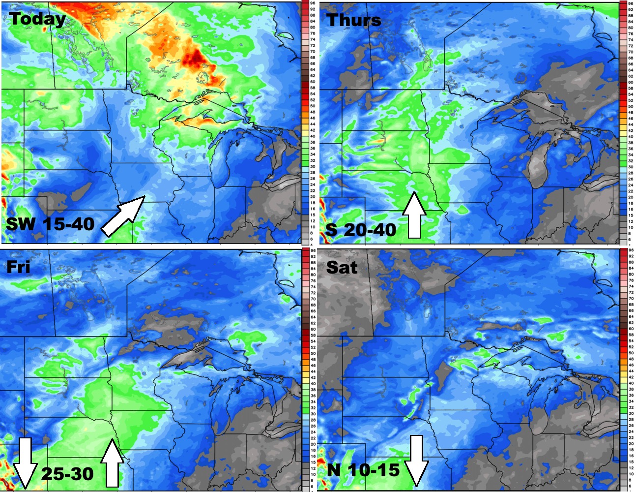
Winds for the next 4 days are shown below.
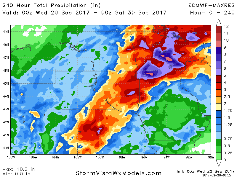
Total rainfall through day 10 (September 29) will be heavy and will likely impact harvest operations in some areas.