Key Points: September 27, 2017
Synopsis: Good morning! The unsettled conditions have finally ended across the region as the cold front has pushed off to the south and east. High pressure will lead to a dry day today along with seasonable conditions. A weak cold front will knock temperatures back tomorrow and Friday before another system approaches the region later this weekend. This system will bring another widespread rain and storm chance to the region. As we approach harvest, we are noting a wet pattern persisting across the Upper Midwest and Plains which could certainly impact harvest operations depending on the time of planted crop. Have a blessed day!
Today’s Video (7 min):
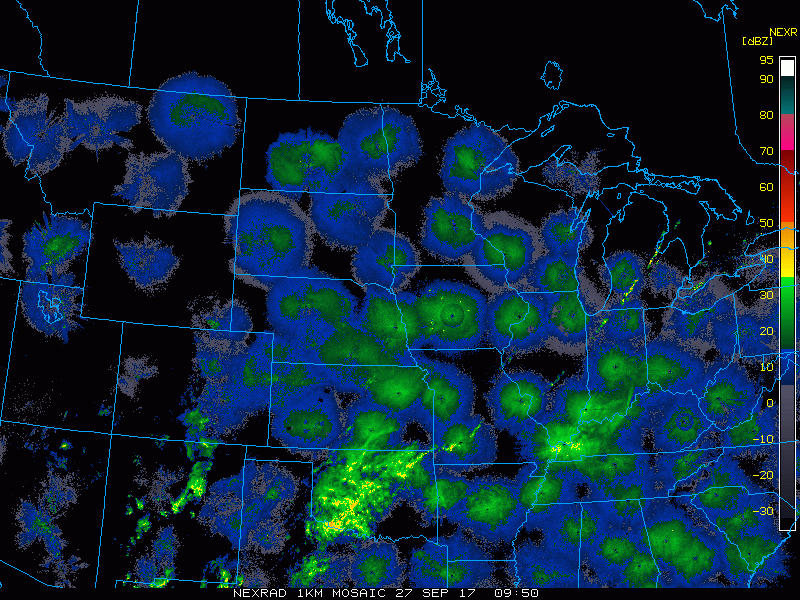
Current radar is finally scanning clear this morning after a very wet last 5 days!
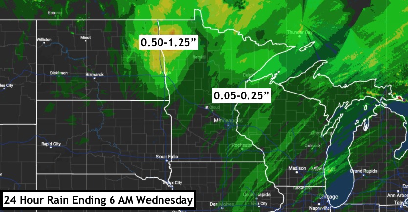
However, another significant amount of rain fell over the last 24 hours in portions of the region.
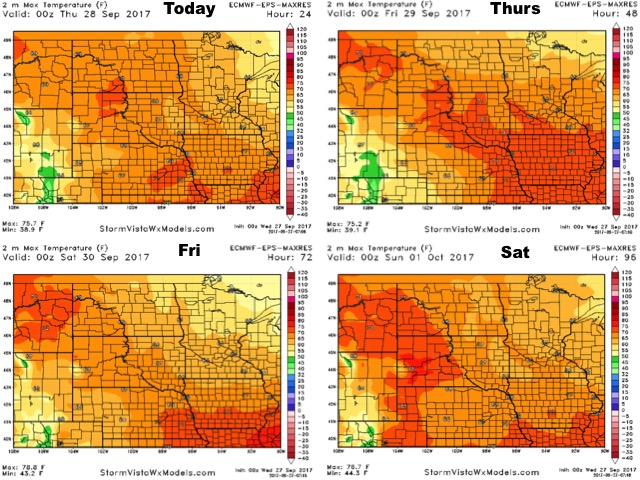
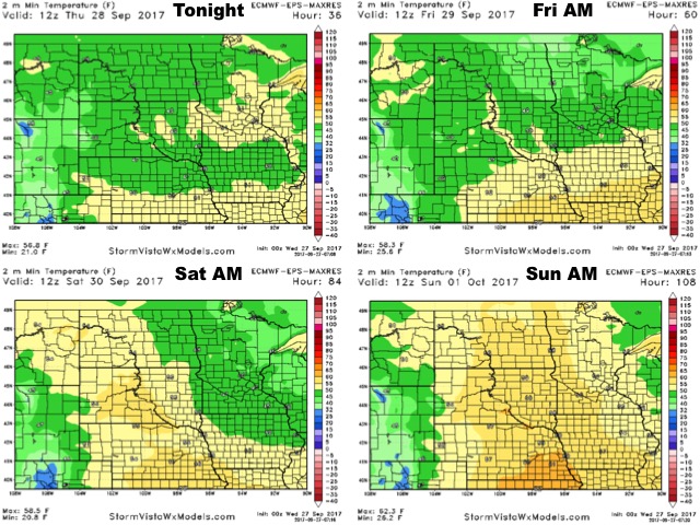
High pressure will lead to seasonable to warm conditions today before a weak cold front brings temperatures back near normal late week.
Low temperatures for the next 4 days are shown below.
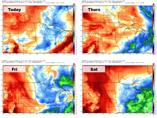
Humidity will be near to above average over the next 4 days.
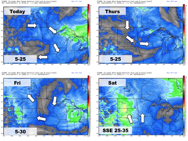
The wind forecast for the next 4 days is below.
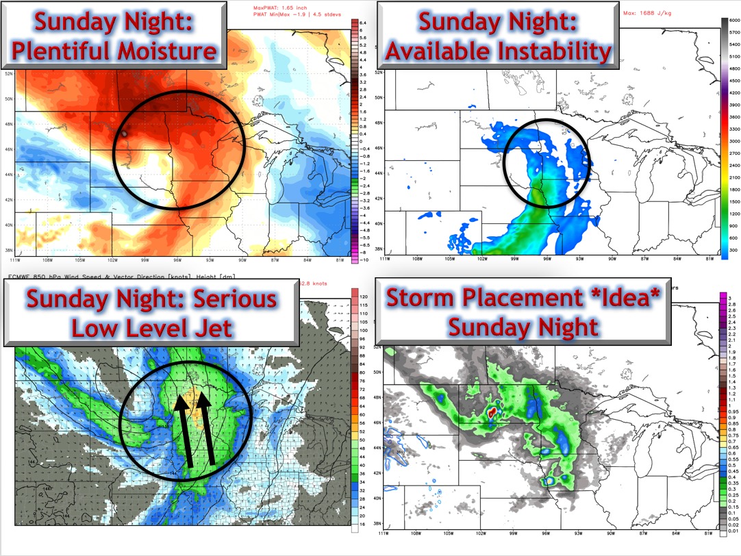
The next chance for rain and storms comes Sunday. Here’s the set up.
Total rainfall over the next 7 days is shown below.
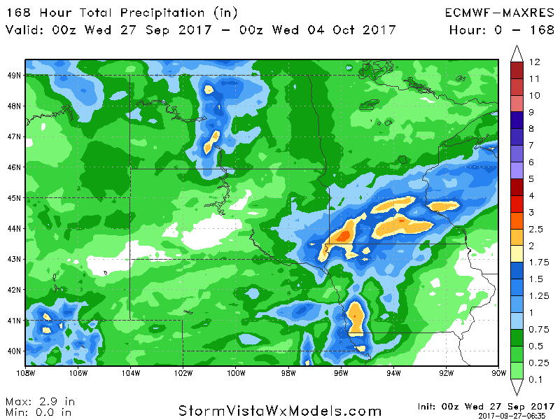
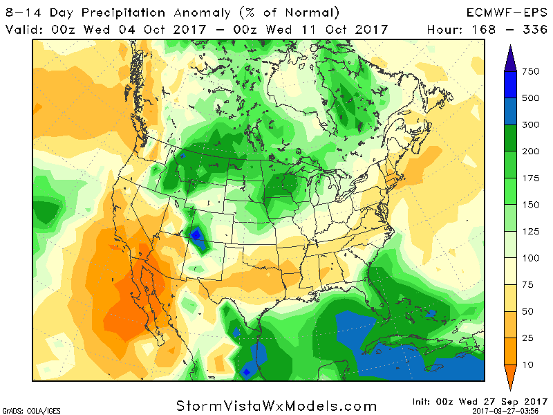
Above normal rainfall looks to continue through the first week of October.